South Bay, Florida
| South Bay, Florida | |
|---|---|
| City | |
 | |
| Motto: "Cross Roads Of South Florida"[1] | |
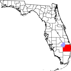
 Location of South Bay, Florida | |
| Coordinates: 26°39′59″N 80°43′8″W / 26.66639°N 80.71889°WCoordinates: 26°39′59″N 80°43′8″W / 26.66639°N 80.71889°W | |
| Country | United States |
| State | Florida |
| County | Palm Beach |
| Government | |
| • Mayor | Joe Kyles |
| Area | |
| • Total | 3.7 sq mi (9.6 km2) |
| • Land | 2.7 sq mi (7.0 km2) |
| • Water | 1.0 sq mi (2.6 km2) |
| Elevation | 20 ft (6 m) |
| Population (2000)[2] | |
| • Total | 4,506 |
| • Density | 1,425.4/sq mi (550.4/km2) |
| Time zone | Eastern (EST) (UTC-5) |
| • Summer (DST) | EDT (UTC-4) |
| ZIP code | 33493 |
| Area code(s) | 561 |
| FIPS code | 12-67175[3] |
| GNIS feature ID | 0291340[4] |
| Website | City of South Bay Florida |
South Bay is a city in Palm Beach County, Florida, United States. It is the westernmost municipality in the South Florida metropolitan area. The population was 3,859 at the 2000 census. As of 2007, the population recorded by the U.S. Census Bureau was 4,506.[5] While the current estimates place South Bay's population in the incorporated city limits at more than 4,000 people, surrounding areas increase the population figures to 54,000 people in a 25-mile (40 km) radius and more than 1.4 million in a 50-mile (80 km) radius.
History
South Bay was named for its location on Lake Okeechobee.[6] The town was incorporated in 1941.[7] The first mayor of South Bay was Aubrey (a.k.a. "Orb") Walker, who, along with his brother, Haughty D. Walker (a.k.a. "Haut"), survived the great hurricane of 1928 by gathering his family members onto a barge in the canal.[8]
Geography
South Bay is located at 26°39′59″N 80°43′8″W / 26.66639°N 80.71889°W (26.666487, -80.718985),[9] near the southern bank of Lake Okeechobee.
According to the United States Census Bureau, the city has a total area of 3.7 square miles (9.6 km2), including 2.7 square miles (7.0 km2) of land and 1.0 square mile (2.6 km2) of (26.95%) water. The Lake Okeechobee Scenic Trail runs through South Bay.
Demographics
| Historical population | |||
|---|---|---|---|
| Census | Pop. | %± | |
| 1950 | 1,050 | — | |
| 1960 | 1,631 | 55.3% | |
| 1970 | 2,958 | 81.4% | |
| 1980 | 3,886 | 31.4% | |
| 1990 | 3,558 | −8.4% | |
| 2000 | 3,859 | 8.5% | |
| 2010 | 4,876 | 26.4% | |
| Est. 2015 | 5,101 | [10] | 4.6% |
As of the census[3] of 2000, there were 3,859 people, 805 households, and 644 families residing in the city. The population density was 1,425.4 inhabitants per square mile (549.8/km²). There were 935 housing units at an average density of 345.4 per square mile (133.2/km²). The racial makeup of the city was 12.5% White (non-Hispanic), 66.93% Black or African American, 19.56% Hispanic or Latino of any race, 0.29% Native American, 0.26% Asian, 0.03% Pacific Islander, 5.83% from other races, and 2.44% from two or more races.[12]
There were 805 households out of which 41.7% had children under the age of 18 living with them, 39.5% were married couples living together, 32.0% had a female householder with no husband present, and 20.0% were non-families. 15.8% of all households were made up of individuals and 4.7% had someone living alone who was 65 years of age or older. The average household size was 3.39 and the average family size was 3.76.
In the city the population was spread out with 27.0% under the age of 18, 9.3% from 18 to 24, 37.3% from 25 to 44, 20.4% from 45 to 64, and 6.0% who were 65 years of age or older. The median age was 32 years. For every 100 females there were 172.5 males. For every 100 females age 18 and over, there were 210.6 males.
The median income for a household in the city was $23,558, and the median income for a family was $26,944. Males had a median income of $21,087 versus $22,321 for females. The per capita income for the city was $9,126. About 29.2% of families and 36.7% of the population were below the poverty line, including 48.4% of those under age 18 and 27.4% of those age 65 or over.
As of 2000, speakers of English made up 77.76% of all residents, while Spanish comprised 21.51%, and French as a mother tongue accounted for 0.72% of the population.[13]
Infrastructure
Transportation
Two major roads, East-West State Road 80 and North-South U.S. 27 intersect in the town.
Notable person
- Clarence E. Anthony, mayor, 1984 to 2008
References
- ↑ "City of South Bay Florida". City of South Bay Florida. Retrieved September 22, 2012.
- ↑ "Annual Estimates of the population for the Incorporated Places of Florida" (XLS). US Census Bureau. Retrieved 2007-08-15.
- 1 2 "American FactFinder". United States Census Bureau. Archived from the original on 2013-09-11. Retrieved 2008-01-31.
- ↑ "US Board on Geographic Names". United States Geological Survey. 2007-10-25. Retrieved 2008-01-31.
- ↑ http://www.census.gov/popest/cities/tables/SUB-EST2007-04-12.xls
- ↑ Kleinberg, Eliot (Sep 16, 1987). "A Town By Any Other Name". The Palm Beach Post. pp. D7. Retrieved 30 May 2015.
- ↑ "South Bay". Palm Beach Historical Society. Retrieved 30 May 2015.
- ↑ Will, Lawrence (1964). A Cracker History of Okeechobee (First ed.). Great Outdoors. p. 212.
- ↑ "US Gazetteer files: 2010, 2000, and 1990". United States Census Bureau. 2011-02-12. Retrieved 2011-04-23.
- ↑ "Annual Estimates of the Resident Population for Incorporated Places: April 1, 2010 to July 1, 2015". Retrieved July 2, 2016.
- ↑ "Census of Population and Housing". Census.gov. Archived from the original on May 11, 2015. Retrieved June 4, 2015.
- ↑ "Demographics of South Bay, FL". MuniNetGuide.com. Retrieved 2007-11-12.
- ↑ "MLA Data Center Results of South Bay, FL". Modern Language Association. Retrieved 2007-11-12.
External links
| Wikimedia Commons has media related to South Bay, Florida. |
- City of South Bay Florida Portal style website, Government, Business, Library, Recreation and more
- City-Data.com Comprehensive Statistical Data and more about South Bay
- ePodunk Profile for South Bay