Sosto
| Sosto | |
|---|---|
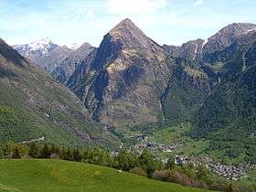 View from the south side | |
| Highest point | |
| Elevation | 2,221 m (7,287 ft) |
| Prominence | 524 m (1,719 ft) [1] |
| Coordinates | 46°32′54.3″N 8°57′07.1″E / 46.548417°N 8.951972°ECoordinates: 46°32′54.3″N 8°57′07.1″E / 46.548417°N 8.951972°E |
| Geography | |
 Sosto Location in Switzerland | |
| Location | Ticino, Switzerland |
| Parent range | Lepontine Alps |
The Sosto (2,220.6 m) is a mountain of the Swiss Lepontine Alps, overlooking Olivone in the canton of Ticino. It lies south of the lake of Luzzone and west of the Torrone di Nav.
References
External links
This article is issued from Wikipedia - version of the 5/9/2016. The text is available under the Creative Commons Attribution/Share Alike but additional terms may apply for the media files.