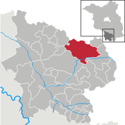
Sonnewalde
Sonnewalde is a town in the Elbe-Elster district, in southwestern Brandenburg, Germany. It is situated 8 km northwest of Finsterwalde.
Demography

Development of Population since 1875 within the Current Boundaries (Blue Line: Population; Dotted Line: Comparison to Population Development of Brandenburg state; Grey Background: Time of Nazi rule; Red Background: Time of Communist rule)
Sonnewalde:
Population development within the current boundaries[2]
| Year |
Population |
|
|
|---|
| 1875 | 4 866 |
| 1890 | 4 789 |
| 1910 | 4 685 |
| 1925 | 4 489 |
| 1933 | 4 378 |
| 1939 | 4 290 |
| 1946 | 6 061 |
| 1950 | 5 793 |
| 1964 | 4 703 |
| 1971 | 4 524 |
|
|
| Year |
Population |
|
|
|---|
| 1981 | 4 091 |
| 1985 | 4 010 |
| 1989 | 4 028 |
| 1990 | 3 989 |
| 1991 | 3 899 |
| 1992 | 4 144 |
| 1993 | 4 114 |
| 1994 | 4 198 |
| 1995 | 4 093 |
| 1996 | 4 308 |
|
|
| Year |
Population |
|
|
|---|
| 1997 | 4 025 |
| 1998 | 4 038 |
| 1999 | 4 139 |
| 2000 | 4 038 |
| 2001 | 4 010 |
| 2002 | 3 851 |
| 2003 | 3 771 |
| 2004 | 3 708 |
| 2005 | 3 673 |
| 2006 | 3 600 |
|
|
| Year |
Population |
|
|
|---|
| 2007 | 3 567 |
| 2008 | 3 529 |
| 2009 | 3 506 |
| 2010 | 3 452 |
| 2011 | 3 446 |
| 2012 | 3 385 |
|
|
Detailed data sources are to be found in the Wikimedia Commons.[3]
References