Sonneborn
For people named Sonneborn, see Sonneborn (disambiguation).
| Sonneborn | ||
|---|---|---|
| ||
 Sonneborn | ||
Location of Sonneborn within Gotha district 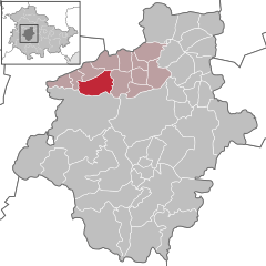
 | ||
| Coordinates: 51°0′0″N 10°35′0″E / 51.00000°N 10.58333°ECoordinates: 51°0′0″N 10°35′0″E / 51.00000°N 10.58333°E | ||
| Country | Germany | |
| State | Thuringia | |
| District | Gotha | |
| Municipal assoc. | Mittleres Nessetal | |
| Government | ||
| • Mayor | Günter Dietmar | |
| Area | ||
| • Total | 16.48 km2 (6.36 sq mi) | |
| Population (2015-12-31)[1] | ||
| • Total | 1,187 | |
| • Density | 72/km2 (190/sq mi) | |
| Time zone | CET/CEST (UTC+1/+2) | |
| Postal codes | 32683 | |
| Dialling codes | 05263 | |
| Vehicle registration | LIP | |
| Website | www.mittleres-nessetal.de | |

Sonneborn is a municipality in the district of Gotha, in Thuringia, Germany.
References
This article is issued from Wikipedia - version of the 8/27/2016. The text is available under the Creative Commons Attribution/Share Alike but additional terms may apply for the media files.