Sonitpur district
| Sonitpur district শোণিতপুৰ | |
|---|---|
| District | |
|
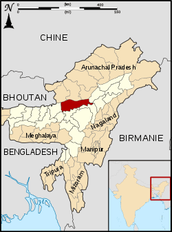
Map of Sonitpur district | |
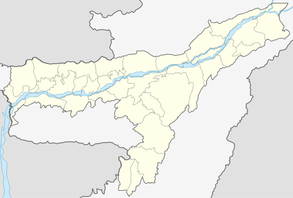 Sonitpur district  Sonitpur district | |
| Coordinates: 26°38′N 92°48′E / 26.63°N 92.8°ECoordinates: 26°38′N 92°48′E / 26.63°N 92.8°E | |
| Country |
|
| State | Assam |
| Headquarters | Tezpur |
| Area | |
| • Total | 5,324 km2 (2,056 sq mi) |
| Elevation | 48 m (157 ft) |
| Population (2011) | |
| • Total | 1,925,975 |
| • Density | 360/km2 (940/sq mi) |
| Languages | |
| • Official | Assamese |
| Time zone | IST (UTC+5:30) |
| ISO 3166 code | IN-AS |
| Vehicle registration | AS |
| Website |
sonitpur |
Sonitpur {Pron: ˌsə(ʊ)nɪtˈpʊə or ˌʃə(ʊ)nɪtˈpʊə} (Assamese: শোণিতপুৰ) is an administrative district in the state of Assam in India. It stands among the largest districts of Assam. In terms of area Sonitpur is the second largest district of Assam after Karbi Anglong district. It is spread over an area of 5324 km2 on the northern banks of Brahmaputra, the lifeline of Assam. The population of Sonitpur district is 19, 24,110 as per 2011 Census. It is the third most populous district of Assam (out of 27), after Nagaon and Dhubri.[1] The demography of Sonitpur district is not entirely homogenous as several linguistic, religious and ethnic communities and groups live in Sonitpur district. It is also home to several natural beauty and wildlife hotspots with number of such wildlife sanctuaries, national parks are situated in and around Sonitpur. The district headquarters are located at Tezpur. Distance from State Capital (Dispur) is 198 km (via Nagaon) and 181 km (via Mangaldoi).
Etymology
The name Tezpur is derived from the Sanskrit words 'Teza' (meaning blood) and 'Pura' (meaning town or city). Legend has it that the original name of this place was 'Sonitpur' ("sonit" in Sanskrit also means blood), the capital of asura king, Banasura, a devout of Shiva. Later his daughter Usha had a Gandharva marriage with Aniruddha, the grandson of Lord Krishna, whom she had abducted with the help of Chitralekha. On finding this Banasura imprisoned Aniruddha. Subsequently, in the battle between Krishna's army and Banasura's army fought for the rescue of Aniruddha, the grandson of Lord Krishna, according to legend, there was so much bloodshed that the whole place was stained in red.[2][3] This led to the name of the place becoming Tezpur. It is the "seventh largest city" of Assam after Guwahati, Silchar, Dibrugarh, Jorhat, Nagaon and Tinsukia.
History
Sonitpur district was created in 1983 when it was split from Darrang.[4] Udalguri was also carved out for the BTAD.
Administration
- Headquarter : Tezpur
- Number of Sub-Divisions : TEZPUR
- Number of Revenue Circles/ Tehsils : TEZPUR
- Number of Mouza : 26
- Number of Community Development(C.D.) Blocks : 17
- Number of Police Stations : 11
- No. of Anchalik Panchayats : 14
- Name of Gaon Panchayats : 158
- Number of Villages : 1615 (including 19 under BTAD)
- Number of Towns : 5
- Names of Towns : Tezpur, Dhekiajuli, Rangapara, Biswanath Chariali, Gohpur
- Number of Municipality Board: 2
- Number of Town Committees : 3
- Number of Police District : 2 (Sonitpur Police District & Biswanth Police District)
Geography
Sonitpur district occupies an area of 5,324 square kilometres (2,056 sq mi),[5] comparatively equivalent to Guadalcanal.[6] Major Rivers in the district are Brahmaputra, Jiabharali, Gabharu, Borgang & Buroi.
National protected area
Climate
Sonitpur District falls in the Sub-Tropical climatic region, and enjoys Monsoon type of climate. Summers are hot and humid; with an average temperature of 29 °C. Summer rain is heavy which is both a boon and a bane for the people. A boon, for it provides natural irrigation to the fields; and a bane, as it causes the rivers to overflow their banks and cause floods. Winters extend from the month of October to February, and are cold and generally dry, with an average temperature of 16 °C. It gets quite chilling in late December and early January, on account of snowfall in the upper reaches of Arunachal Pradesh.
Flora and fauna
In 1998 Sonitpur district became home to Nameri National Park, which has an area of 200 km2 (77.2 sq mi).[7] It is also home to Orang National Park, which it shares with Darrang district. Orang was established in 1999 and has an area of 79 km2 (30.5 sq mi).[7]
Sonitpur is home to two wildlife sanctuaries: Burachapori Wildlife Sanctuary and Sonai Rupai Wildlife Sanctuary.[7] It is also home to Behali, Naduar, Charduar RF.
Economy (as on 1997-98 )
- Major Economic Sector : Agriculture (70 – 80) %.
- Net Area Sown : 1580 km2
- Production of Winter Paddy : 65780 (Hectares)
- Number of Tea Garden : 73
- Area under Tea Plantation : 2,81,660 Bighas (Approximately)
- Major Fruit Products : Lichi, Pineapple, Banana
- Major Forest Products : Timber, Stone & Sand.
- Major Industry : Tea Processing, Cane Product, Food Product,Timber Sawing, & Tea Machinery Manufacturer.
- Village Electrified : 1249 nos.
- Total Road Length : 1885.00 km.
- National Highway : 208.00 km (No. 52)
Demographics
According to the 2011 census Sonitpur district has a population of 1,925,975,[1] roughly equal to the nation of Lesotho[8] or the US state of West Virginia.[9] This gives it a ranking of 245th in India (out of a total of 640).[1] The district has a population density of 365 inhabitants per square kilometre (950/sq mi) .[1] Its population growth rate over the decade 2001-2011 was 15.67%.[1] Sonitpur has a sex ratio of 946 females for every 1000 males,[1] and a literacy rate of 69.96%.[1]
Linguistic
The Assamese
There are around 350,000 native speakers of Assamese language inhabiting in the district who use Assamese as their first language. Ahoms, Assamese Brahmins, Koch Rajbongshis, Kalita, Nath Jogis, other caste Hindus and Assamese Muslims are this people. They are considered to be among the early inhabitants of the place, and the typical culture of the place grew with them. They have become a minority in the district due to influx of different ethnic groups into the district from other regions.
The Gorkha
The Nepali speaking Gorkha community composed of Bahun, Chettri, Newar, Tamang, Limbu and other Nepali ethnic castes with a population of over 350,000 which is nearly one-fifth of district's population is fairly dominant in the central and southern part of the District, especially in the Biswanath Chariali, Gohpur and Jamugurihat Sub-Divisions. Sonitpur district boasts the largest and highest concentration of Nepali speakers in Assam. Nepali people are considered to be immigrated into the district starting from early 1850s.
Adivasi (Tea tribes)
Adivasi community also called Tea tribes mainly composed of Mundas, Santhals, Kurukh, Gonds, Kharia, Bhumij, Tanti, Saora and dozens of motley group of tribes forms a significant portion accounting for nearly one-third of the district's population or if taken as a whole the largest community in the district with over 600,000. Their ancestors were chiefly brought from tribal dominated region of Central India for the purpose of employing in the tea industry by British during late 19th century. They are now spread all over the district. However, they are mostly concentrated in the surrounding regions of Dhekiajuli, Rangapara, Balipara, Jamugurihat, Biswanath chariali, Behali, Gohpur, Helem and northern parts of the district. They use Sadri, a dialect of Hindi as their first and primary language amongst themselves and Assamese as their second or third language. Almost 100,000 of them practices Christianity.
Bengali Hindus
The Bengali speaking Hindus came from erstwhile undivided Bengal, as officials and clerks of the British administration and the Tea Industry; and stayed back. Later, on account of the partition of India, Hindu people from Bangladesh coming as refugees added significantly to the community. Though their primary language is Bengali but most of them speak Assamese too. They are mostly urbanised having sizeable population in towns of Rangapara, Tezpur, Dhekiajuli, Biswanath Chariali and Balipara. The population of Bengali Hindus is over 100,000 in the district.
Bengali Muslims
There has a sizeable population of Bengali speaking Muslims living since colonial times in the district mainly in and around char areas of Brahmaputra river and surrounding areas of Dhekiajuli, Thelamara and Tezpur (Napam). The population of the community is now over 250,000 in the district.
Hindi Speakers
There are nearly 50,000 native speakers of Hindi and it's dialect Bhojpuri living in the district who are primarily immigrated into the district from Northern Hindi speaking regions of India particularly Bihar and Rajasthan.
Tribes
Scheduled Tribes or Tribals forms about 12% of total district's population. The largest tribe being the Bodos followed by Mishings.
Mishings
The Mishing people live in a scattered manner in the northern part of the Naduar and Biswanath Circles, i.e. east of the Bhorali River; and form a significant portion of the population of Gohpur sub-division. The population of Mishings tribe is around 60,000 in the district.
The Bodos
The Bodo with a population around 150,000 dominates the areas of northern part of Dhekiajuli, Chariduar, Naduar, Helem and Gohpur (Sadar) Circles. They speak Bodo language amongst themselves.
Other Tribes
Other tribes living in the District include the Rabha, Mechs, Nyishis, Garos, Adis, Apatanis, Lamas etc. Their population is sparse, and mainly confined to the foothills of the Himalayas near Arunachal Pradesh.
All the tribes have their indigenous cultures but they have adopted Assamese culture and thereby they are considered as part of greater Assamese community.
Religion
The major religions of the populace of Sonitpur district are – Hindu and Muslim, As per 2011 census there are approximately 1,422,821 (73.83%) Hindus and 350,675 (18.18%) Muslims in the district. There are around 138,355 (7.19%) Christians in the district. Other small population following Buddhism (0.5%), Jainism and Sikhism is also present in the district.
Notable personalities
Tezpur is considered to be the cultural capital of Assamese culture. Being from the core Assamese cultural region, the town has produced many stalwarts such as:
- Dr. Bhupen Hazarika
- Rupkonwar Jyoti Prasad Agarwala (1903–51)
- Kalaguru Bishnu Prasad Rabha (1909–69)
- Phani Sarma (1909–70)
- Ananda Chandra Agarwala (1874–1939).
- Somnath Chatterjee, birthplace of the former Speaker of the Indian Parliament (2004–2009)
Some other notable persons are :
- Chandra Kumar Agarwala
- Dandinath Kalita
- Kamalakanta Bhattacharya
- Lambodhar Bora
- Reema Borah
Education
- Number of University : 1
- Number of Colleges : 13
- Number of I.T.I. : 1
- No. of Higher Secondary School : 30
- No. of High School : 166
- No. of Junior Basic School : 1242
- No. of Senior Basic School : 220
- No. of Medical College : 1
Health Centre
- No. of Hospitals : 6
- No. of Primary Health Centre : 23
- No. of Dispensaries : 11
- No. of Sub-centres : 294
- No. of Mental Hospital : 1
Transportation
- Major Railway Station : Dekargaon, Rangapara & Biswanath Chariali .
- Nearest Airport : Salonibari Airport, Tezpur
- Assam State Transport Corporation (ASTC) Stand : At the midst of Tezpur town.
References
- 1 2 3 4 5 6 7 "District Census 2011". Census2011.co.in. 2011. Retrieved 2011-09-30.
- ↑ Sajnani, Manohar (2001). Encyclopaedia of Tourism Resources in India. Gyan Publishing House. pp. 12–. ISBN 978-81-7835-017-2.
- ↑ "Legend & History". Sonitpur district website. Retrieved 2014-04-11.
- ↑ Law, Gwillim (2011-09-25). "Districts of India". Statoids. Retrieved 2011-10-11.
- ↑ Srivastava, Dayawanti et al. (ed.) (2010). "States and Union Territories: Assam: Government". India 2010: A Reference Annual (54th ed.). New Delhi, India: Additional Director General, Publications Division, Ministry of Information and Broadcasting (India), Government of India. p. 1116. ISBN 978-81-230-1617-7.
- ↑ "Island Directory Tables: Islands by Land Area". United Nations Environment Program. 1998-02-18. Retrieved 2011-10-11.
Guadalcanal 5,353km2
- 1 2 3 Indian Ministry of Forests and Environment. "Protected areas: Assam". Retrieved September 25, 2011.
- ↑ US Directorate of Intelligence. "Country Comparison:Population". Retrieved 2011-10-01.
Lesotho 1,924,886
- ↑ "2010 Resident Population Data". U. S. Census Bureau. Retrieved 2011-09-30.
West Virginia 1,852,994
External links
| Wikimedia Commons has media related to Sonitpur district. |

| Topics | |
|---|---|
| History | |
| Districts & Divisions |
|
| Geography | |
| Culture | |
| Arts, Literature, Music Cinema |
|
| People | |
| Notable surnames |
|
| Urban centres | |
| |