Solosolo
| Solosolo | |
|---|---|
| Village | |
 | |
 Solosolo | |
| Coordinates: 13°52′26″S 171°38′26″W / 13.87389°S 171.64056°W | |
| Country |
|
| District | Atua |
| Population (2006) | |
| • Total | 1,606 |
| Time zone | -11 |
Solosolo is a village on the northeast coast of Upolu island in Samoa. The village is in the political district of Atua and is one of the prominent settlements in the area with the largest population in its electoral constituency of Anoama'a West.[1]
Geography
The villagers live on a small peninsula jutting out into the sea and bounded by Vainamo bay in the west and Mulivai river to the east. Settlement has grown well into the plantation hinterland in the hills above Vainamo and reaches at least 200m inland. The upland and lowland portions of the village are separated by the main east coast road connecting Solosolo to Apia, the country's capital, (30 minutes west) and eastern Upolu.
Governance
At the cross-roads of the village between the upland and peninsula, sits the village council maota fono. It is here that the chiefs of all the families of the village meet regularly to deliberate on the political, social, and economic affairs of the village. It is guided by the faalupega (customary greetings/genealogy) of Solosolo, which acts as a constitution for governance.
Faalupega o Solosolo Afio le paia o le Taofia o Malietoa Taulapapa ma le latou tama, Tupo-le-Sava, Afio maia le paia o le Usoalii ma e na 'au i Ao, Maliu maia le mamalu o Saleutogipo'e, o le limamatua o Faleupolu tofiga
Village
The main malae (village commons) of Solosolo is on the peninsula. This is where the major ceremonies and sporting events take place, and like any Samoan village is the centre of the settlement. The malae is bordered to the west by a Congregational Christian Church and to the east by a Catholic church. These were the two churches built in the village. In recent times, the village has acquired other Christian denominations including Methodist, Nazarene, Assembly of God, and Latter Day Saints.
The local primary school sits on the upland part of Solosolo and can be accessed by an inland sealed road.
Environment
Given its susceptibility to past cyclones and the mountainous terrain of the area, Solosolo's infrastructure is particularly sensitive to natural disaster. The government constructed a seawall in 2006 to ring the Vainamo bay to protect the main east coast road and the bridge over the Namo river to the west of the bay, from wave damage during cyclones.
Surfing
The bay is still renowned for surfing and is popular with visitors and local surfers, although the reef breaks are not for the inexperienced. There's a right break by a small rocky outcrop nicknamed 'Plum Pudding Rock.'
References
- ↑ "Population and Housing Census Report 2006" (PDF). Samoa Bureau of Statistics. July 2008. Retrieved 18 December 2009.
External links
Coordinates: 13°51′S 171°36′W / 13.850°S 171.600°W
Traditional center: Lufilufi | ||
| Villages | 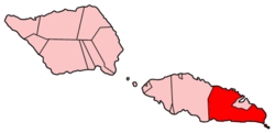 | |
| Landmarks | ||
| Islands |
| |
| Environment | ||
| Electoral constituencies: Faipule Districts |
| |