Sogndal
| Sogndal kommune | |||
|---|---|---|---|
| Municipality | |||
|
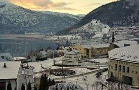
Sogndal by night | |||
| |||
 Sogndal within Sogn og Fjordane | |||
| Coordinates: 61°14′32″N 07°03′18″E / 61.24222°N 7.05500°ECoordinates: 61°14′32″N 07°03′18″E / 61.24222°N 7.05500°E | |||
| Country | Norway | ||
| County | Sogn og Fjordane | ||
| District | Sogn | ||
| Administrative centre | Sogndalsfjøra | ||
| Government | |||
| • Mayor (2007) | Jarle Aarvoll (Ap) | ||
| Area | |||
| • Total | 745.91 km2 (288.00 sq mi) | ||
| • Land | 736.13 km2 (284.22 sq mi) | ||
| • Water | 9.78 km2 (3.78 sq mi) | ||
| Area rank | 146 in Norway | ||
| Population (2010) | |||
| • Total | 7,477 | ||
| • Rank | 141 in Norway | ||
| • Density | 10.2/km2 (26/sq mi) | ||
| • Change (10 years) | 10.7 % | ||
| Demonym(s) | Sogndøl[1] | ||
| Time zone | CET (UTC+1) | ||
| • Summer (DST) | CEST (UTC+2) | ||
| ISO 3166 code | NO-1420 | ||
| Official language form | Nynorsk | ||
| Website |
www | ||
|
| |||


Sogndal is a municipality in Sogn og Fjordane county, Norway. It is located on the northern shore of the Sognefjorden in the traditional district of Sogn. The village of Sogndalsfjøra (population 3,455 in 2012) is the administrative center of Sogndal municipality.[2] Other villages include Kaupanger, Kjørnes, Fimreite, Nornes, and Fjærland. Sogndal Airport, Haukåsen is located 10 kilometres (6.2 mi) southwest of Kaupanger.
The Norwegian dialect spoken in Sogndal is called sognamål.
In 1917, a farmer in Sogndal plowed up the Eggja stone, a gravestone with runic inscriptions important for the history of the Old Norse language.
General information

Sogndal was established as a municipality on 1 January 1838 (see formannskapsdistrikt). The original municipality was identical to the Sogndal parish (prestegjeld) with the sub-parishes (sokn) of Stedje, Norane, and Kaupanger. On 1 January 1964, the Tingstad area (population: 5) was transferred from Leikanger municipality to Sogndal municipality. On 1 January 2000, the sub-parish of Fjærland was transferred from Balestrand municipality to Sogndal.[3][4]
Name
The Old Norse form of the name was Sóknardalr. The first element is the genitive case of the river name Sókn (now called Sogndalselvi), the last element is dalr which means "valley" or "dale". The name of the river is derived from the verb sœkja which means "to seek", and the meaning of the name is "the river which seeks (finds/forces) its way".[5]
Coat-of-arms
The coat of arms for Sogndal are modern; they were granted on 14 December 1984. The arms show the front of a Viking ship in gold on a blue background. The ship symbolizes the nearby naval Battle of Fimreite between King Sverre of Norway and the local King Magnus Erlingsson in the year 1184. The latter was killed together with many nobles of the time.[6]
Churches

The Church of Norway has four parishes (sokn) within the municipality of Sogndal. It is part of the Indre Sogn deanery in the Diocese of Bjørgvin.
The main church of the parish is in Stedje. This is probably one of the oldest church sites in Sogn, probably erected in the first half of the 11th century. The present church was built in 1867, at the same time the old stave church was torn down. A runestone stands near the church, and traces of a Viking settlement have been found nearby.
Sogndal has historically had three sub-parishes (under Stedje): Kaupanger, Norane, and Fjærland. All three of these are also old church sites. The first churches in Kaupanger and Norane were probably built as early as the 11th century and in Fjærland the original church was built around 1600. The present church in Fjærland was built in 1861 and in Norane in 1863. In Kaupanger, the old Stave church from the 12th century is still standing. Excavations show that this was probably the third church on this site. The church was rebuilt in 1862 and lost most of its original character. But today, as a result of a restoration project you will find the church much as it was prior to 1862.[7]
| Parish (Sokn) | Church Name | Location of the Church | Year Built |
|---|---|---|---|
| Fjærland | Fjærland Church | Fjærland | 1861 |
| Kaupanger | Kaupanger Stave Church | Kaupanger | 12th century |
| Norum | Ølmheim Church | Nornes | 1863 |
| Stedje | Stedje Church | Sogndalsfjøra | 1867 |
Government
The municipality is governed by a municipal council of elected representatives, which in turn elect a mayor.
Municipal council

The municipal council (Kommunestyre) of Sogndal is made up of 25 representatives that are elected to every four years. For 2007–2011, the party breakdown is as follows:[8]
| Party Name | Name in Norwegian | Number of representatives | |
|---|---|---|---|
| Labour Party | Arbeiderpartiet | 9 | |
| Progress Party | Framstegspartiet | 3 | |
| Conservative Party | Høgre | 3 | |
| Christian Democratic Party | Kristelig Folkeparti | 2 | |
| Centre Party | Senterpartiet | 4 | |
| Socialist Left Party | Sosialistisk Venstreparti | 2 | |
| Liberal Party | Venstre | 2 | |
| Total number of members: | 25 | ||
Mayor
The mayor of Sogndal is a representative of the majority party of the municipal council who is elected to lead the council. Jarle Aarvoll of the Labour Party was elected mayor for the 2007–2011 term and re-elected for the 2011-2015 term.[9]
Education
With more than 2,000 students in the municipality, Sogndal is the educational center of Sogn og Fjordane County. Students from all over Norway come to Sogndal and they create a high level of activity, which is hard to find in places of similar size.
Sogn og Fjordane University College is one of the main employers in Sogndal. The Western Norway Research Institute is located within the campus, but it is an independent institution with special expertise in information communication, technology systems, environmental research, and organizational research. In addition to the University College, Sogndal has a large upper secondary school and the oldest continuously running folk high school in the country.[10]
History
Subsistence farming
Sogndal is an old dwelling place. Archaeological excavations indicate that people have been living there as far back as 700 BC. The first farms in Sogndal date back to the 1st century AD and findings indicate that these were rich farms. Since ancient time, agriculture has been the most important trade in Sogndal. Traditionally grain cultivation and animal husbandry were the most important, but forestry and fruit growing were also common. Fruit, especially apples, have been grown as far back as there are written sources. In the historical records of King Sverre (1100) there are words and names indicating that apples have been grown in this area.[7]
Industrial revolution
The center of Sogndal, Sogndalsfjøra has a long and remarkable history as a seaside settlement. It probably served as the center of the parish for centuries, with general stores and bakeries testifying to its early importance as a center of commerce and trade.
This was a community characterized by vigorous activity. There were boat landings for farmers living alongside the fjord, military functions were established here, and later on, house owners would rent rooms to the first students of the newly established folk high school. Legal assemblies were held at Hofslund, the vicar lived just nearby, and the church was located within sight at Stedje.
Sogndalsfjøra was inhabited as early as the 17th century. By 1701, the number of permanent residents had reached 60-70, mainly people who did not own property but made their living as day laborers. A century later, the population had increased to 222, and by 1900, 422 residents were registered.
Towards the end of the 19th century, the industrial base had been widened and strengthened. In 1881, there were house painters, a goldsmith, saddlers, carpenters, shoemakers, watchmakers, a tinker, and a butcher. Ten years later, Sogndalsfjøra had its own insurance agent, a telephone operator, an ”automobile chauffeur”, a photographer, and a printer. Sogndalsfjøra was no longer a slum, it was becoming a center of trade, commerce and education.
Sogndal has never been a typical industrial community. Situated along the river 300 metres (980 ft) upstream from the fjord, there was a matchstick factory from the mid-19th century onwards. Later, a wool mill and a bottling plant for soft drinks and fruit juices were added. In 1911, a hydroelectric power station with a 200 kilowatt generator was built here. This was one of the region's first power stations, in fact one of the very first in rural Norway.
On the other side of the river is the Stedje Mill, a turbine-driven grain mill that was of great importance to Sogndal and the neighboring parishes during the early 20th century. It was established in 1893 and remained in use until the 1960s, owned and run by the same family through three generations.[7]
Geography
Sogndal is located on the northern shore of the large Sognefjorden, surrounding the Sogndalsfjorden which branches off the main fjord. Northern Sogndal surrounds the inner part of the Fjærlandsfjorden. The municipality is cut in half by mountains and the Frudal Tunnel connects the southern (more populous) part of Sogndal to the Fjærland area in the north. The Fjærland area is surrounded by mountains and water. The only other access to the Fjærland area comes via the Fjærland Tunnel which connects to Jølster municipality to the north.
The Jostedalsbreen National Park lies in the far northern part of the municipality. The Jostedalsbreen glacier is partially located in Sogndal, and it has several small glacial arms inside Sogndal: Bøyabreen, Jostefonn, and Supphellebreen.
The municipality of Luster lies to the northeast and east; Jølster municipality lies to the northwest; Gaular, Leikanger, and Balestrand municipalities lie to the west; Vik and Lærdal municipalities lie to the south (across the Sognefjorden).
Economy
Agriculture has always played a major role in the municipality of Sogndal. Traditionally, the industries in Sogndal have been centered around the processing of agricultural and forestry products.
Industrial park
The Kaupanger Industrial Park is home to several large companies. Lerum Industries A/S, a producer of lemonade, syrup, juice, and jam, is a cornerstone company in Sogndal, and it is also the largest factory of its kind in Norway. Gilde is a meat processing company specializing in cured meat products. Together with Lerum it constitutes the majority of the traditional industry in Sogndal. Many of the public service functions for the region are also located in Sogndal.[11]
River fishing
Fishing permits (for salmon fishing) are sold for use on specific rivers, including Årøy-elva.[12]
Shopping
Sogndal is the shopping and retail center for the surrounding region which has about 30,000 inhabitants. There are about 70 shops in the compact center of Sogndalsfjøra. Many of these shops are located in the new, modern shopping mall called Sogningen Storsenter.[11]
Sports

Sogndal football
Sogndal has excellent sports accommodations for both indoor and outdoor sports and can offer a great variety of activities. On the national level, Sogndal Fotball (soccer), which plays at Fosshaugane stadium is well known. Sogndal Fotball (formerly Sogndal IL), plays in the Norwegian Premier League (Tippeligaen), which is the top tier of Norwegian football.
Sognahallen
There is room for both competitive and recreational sports, and Sognahallen is the main sports arena in Sogndal. This is a modern sports hall, which has a full-sized football field, including team handball fields, a 100 metres (330 ft) athletics track, and an 18-metre (59 ft) high climbing wall. In cooperation with the Norwegian State College for Physical Education and Sport, Sognahallen has established a great scientific sports centre. This sports centre consists of a strength training studio, an aerobic hall, and a spinning hall. Together with the Sogn og Fjordane University College, Sognahallen has good facilities for sports education, rehabilitation, and testing.[13]
Attractions
- De Heibergske Samlinger – Sogn Folkemuseum and Sogn Fjordmuseum at Kaupanger. It demonstrate life along the Sognefjord in the 18th century to present.
- Kaupanger stavkyrkje - the biggest Stave church in the Sognefjord region, built around 1190.
- Norsk Bremuseum in Fjærland – a museum with “hands on” activities which has won many awards and where you can learn about snow, ice and glaciers.
- Den norske bokbyen in Fjærland - various second hand bookshops, antique stores, and book cafes.[14]
Famous people
- Footballer (soccer player) Eirik Bakke
- Singers Tone Damli Aaberge and Olav Stedje
- The Norwegian sognametal band Windir originated in Sogndal, all of its members were born and raised there
- 19th century thief Gjest Baardsen
- Radio host Kent Fimreite from the international radio channel Hallo Sogn who broadcasting worldwide over the internet
References
- ↑ "Navn på steder og personer: Innbyggjarnamn" (in Norwegian). Språkrådet. Retrieved 2015-12-01.
- ↑ Statistisk sentralbyrå (1 January 2009). "Urban settlements. Population and area, by municipality.".
- ↑ Natvik, Oddvar (9 February 2005). "Some historical data on the 26 Kommunes". Retrieved 23 June 2008.
- ↑ Jukvam, Dag (1999). "Historisk oversikt over endringer i kommune- og fylkesinndelingen" (PDF) (in Norwegian). Statistics Norway.
- ↑ Rygh, Oluf (1919). Norske gaardnavne: Nordre Bergenhus amt (in Norwegian) (12 ed.). Kristiania, Norge: W. C. Fabritius & sønners bogtrikkeri. p. 81.
- ↑ "Civic heraldry of Norway - Norske Kommunevåpen". Heraldry of the World. Retrieved 2014-02-14.
- 1 2 3 "Old time Sogndal". Sogndal Kommune. 17 March 2004. Retrieved 23 June 2008.
- ↑ "Members of the local councils, by party/electoral lists and municipality" (in Norwegian). Statistics Norway. 2011. Retrieved 2014-02-14.
- ↑ Sogndal Kommune (12 October 2008). "Kommunestyret" (in Norwegian). Retrieved 23 June 2008.
- ↑ "Education and Research Centre". Sogndal Kommune. 17 March 2005. Retrieved 23 June 2008.
- 1 2 "Industries, trade and service". Sogndal Kommune. 19 September 2006. Retrieved 23 June 2008.
- ↑ "Laksefiske for alle". Aftenposten. 2014-07-19. p. 11.
- ↑ "Regional Sports Centre". Sogndal Kommune. 19 September 2006. Retrieved 23 June 2008.
- ↑ "Tourism in Sogndal". Sogndal Kommune. 10 December 2004. Retrieved 23 June 2008.
External links
![]() Media related to Sogndal at Wikimedia Commons
Media related to Sogndal at Wikimedia Commons