Smithfield, Ohio
| Smithfield, Ohio | |
|---|---|
| Village | |
|
Smithfield Presbyterian Church | |
 Location of Smithfield, Ohio | |
 Location of Smithfield in Jefferson County | |
| Coordinates: 40°16′15″N 80°46′50″W / 40.27083°N 80.78056°WCoordinates: 40°16′15″N 80°46′50″W / 40.27083°N 80.78056°W | |
| Country | United States |
| State | Ohio |
| County | Jefferson |
| Township | Smithfield |
| Platted | 1803 |
| Area[1] | |
| • Total | 0.95 sq mi (2.46 km2) |
| • Land | 0.95 sq mi (2.46 km2) |
| • Water | 0 sq mi (0 km2) |
| Elevation[2] | 1,247 ft (380 m) |
| Population (2010)[3] | |
| • Total | 869 |
| • Estimate (2012[4]) | 852 |
| • Density | 914.7/sq mi (353.2/km2) |
| Time zone | Eastern (EST) (UTC-5) |
| • Summer (DST) | EDT (UTC-4) |
| ZIP code | 43948 |
| Area code(s) | 740 |
| FIPS code | 39-72760[5] |
| GNIS feature ID | 1065337[2] |

Smithfield is a village in Smithfield Township, Jefferson County, Ohio, United States. The population was 869 at the 2010 census. It is part of the Weirton–Steubenville, WV-OH Metropolitan Statistical Area.
History
Smithfield was platted in 1803.[6] A post office called Smithfield has been in operation since 1814.[7]
During Morgan's Raid, a Union victory in the Civil War in 1863, Confederate Brid. Gen. John Hunt Morgan traveled through the Moorefield, Harrisville, New Athens, Smithfield, New Alexandria, Wintersville, Two Ridge, Richmond, East Springfield, Bergholz, and Monroeville on his way to defeat at the Battle of Salineville.
In 2016, Smithfield survived an initiative to dissolve the village into surrounding Smithfield Township.[8][9]
Geography
Smithfield is located at 40°16′15″N 80°46′50″W / 40.27083°N 80.78056°W (40.270853, -80.780493).[10]
According to the United States Census Bureau, the village has a total area of 0.95 square miles (2.46 km2), all land.[1]
Demographics
| Historical population | |||
|---|---|---|---|
| Census | Pop. | %± | |
| 1820 | 243 | — | |
| 1830 | 386 | 58.8% | |
| 1850 | 425 | — | |
| 1870 | 515 | — | |
| 1880 | 559 | 8.5% | |
| 1890 | 639 | 14.3% | |
| 1900 | 503 | −21.3% | |
| 1910 | 589 | 17.1% | |
| 1920 | 620 | 5.3% | |
| 1930 | 1,023 | 65.0% | |
| 1940 | 1,169 | 14.3% | |
| 1950 | 1,255 | 7.4% | |
| 1960 | 1,312 | 4.5% | |
| 1970 | 1,245 | −5.1% | |
| 1980 | 1,308 | 5.1% | |
| 1990 | 722 | −44.8% | |
| 2000 | 867 | 20.1% | |
| 2010 | 869 | 0.2% | |
| Est. 2015 | 835 | [11] | −3.9% |
2010 census
As of the census[3] of 2010, there were 869 people, 362 households, and 234 families residing in the village. The population density was 914.7 inhabitants per square mile (353.2/km2). There were 437 housing units at an average density of 460.0 per square mile (177.6/km2). The racial makeup of the village was 86.7% White, 11.3% African American, 0.1% Pacific Islander, 0.3% from other races, and 1.6% from two or more races. Hispanic or Latino of any race were 1.2% of the population.
There were 362 households of which 28.7% had children under the age of 18 living with them, 48.3% were married couples living together, 10.2% had a female householder with no husband present, 6.1% had a male householder with no wife present, and 35.4% were non-families. 30.9% of all households were made up of individuals and 14.6% had someone living alone who was 65 years of age or older. The average household size was 2.35 and the average family size was 2.90.
The median age in the village was 42.9 years. 22.4% of residents were under the age of 18; 7.2% were between the ages of 18 and 24; 23.3% were from 25 to 44; 29.8% were from 45 to 64; and 17.3% were 65 years of age or older. The gender makeup of the village was 47.5% male and 52.5% female.
2000 census
As of the census[5] of 2000, there were 867 people, 358 households, and 230 families residing in the village. The population density was 904.5 people per square mile (348.7/km²). There were 405 housing units at an average density of 422.5 per square mile (162.9/km²). The racial makeup of the village was 86.97% White, 9.80% African American, 0.12% Native American, 0.35% from other races, and 2.77% from two or more races. Hispanic or Latino of any race were 0.23% of the population.
There were 358 households out of which 27.4% had children under the age of 18 living with them, 48.9% were married couples living together, 11.5% had a female householder with no husband present, and 35.5% were non-families. 32.1% of all households were made up of individuals and 15.6% had someone living alone who was 65 years of age or older. The average household size was 2.34 and the average family size was 2.90.
In the village the population was spread out with 24.1% under the age of 18, 6.0% from 18 to 24, 26.1% from 25 to 44, 24.0% from 45 to 64, and 19.8% who were 65 years of age or older. The median age was 40 years. For every 100 females there were 90.5 males. For every 100 females age 18 and over, there were 82.8 males.
The median income for a household in the village was $25,179, and the median income for a family was $30,833. Males had a median income of $33,500 versus $17,813 for females. The per capita income for the village was $13,734. About 21.4% of families and 28.8% of the population were below the poverty line, including 37.0% of those under age 18 and 19.1% of those age 65 or over.
Education
Public education in the village of Smithfield is provided by the Buckeye Local School District.
Notable people
- William Sharon - former United States Senator from Nevada
- James Sutherland - former Wisconsin State Senator
References
- 1 2 "US Gazetteer files 2010". United States Census Bureau. Retrieved 2013-01-06.
- 1 2 "US Board on Geographic Names". United States Geological Survey. 2007-10-25. Retrieved 2008-01-31.
- 1 2 "American FactFinder". United States Census Bureau. Retrieved 2013-01-06.
- ↑ "Population Estimates". United States Census Bureau. Retrieved 2013-06-17.
- 1 2 "American FactFinder". United States Census Bureau. Retrieved 2008-01-31.
- ↑ Doyle, Joseph Beatty (1910). 20th Century History of Steubenville and Jefferson County, Ohio and Representative Citizens. Richmond-Arnold Publishing Company. p. 503.
- ↑ "Jefferson County". Jim Forte Postal History. Retrieved 2 January 2016.
- ↑ "Election Summary Report, Jefferson County Primary Election, March 15, 2016, Summary For Jurisdiction Wide, All Counters, All Races, Final Unofficial Results". GEMS Election Results. OhioBOE.com. March 15, 2016. Retrieved March 16, 2016.
- ↑ Haberley, Jessica (March 15, 2016). "It was a big night for income tax levies in Jefferson County". WTOV-TV. Steubenville, Ohio. Retrieved March 16, 2016.
- ↑ "US Gazetteer files: 2010, 2000, and 1990". United States Census Bureau. 2011-02-12. Retrieved 2011-04-23.
- ↑ "Annual Estimates of the Resident Population for Incorporated Places: April 1, 2010 to July 1, 2015". Retrieved July 2, 2016.
- ↑ "Census of Population and Housing". Census.gov. Retrieved June 4, 2015.
Municipalities and communities of Jefferson County, Ohio, United States | ||
|---|---|---|
| Cities | 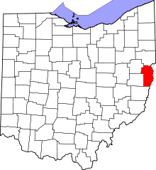 | |
| Villages | ||
| Townships | ||
| CDPs |
| |
| Unincorporated communities |
| |
| Ghost town | ||
| Footnotes | ‡This populated place also has portions in an adjacent county or counties | |
| Counties |  Map of the Pittsburgh Tri-State with green counties in the metropolitan area and yellow counties in the combined area. | |
|---|---|---|
| Major cities | ||
| Cities and towns 15k-50k (in 2010) | ||
| Airports | ||
| Topics | ||
| ||