Slussen metro station
Slussen | |||||||||||||||||||||||||||||||
|---|---|---|---|---|---|---|---|---|---|---|---|---|---|---|---|---|---|---|---|---|---|---|---|---|---|---|---|---|---|---|---|
| Stockholm metro station | |||||||||||||||||||||||||||||||
 | |||||||||||||||||||||||||||||||
| Location | Södermalm, Stockholm | ||||||||||||||||||||||||||||||
| Coordinates | 59°19′9″N 18°4′19″E / 59.31917°N 18.07194°ECoordinates: 59°19′9″N 18°4′19″E / 59.31917°N 18.07194°E | ||||||||||||||||||||||||||||||
| Owned by | Storstockholms Lokaltrafik | ||||||||||||||||||||||||||||||
| Other information | |||||||||||||||||||||||||||||||
| Station code | Slu | ||||||||||||||||||||||||||||||
| History | |||||||||||||||||||||||||||||||
| Opened | 1933 | ||||||||||||||||||||||||||||||
| Rebuilt | 1957 | ||||||||||||||||||||||||||||||
| Services | |||||||||||||||||||||||||||||||
| |||||||||||||||||||||||||||||||
| Location | |||||||||||||||||||||||||||||||
|
 | |||||||||||||||||||||||||||||||

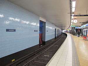
Slussen is a station of the Stockholm metro, located in the district of Södermalm. The station is served by the red and green lines. Originally opened in 1933 as an underground tram stop, in 1950 it became the terminal of the first metro line running south to Hökarängen, it was again rebuilt in 1957 when the line north to Hötorget was opened.[1]
Just outside the entrance to the metro station, there is the end station of the Saltsjöbanan railway, and a bus terminal for buses to the Nacka and Värmdö municipalities.
References
External links
This article is issued from Wikipedia - version of the 4/11/2015. The text is available under the Creative Commons Attribution/Share Alike but additional terms may apply for the media files.