Sloan, New York
| Sloan, New York | |
|---|---|
| Village | |
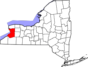
 Location in Erie County and the state of New York | |
| Coordinates: 42°53′40″N 78°47′29″W / 42.89444°N 78.79139°WCoordinates: 42°53′40″N 78°47′29″W / 42.89444°N 78.79139°W | |
| Country | United States |
| State | New York |
| County | Erie |
| Town | Cheektowaga |
| Area | |
| • Total | 0.8 sq mi (2.1 km2) |
| • Land | 0.8 sq mi (2.1 km2) |
| • Water | 0.0 sq mi (0.0 km2) |
| Elevation | 614 ft (187 m) |
| Population (2010) | |
| • Total | 3,661 |
| Time zone | Eastern (EST) (UTC-5) |
| • Summer (DST) | EDT (UTC-4) |
| ZIP code | 14212 |
| Area code(s) | 716 |
| FIPS code | 36-67686 |
| GNIS feature ID | 0965429 |
| Website |
ns |
Sloan is a village in Erie County, New York, United States. The population was 3,661 at the 2010 census. It is part of the Buffalo–Niagara Falls Metropolitan Statistical Area and is in the town of Cheektowaga.
History
The village was incorporated in 1896 from part of Cheektowaga. The CSX rail yards to the village's north and the Norfolk Southern yards to the south mark its historical importance as a railroad town like nearby Depew. (These yards were originally the New York Central and Erie-Lackawanna, respectively.)
For much of its history the village had a police force ranging from three to six officers. The force was abolished circa 1978, and the four patrolmen and one captain were absorbed by the Cheektowaga Police Department, which to this day provides police services to the village.
Visniak brand soft drinks were made in Sloan.
Notable people
- Jerry Augustyniak, drummer for 10,000 Maniacs
- David Dale, former Erie County Legislator
- Edmund P. Radwan, former US congressman
Geography
Sam Sloan owned the land which extended to the New York State Thruway when it was founded, but it is only 1-square-mile (2.6 km2) today. Sloan is located at 42°53′40″N 78°47′29″W / 42.89444°N 78.79139°W (42.894458, -78.791353).[1]
According to the United States Census Bureau, the village has a total area of 0.8 square miles (2.1 km2), all of it land.
The village is bounded on the north by New York State Route 130 (Broadway) and on the east by New York State Route 240 (Harlem Road).
Demographics
| Historical population | |||
|---|---|---|---|
| Census | Pop. | %± | |
| 1900 | 873 | — | |
| 1910 | 1,259 | 44.2% | |
| 1920 | 1,791 | 42.3% | |
| 1930 | 3,482 | 94.4% | |
| 1940 | 3,836 | 10.2% | |
| 1950 | 4,698 | 22.5% | |
| 1960 | 5,803 | 23.5% | |
| 1970 | 5,216 | −10.1% | |
| 1980 | 4,529 | −13.2% | |
| 1990 | 3,830 | −15.4% | |
| 2000 | 3,775 | −1.4% | |
| 2010 | 3,661 | −3.0% | |
| Est. 2015 | 3,601 | [2] | −1.6% |
As of the census[4] of 2000, there were 3,775 people, 1,680 households, and 1,033 families residing in the village. The population density was 4,755.6 people per square mile (1,845.0/km²). There were 1,789 housing units at an average density of 2,253.7 per square mile (874.4/km²). The racial makeup of the village was 99.05% White, 0.21% African American, 0.13% Native American, 0.13% Asian, 0.16% from other races, and 0.32% from two or more races. Hispanic or Latino of any race were 0.72% of the population.
There were 1,680 households out of which 24.0% had children under the age of 18 living with them, 44.5% were married couples living together, 12.5% had a female householder with no husband present, and 38.5% were non-families. 33.3% of all households were made up of individuals and 18.9% had someone living alone who was 65 years of age or older. The average household size was 2.25 and the average family size was 2.89.
In the village the population was spread out with 20.1% under the age of 18, 6.5% from 18 to 24, 28.8% from 25 to 44, 20.4% from 45 to 64, and 24.2% who were 65 years of age or older. The median age was 42 years. For every 100 females there were 89.3 males. For every 100 females age 18 and over, there were 86.2 males.
The median income for a household in the village was $29,420, and the median income for a family was $39,863. Males had a median income of $31,679 versus $23,438 for females. The per capita income for the village was $15,964. About 10.1% of families and 11.5% of the population were below the poverty line, including 19.1% of those under age 18 and 3.9% of those age 65 or over.
References
- ↑ "US Gazetteer files: 2010, 2000, and 1990". United States Census Bureau. 2011-02-12. Retrieved 2011-04-23.
- ↑ "Annual Estimates of the Resident Population for Incorporated Places: April 1, 2010 to July 1, 2015". Retrieved July 2, 2016.
- ↑ "Census of Population and Housing". Census.gov. Retrieved June 4, 2015.
- ↑ "American FactFinder". United States Census Bureau. Retrieved 2008-01-31.