Skorpa, Sogn og Fjordane
 Location in Sogn og Fjordane county | |
| Geography | |
|---|---|
| Location | Sogn og Fjordane, Norway |
| Coordinates | 61°36′00″N 4°50′30″E / 61.6001°N 4.8416°ECoordinates: 61°36′00″N 4°50′30″E / 61.6001°N 4.8416°E |
| Area | 9 km2 (3.5 sq mi) |
| Length | 5.7 km (3.54 mi) |
| Width | 2.8 km (1.74 mi) |
| Highest elevation | 393 m (1,289 ft) |
| Highest point | Blåkollen |
| Administration | |
| County | Sogn og Fjordane |
| Municipality | Flora Municipality |
Skorpa is an island in the municipality in Flora in Sogn og Fjordane county, Norway. The 9-square-kilometre (3.5 sq mi) island lies about 6 kilometres (3.7 mi) west of the town of Florø in a large group of inhabited islands. Skorpa lies about 1.5 kilometres (0.93 mi) north of the islands of Reksta and Kinn and about 1.5 kilometres (0.93 mi) south of the island of Fanøya.
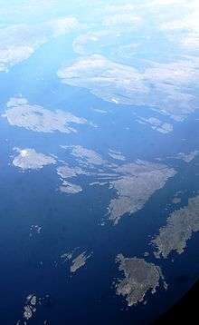
Aerial view (center right part of the picture)
The island is rocky, mountainous, and barren. Almost all the settlement is located on the southwestern shore. The population (2001) was about 60 residents.[1]
See also
References
- ↑ Store norske leksikon. "Skorpa" (in Norwegian). Retrieved 2013-11-05.
This article is issued from Wikipedia - version of the 11/17/2016. The text is available under the Creative Commons Attribution/Share Alike but additional terms may apply for the media files.