Sirod
| Sirod | |
|---|---|
|
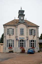
Town hall | |
 Sirod | |
|
Location within Bourgogne-Franche-Comté region  Sirod | |
| Coordinates: 46°44′02″N 5°59′04″E / 46.7339°N 5.9844°ECoordinates: 46°44′02″N 5°59′04″E / 46.7339°N 5.9844°E | |
| Country | France |
| Region | Bourgogne-Franche-Comté |
| Department | Jura |
| Arrondissement | Lons-le-Saunier |
| Canton | Champagnole |
| Government | |
| • Mayor (2014–2020) | Luc Dodane |
| Area1 | 16.10 km2 (6.22 sq mi) |
| Population (2013)2 | 582 |
| • Density | 36/km2 (94/sq mi) |
| Time zone | CET (UTC+1) |
| • Summer (DST) | CEST (UTC+2) |
| INSEE/Postal code | 39517 / 39300 |
| Elevation | 560–890 m (1,840–2,920 ft) |
|
1 French Land Register data, which excludes lakes, ponds, glaciers > 1 km² (0.386 sq mi or 247 acres) and river estuaries. 2 Population without double counting: residents of multiple communes (e.g., students and military personnel) only counted once. | |
Sirod is a commune in the Jura department in the Bourgogne-Franche-Comté region in eastern France.
Population
| Historical population | ||
|---|---|---|
| Year | Pop. | ±% |
| 1793 | 788 | — |
| 1806 | 822 | +4.3% |
| 1821 | 822 | +0.0% |
| 1831 | 1,152 | +40.1% |
| 1841 | 1,080 | −6.2% |
| 1851 | 833 | −22.9% |
| 1861 | 775 | −7.0% |
| 1872 | 774 | −0.1% |
| 1881 | 740 | −4.4% |
| 1891 | 602 | −18.6% |
| 1901 | 529 | −12.1% |
| 1911 | 511 | −3.4% |
| 1921 | 499 | −2.3% |
| 1931 | 472 | −5.4% |
| 1946 | 502 | +6.4% |
| 1954 | 484 | −3.6% |
| 1962 | 496 | +2.5% |
| 1968 | 452 | −8.9% |
| 1975 | 518 | +14.6% |
| 1982 | 574 | +10.8% |
| 1990 | 539 | −6.1% |
| 1999 | 528 | −2.0% |
| 2006 | 550 | +4.2% |
| 2013 | 582 | +5.8% |
See also
References
| Wikimedia Commons has media related to Sirod. |
This article is issued from Wikipedia - version of the 2/26/2016. The text is available under the Creative Commons Attribution/Share Alike but additional terms may apply for the media files.