Sipson
| Sipson | |
 King William IV public house |
|
 Sipson |
|
| OS grid reference | TQ075785 |
|---|---|
| – Charing Cross | 14.3 mi (23.0 km) E |
| London borough | Hillingdon |
| Ceremonial county | Greater London |
| Region | London |
| Country | England |
| Sovereign state | United Kingdom |
| Post town | WEST DRAYTON |
| Postcode district | UB7 |
| Dialling code | 020 |
| Police | Metropolitan |
| Fire | London |
| Ambulance | London |
| EU Parliament | London |
| UK Parliament | Hayes and Harlington |
| London Assembly | Ealing and Hillingdon |
Coordinates: 51°29′42″N 0°27′02″W / 51.4951°N 0.4505°W
Sipson is a village in the historic county of Middlesex, England, but since 1965 has been administered as part of the London Borough of Hillingdon, the westernmost borough of Greater London. It is 14.3 miles (23 km) west of Charing Cross and near the north perimeter of London Heathrow Airport.
History
Toponymy
The village's name comes from the Anglo-Saxon Sibbwines tūn: "Sibbwine's farmstead". Sipson village adjoins the famous "Bath Road" (the modern A4), which linked London to Bath.
Heathrow expansion
On 10 January 1946 the British Cabinet agreed Stage 3 of the airport, which was an extension north of the Bath Road, with a large triangle of 3 runways, obliterating Sipson and most of Harlington, and diverting the Bath Road.[1]
In 2009 the majority of the village was under threat of demolition owing to the planned expansion of London Heathrow Airport, which would have created a third runway at the airport.[2][3] However, in March 2010 in accordance with multilateral environmental regulations and evidence that gas pollutant thresholds would be further breached within the wider area the English High Court of Justice ruled that the plan which the Department had submitted must be reconsidered.[4] Accordingly, the Government announced in May 2010 that the third runway plan had been cancelled but that a long-term study into airport capacity in the South East and beyond may recommend expansion to any of the London Airports where the environmental constraints can all be met.[5] Since 2009 BAA have been acquiring property in Sipson and elsewhere when advertised for sale which means there will be fewer resident owners to oppose further plans for expansion with a third runway. Contrary to this movement, opponents such as actress Emma Thompson and various others have bought land within the boundaries in 2009 with a view to preventing such expansion. In addition to this there has been a long term occupation of land within Sipson by climate activists on the invitation of local residents, following the latest Climate Camp. Grow Heathrow is a squatted community, opposed to the expansion of Heathrow airport and committed to finding sustainable alternatives in the face of climate change, peak oil and economic crises. Further, local residents have started a new campaign in 2014 called Stop Heathrow Expansion, with widespread support from local MPs and Councillors.
Businesses
Sipson Farm
Sipson Farm was in the northeast angle of the Sipson crossroads. It was the biggest farm in the area. It had a big area of greenhouses. It had 500 acres of land in Harmondsworth and Sipson and Harlington and Heathrow. In 1900 it had a big area of fruit orchard.
- 1819: Enclosure of Harmondsworth parish
- And see Heathrow (hamlet)#19th century.
- 1842: Thomas Wild was born.
- Late 19th century: Sipson Farm was run by Thomas Wild & Son.
- 1898: Thomas Wild took on Rowland Richard Robbins as junior partner and the firm became Wild and Robbins.
- 1900 to 1948; R.R.Robbins lived in a house called Hollycroft, where Hollycroft Close is now.[6]
- c.1910: Wild and Robbins gave some land in Sipson to be tennis courts and a children's playground.[7]
- 1932: Thomas Wild died and was succeeded by his son Thomas Wild.
- 6 April 1938: Wild & Robbins was wound up "for reconstruction".[8]
- 1944. The Heathrow Airport scheme started. Sipson Farm lost all or most of its land that was south of the Bath Road.
- 31 March 1949: R.R.Robbins left the partnership by mutual agreement, but the firm's name remained Wild & Robbins.[9] Sipson Farm was now run by Thomas Wild and his son Thomas Wild.
- This is genuine: there were three successive Thomas Wilds.
- 1965: The M4 motorway was opened past Sipson. Its course and the Heathrow Airport slip road and its junction took much of Sipson Farm's remaining land. After this, Sipson Farm struggled to keep running.
- 1970: Sipson Farm shut down. Some of its remaining land was left to fall back to wild overgrown vegetation.
- Early 1980s: Sipson Farm's farm buildings were demolished and replaced by a residential road called Russell Gardens. The entry to the farm became the entry to 335 Sipson Road.
- 23 December 1987: It was agreed that Sipson Farm Estates Ltd. should be wound up.[10][11][12]
Wall Garden Farm
Wall Garden Farm is a little east of the Sipson crossroads, north of the road to Harlington. It was orchard land, surrounded and divided by high walls to keep winds and frost (and fruit thieves) off.
- Early 1900s: See Heathrow (hamlet)#20th century for events involving Jonathan Smith. Jonathan Smith went bankrupt and moved from Heathrow Hall to Wall Garden Farm. Later he came to an arrangement with his creditors and the bankruptcy was discharged. He set up a jam factory to use the abundant fruit grown in the area. His son Frederick ran the jam factory after him. (Kenwood Close (a street in Sipson) is where the jam factory was.)[13]
- 1970: By now most of Wall Garden Farm's trees had been grubbed out.
- 2004: Wall Garden Farm was being used for off-airport car parking for Heathrow Airport.
King William IV pub
The King William IV public house at the Sipson crossroads was built in the 16th century, and later altered, including a refronting in the 1930s. Originally a Wealden-type mediaeval hall house, it is a Grade II listed building.[14]
Excavating gravel
Gravel companies own much land in Harmondsworth and Sipson and Harlington. They get planning permission to extract gravel and sand on condition that they restore the land for agriculture afterwards. Their land is used for growing wheat before and after gravel extracting.[15]
Other history
- 1923: Sipson Way was made.
Notable buildings
| name | type | built | occupant | demolished? | use of house or site now |
|---|---|---|---|---|---|
| The Vineries | big house | 1880s | Thomas Wild (born 1842), then his son Thomas | 1970 | street: Vineries Close |
| Sipson Baptish Church | religious | 1891 | misc. Christian religious uses | no | mid-1980s converted into apartments |
| Inglenook | big house | for Thomas Wild jr. when he married Elizabeth Rayner, then his son Thomas | no | now a children's day nursery | |
| Hollycroft | big house | 18th century | 1900-1948 R.R.Robbins | 1960s | street: Hollycroft Close |
| The Crown | pub | mid-Victorian | no | now Zayani Indian Restaurant | |
| Sipson House | big house | 18th century | 1970s except for façade | rebuilt in same style, as office block, now called Sipson Court | |
| Sipson Post Office | Post office and village shop | 17th century with 19th century shop extension | Formerly owned by the Francis family from the 1920s to 2012 | No | Post Office and village shop and butchery |
| The King William IV | Public House | 17th century | No | Pub | |
Notable people
- Lionel Robbins (1898-1984), eminent economist, was born in Sipson
Nearest places
 |
West Drayton | West Drayton | Hayes | |
| Harmondsworth | |
Harlington | ||
| ||||
| | ||||
| across Heathrow Airport Stanwell |
across Heathrow Airport Bedfont |
across Heathrow Airport Hatton |
References
- For book references see London Heathrow Airport#Bibliography.
- ↑ Sherwood 2009, p87
- ↑ "Transport Secretary's statement to the House of Commons, 15th January 2009". Department of Transport. Retrieved 2009-01-16.
- ↑ "New runway will demolish village". BBC News. 2009-01-15. Retrieved 2009-01-15.
- ↑ Bowcott, Owen (2010-03-26). "Heathrow protesters win third runway court victory". The Guardian. London.
- ↑ "Heathrow runway plans cancelled". BBC News. 2010-05-12.
- ↑ Sherwood, 2012, p58.
- ↑ Sherwood, 2012, p61.
- ↑ London Gazette
- ↑ London Gazette
- ↑ London Gazette
- ↑ Sherwood, 2011, p59.
- ↑ Sherwood, 2012, p3.
- ↑ Sherwood, 2011, p61.
- ↑ Sherwood, 2011, p62.
- ↑ Sherwood, 2012, p96.
External links
| Districts | 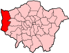 | |
|---|---|---|
| Attractions |
| |
| Parks and open spaces |
| |
| Constituencies | ||
| Local government | ||
| Tube and rail stations | ||
| Places of worship | ||
| Other topics | ||
| ||