Sinus Roris
 | |
| Coordinates | 54°00′N 56°36′W / 54.0°N 56.6°WCoordinates: 54°00′N 56°36′W / 54.0°N 56.6°W |
|---|---|
| Diameter | 202 km |
| Eponym | Bay of Dew |
Sinus Roris (Latin for "Bay of Dew") is an extension of the northern edge of Oceanus Procellarum on the Moon. The IAU-defined selenographic coordinates of this bay are 54.0° N, 56.6° W, and the diameter is 202 km.
The borders of this feature are somewhat indistinct. The bay proper is framed along the western edge by the craters Markov and Oenopides, and to the north by Babbage and South. At the eastern edge it joins the Mare Frigoris.
Many selenographers have taken liberties with the dimensions of Sinus Roris. Lunar maps often indicate a much larger region for this bay than the official dimensions. These can range out as far as the craters Gerard and Repsold to the west, Harpalus to the east, and as far south as 44° N latitude, approaching Mons Rümker.
The area where the official coordinates place this bay has a generally higher albedo than the mare to the south, most likely due to deposits of ejecta from impacts to the north.
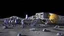
Early concepts of a moon landing promoted by Wernher von Braun envisaged the establishment of a permanent lunar base in the Sinus Roris region.[1] These concepts lead, in much modified form, to Project Apollo.
Arthur C. Clarke's novel A Fall of Moondust is set in a fictional "Sea of Thirst" located within Sinus Roris.
References
- ↑ "Von Braun Lunar Lander". Encyclopedia Astronautica. Retrieved September 5, 2015.
External links
| American projects |
|  |
|---|---|---|
| Soviet and Russian projects |
| |
| Others projects |
| |
| Proposed sites | ||