Silverlake (Washington)
| Silverlake, Washington | |
|---|---|
| Unincorporated community | |
 Silverlake, Washington Location in the state of Washington | |
| Coordinates: 46°17′50″N 122°48′38″W / 46.29722°N 122.81056°WCoordinates: 46°17′50″N 122°48′38″W / 46.29722°N 122.81056°W | |
| Country |
|
| State |
|
| County | Cowlitz |
| Elevation[1] | 158 m (518 ft) |
| Time zone | PST (UTC−8) |
| • Summer (DST) | PDT (UTC−7) |
| ZIP code | 98645 |
| Area code(s) | 360 |
| FIPS code[2] | 53-01500 |
| GNIS feature ID | 1508354 |
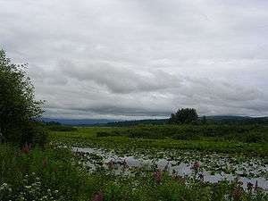
Silverlake (Not to be confused with Silver Lake), in Washington, United States, is both a marsh and unincorporated area located about 30 miles (48 km) west of Mount St. Helens. It is home to a nature trail, and the visitor center for the Mount St. Helens National Monument. The lake itself is 3,000 acres (12 km2) in size and camping is available at Seaquest State Park, which occupies 475 acres (192 ha) along 1 mile (1.6 km) of the lakeshore. Camping, fishing, and boating also available at Silverlake Resort, Streeters Resort, and Mt. St. Helens RV Resort.
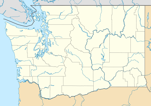
Silverlake is located in Cowlitz County, in the southwestern portion of Washington. Employment in the area is primarily centered on the cities of Longview, Kelso, and Castle Rock, which are all situated along the Interstate-5 freeway.
The area considered Silverlake is about 6 miles (10 km) east of Interstate 5 (I-5) and is approximately 50 miles (80 km) from Portland, Oregon, to the south and Seattle about 110 miles (180 km) to the north. The closest cities to the subject property are Castle Rock, six miles (10 km) to the west, and Toutle, four miles (6 km) east. The area in general relies on an economy that is largely based around the timber and tourism industry, but tourism has taken precedence since the declining timber industry.
Local economic growth has remained stable due to the plethora of outdoor activities take place in the scenic Silverlake area, including camping, hunting, and fishing. Additionally, the Pacific Ocean is approximately 90 minutes west and skiing and other wilderness activities are all within an hour away.
Silverlake is served by one major road, Spirit Lake Memorial Highway, which joins I-5 in Castle Rock to the west and runs east to the US Forest Services’ Mount Saint Helens Observatory at Johnson Ridge. This highway is a two-directional arterial heading west and east with both residential and commercial development areas running alongside it. Major shopping, dining and commercial properties are located up and down the I-5 corridor.
Silverlake is not an incorporated town, but relies primarily on Castle Rock and the town of Toutle for schools and services. Cowlitz County provides most services including police, fire, ambulance, water, sewer, and garbage. Gas service is provided by Cascade Natural Gas while CenturyLink and Frontier Communications provide telephone service. The area is composed of a mixture of uses that range from single-family and multi-family residential, commercial, retail, and agricultural uses. Traffic volume along Silver Lake remains consistent with approximately 1,000 cars passing it per day.
References
- ↑ "USGS—Silver Lake, Washington". Retrieved 31 December 2014.
- ↑ EPA— Washington Codes by County Retrieved 31 December 2014