Silver City, North Carolina
| Silver City, North Carolina | |
|---|---|
| CDP | |
 Location of Silver City, North Carolina | |
| Coordinates: 34°59′41″N 79°13′42″W / 34.99472°N 79.22833°WCoordinates: 34°59′41″N 79°13′42″W / 34.99472°N 79.22833°W | |
| Country | United States |
| State | North Carolina |
| County | Hoke |
| Area | |
| • Total | 1.5 sq mi (4.0 km2) |
| • Land | 1.5 sq mi (4.0 km2) |
| • Water | 0.0 sq mi (0.0 km2) |
| Elevation | 249 ft (76 m) |
| Population (2010) | |
| • Total | 882 |
| • Density | 746.7/sq mi (288.3/km2) |
| Time zone | Eastern (EST) (UTC-5) |
| • Summer (DST) | EDT (UTC-4) |
| FIPS code | 37-61920[1] |
| GNIS feature ID | 1022633[2] |
Silver City is a census-designated place (CDP) in Hoke County, North Carolina in the United States. The population was 1,146 at the 2000 census.
Geography
Silver City is located at 34°59′41″N 79°13′42″W / 34.994715°N 79.228395°W.[3]
According to the United States Census Bureau, the CDP has a total area of 1.5 square miles (3.9 km2), all of it land.
Demographics
As of the census[1] of 2000, there were 1,146 people, 424 households, and 303 families residing in the CDP. The population density was 746.7 people per square mile (289.2/km2). There were 465 housing units at an average density of 303.0 per square mile (117.3/km2). The racial makeup of the CDP was 3.40% White, 94.24% African American, 0.70% Native American, 0.44% Asian, 0.44% from other races, and 0.79% from two or more races. Hispanic or Latino of any race were 1.31% of the population.
There were 424 households out of which 25.9% had children under the age of 18 living with them, 30.0% were married couples living together, 35.8% had a female householder with no husband present, and 28.5% were non-families. 26.7% of all households were made up of individuals and 11.3% had someone living alone who was 65 years of age or older. The average household size was 2.70 and the average family size was 3.26.
In the CDP the population was spread out with 27.1% under the age of 18, 9.0% from 18 to 24, 26.4% from 25 to 44, 22.9% from 45 to 64, and 14.7% who were 65 years of age or older. The median age was 38 years. For every 100 females there were 76.3 males. For every 100 females age 18 and over, there were 75.1 males.
The median income for a household in the CDP was $25,238, and the median income for a family was $29,464. Males had a median income of $24,444 versus $18,850 for females. The per capita income for the CDP was $13,139. About 15.3% of families and 20.7% of the population were below the poverty line, including 25.8% of those under age 18 and 23.8% of those age 65 or over.
References
- 1 2 "American FactFinder". United States Census Bureau. Retrieved 2008-01-31.
- ↑ "US Board on Geographic Names". United States Geological Survey. 2007-10-25. Retrieved 2008-01-31.
- ↑ "US Gazetteer files: 2010, 2000, and 1990". United States Census Bureau. 2011-02-12. Retrieved 2011-04-23.
Municipalities and communities of Hoke County, North Carolina, United States | ||
|---|---|---|
| City | 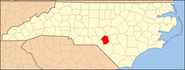 | |
| Town | ||
| CDPs | ||
| Military base | ||
| Footnotes | ‡This populated place also has portions in an adjacent county or counties | |