Silchar
| Silchar শিলচর | |
|---|---|
| City | |
|
Aerial view of the Barak river, Silchar | |
| Nickname(s): The Island of Peace | |
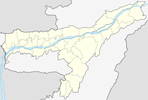 Silchar  Silchar Location in Assam, India | |
| Coordinates: 24°49′N 92°48′E / 24.82°N 92.8°ECoordinates: 24°49′N 92°48′E / 24.82°N 92.8°E | |
| Country | India |
| State | Assam |
| District | Cachar |
| Government | |
| • Body | Silchar Municipality Board |
| • No. of Wards | 28 |
| Elevation | 22 m (72 ft) |
| Population (2011) | |
| • Total | 228,985 |
| • Rank | 2 (in Assam after Guwahati ) |
| Languages | |
| • Official | bangla |
| Time zone | IST (UTC+5:30) |
| PIN | 7880xx |
| Telephone code | +91 (0) 3842 |
| ISO 3166 code | IN-AS |
| Vehicle registration | AS-11 |
| Website |
www |

Silchar (/ˈsɪlˌʧə/ or /ˈʃɪlˌʧə/) (Bengali: শিলচর Shilchôr) is the headquarters of Cachar district in the state of Assam in India. It is 343 kilometres (213 mi) south east of Guwahati. It is the second-largest city of the state in terms of population and municipal area.[1]
It also has the 2nd busiest Airport (76 civilian flights/week) in Assam and 4th busiest in North east after Guwahati, Agartala and Imphal.
After around 68 years of Indian independence, only recently, the railroad connectivity has been upgraded to broad gauge. Suresh Prabhu, the present rail minister, has announced direct rail connectivity to metropolitan cities like New Delhi and Kolkata with regular train services having been commenced as planned.
Being politically stable in the otherwise disturbed Northeast earned it the bon mot of "Island of Peace" from India's then Prime Minister Indira Gandhi.[2]
Approximately 90% residents of Silchar are Bengalis who speak the Sylheti dialect, the rest being Bihari people, Bishnupuriya, Dimasa Kachari, Manipuri (Meitei), Marwaris, Assamese and some tribal groups like Nagas. Silchar is situated by the banks of the Barak River in what is popularly known as Barak Valley. Rice is the staple cereal. Fish is also widely consumed. Shuţki (the local name for dried fish), shidal chutney and chunga-r peetha (sticky rice cakes prepared inside bamboo sticks) are some of the local delicacies.
Etymology
During the British rule, ships were docked at the bank of the river Barak. Gradually, a market developed at the bank and became a major place of economic activity. The bank was covered with stones to help dock ships and vessels, and the market was developed at a place that was fully covered with stones. People started to refer to the place as Shiler Chor, meaning "a bank of stones". With the passage of time, Shiler Chor was simplified to Silchar, and ultimately the British officials started to use the name Silchar in their official documents referring to the surrounding area of the market. Thus Silchar became the official name of the place.[3]
History
Cachar district records
In the 1850s, British tea planters re-discovered the game polo in Manipur on the Burmese border with India. The first polo club in the world was formed at Silchar.
http://www.guardspoloclub.com/the-club/the-sport http://www.avictorian.com/polo_gallery.html
The first competitive modern form of polo was played in Silchar, the plaque for this feat still stands behind the District Library, Silchar.
Railway link

The Assam Bengal Railway brought Silchar into the Indian railway map in 1899. The railway line from Lumding to Silchar is hailed as one of the most exciting pristine railway tracks of India. Built by the British during the colonial rule, the meter gauge line stands testimony to the grandiose of what was once a highly popular city in the North-East is now converted to Broad Gauge. But in November 2015 a new railway track broad gauge introduce by replacing meter gauge between silchar to guwahati.
Language martyrs

Silchar saw one of the uprisings in favour of the Bengali language. When the Assam government, under Chief Minister Bimala Prasad Chaliha, passed a circular to make Assamese mandatory, Bengalis of Barak Valley protested. On 19 May 1961, when Assam police opened fire on unarmed protesters at Silchar railway station, 11 agitators died. After the popular revolt, the Assam government had to withdraw the circular and Bengali was ultimately given official status in the three districts of Barak Valley.[4][5]
Economy

Over the past few years, the town has seen an influx of people from nearby States and places due to the Silchar's increasing prospects and other developments in the field of education , medical facilities etc. making the town quite over-crowded.
Industries
- Tea Estate: Silchar is surrounded by approximately, 100 tea estates. The quality of soil and climate around Silchar is conducive for production of high quality Assam Tea, during the British occupation tea plantation was introduced in the area. Popular tea companies based in Silchar are Dewan, Doloo, Koomber and Chandighat. These tea gardens also double up as tourist attractions and scenic spots given the picturesque view. The office of the Surma Valley Branch Indian Tea Association (SVBITA) is located at Silchar.
- ONGC has its base at silchar located in SRIKONA known as CACHAR FORWARD BASE with ongoing operations in Tripura, Mizoram and Barak Valley.[6]
- MEGA IOC DEPOT: The Indian Oil Corporation has resolved to set up a mega storage depot at Silchar.
According to official sources at the IOC, the new depot can store up to 30,000 kilo litres of petroleum. "Once the depot comes up, there will be no dearth of petroleum products not only for Barak Valley, but this will be a buffer stock for export even to the ASEAN nations," the source claimed.Cachar district administration say the land acquisition process is also wrapped up and the IOC is waiting for the mandatory environmental clearance.[7]
- CACHAR PAPER MILL: It's a unit of Hindustan Paper Corporation Limited (A Govt. Of India Enterprises). It is located in Panchgram. The distance is 26 km from Silchar. The mill has the capacity to install 1 lakh MT production.The Industry produces a fine quality paper from bamboo.Many people from Silchar are working in paper mill.
- Assam Industrial Development Corporation Complex at Malinibeel Silchar is a hub for micro small scale units in Silchar. It houses units like manufacturing of Industrial gas, manufacturing of HDPE products, Biscuit factory, lime factory and many more Small scale units are coming up.
- Bisleri Bottling Plant is located near NIT-Silchar.
Shopping complexes
Silchar has a number of malls and shopping complexes such as:


- Ismail Market, Central Road
- Goldighi Mall
- Big Bazaar
- Pantaloons
- Reliance Mart
- Metro Bazar
- Vishal
- Entertainment plaza
- Imperial Mall
- Ellora Super Market
- Nahata-Mart
- Gold Digital Cinema
- Eylex
- City-Life
- KFC
- Dominos
- Pizza Hut
- SUBWAY
- NAHAZ
Geography
Silchar is located in the southern part of Assam.[8][9] Situated on the banks of the Barak River, it is a trade and processing centre for tea, rice and other agricultural products. There is limited industry, principally papermaking and tea-box manufacturing. The city has an airport and is connecting to Guwahati, Agartala, Imphal, and Aizawl. Silchar is regarded as an important road junction of the North Eastern India and serves as a major point of connection for Tripura, Manipur and Mizoram.
The area of Silchar town is 15.75 km2. It has an average elevation of 25 meters (82 feet).[10]
Demographics
As of 2011 India census, Silchar had a population of 178,865.[11] Total number of males were 89,961 and females 88,904. The sex ratio of Silchar was 988 females per 1000 males, which is above the national ratio of 940 females per 1000 males. Silchar metropolitan region has an average literacy rate of 90.26%, much higher than the national average of 59.5%, with male literacy of 92.90% and female literacy at 87.59%.[12] Hinduism is majority religion in Silchar city with 86.31% followers. Islam is second most popular religion in city of Silchar with approximately 12.17% following it. Jainism is followed by 0.79%, Christianity by 0.59%, Sikhism by 0.04% and Buddhism by 0.04% of the population in the Silchar city. Around 0.00% stated 'Other Religion', approximately 0.08% stated 'No Particular Religion'.[12]
Climate
At Silchar, the climate is tropical by nature. The wind generally blows from the northeast in the morning and from the southeast in the afternoon. Summer is hot, humid and interspersed with heavy rainfall and thunderstorms. Winter generally starts towards the end of November and lasts till late February. Towards the start of the Bengali month of Baishakh (mid-April) rain clouds start covering the skyline. Silchar is inundated frequently due to excessive rainfall and floods by the River Barak. Over the last three decades, Silchar and the Barak Valley have been ravaged by four major floods - one in 1986, followed by the ones in 1991, 2004 and 2007.
| Climate data for Silchar (1971–2000) | |||||||||||||
|---|---|---|---|---|---|---|---|---|---|---|---|---|---|
| Month | Jan | Feb | Mar | Apr | May | Jun | Jul | Aug | Sep | Oct | Nov | Dec | Year |
| Record high °C (°F) | 31.0 (87.8) |
35.0 (95) |
37.8 (100) |
39.4 (102.9) |
39.1 (102.4) |
37.9 (100.2) |
39.4 (102.9) |
39.0 (102.2) |
38.3 (100.9) |
36.7 (98.1) |
35.0 (95) |
31.7 (89.1) |
39.4 (102.9) |
| Average high °C (°F) | 24.5 (76.1) |
26.4 (79.5) |
29.6 (85.3) |
30.5 (86.9) |
31.0 (87.8) |
31.5 (88.7) |
31.4 (88.5) |
31.9 (89.4) |
31.5 (88.7) |
30.9 (87.6) |
29.1 (84.4) |
26.1 (79) |
29.6 (85.3) |
| Average low °C (°F) | 12.1 (53.8) |
14.1 (57.4) |
17.7 (63.9) |
21.0 (69.8) |
23.0 (73.4) |
24.6 (76.3) |
25.1 (77.2) |
25.2 (77.4) |
24.6 (76.3) |
22.9 (73.2) |
18.6 (65.5) |
13.9 (57) |
20.4 (68.7) |
| Record low °C (°F) | 3.3 (37.9) |
2.8 (37) |
8.3 (46.9) |
13.2 (55.8) |
15.6 (60.1) |
19.3 (66.7) |
19.0 (66.2) |
19.4 (66.9) |
16.8 (62.2) |
14.4 (57.9) |
10.6 (51.1) |
4.4 (39.9) |
5.0 (41) |
| Average precipitation mm (inches) | 12.1 (0.476) |
44.2 (1.74) |
229.3 (9.028) |
258.1 (10.161) |
460.7 (18.138) |
612.0 (24.094) |
503.2 (19.811) |
427.7 (16.839) |
366.5 (14.429) |
168.7 (6.642) |
33.3 (1.311) |
12.8 (0.504) |
3,128.6 (123.173) |
| Average rainy days | 1.0 | 3.9 | 8.5 | 12.6 | 16.2 | 21.5 | 22.5 | 19.3 | 15.5 | 7.7 | 2.4 | 0.6 | 131.6 |
| Source: India Meteorological Department (record high and low up to 2010)[13][14] | |||||||||||||
Satellite Townships
The rapidly expanding population of silchar has made it necessary to expand in all directions and small townships. Already two townships are coming up rapidly
Education
Schools
The schools of Silchar are run by the state government and private organisations. Bengali and English are the primary languages of instruction; Assamese and Hindi are also used. The schools are affiliated to either Secondary Board of Education, Assam (SEBA) or the CBSE. Prominent schools of Silchar include:-
- Maharishi Vidya Mandir Higher Secondary School
- Silchar Collegiate School
- Holy Cross Higher Secondary School
- Ramanuj Vidyamandir
- B.N.M.P Higher Secondary school
- Vivekananda Kendriya Vidyalaya
- Adhar Chand Higher Secondary School
- Don Bosco Higher Secondary School
- Pranabananda Holy Child School
- Sarla Birla Gyan Jyoti School
- Cachar High School
- Muktashree High School
- South Point School
- Narsing Higher Secondary School
- Govt. Boys Higher Secondary School
- Govt. Girls Higher Secondary School
- DNNK Girls High School
- Saint Capitano High School
- Chhotelal Seth High School
- Public High School
- Kendriya Vidyalayas- Silchar city
- K.V Kumbhirgram (AAI and IAF base)
- K.V Srikona (ONGC Base)
- K.V Masimpur (INDIAN ARMY Cantonment)
- K.V NIT-Silchar
- K.V Assam University, Silchar (Upcoming)
- Oriental High School
- Tarun Ram Phukan Assamese High School
- Shyama Charan Deb Vidyapith, Tarapur
- Normal School
- Hiron Prova Deb Sishu Mandir School
University
Silchar is home to the main campus of Assam University, a central university, which imparts education in both the general as well as professional streams. The university, which came into existence in 1994, has 16 schools and 35 post-graduate departments under them. The university has 56 affiliated colleges under it.[17][18] The colleges in Silchar are mostly affiliated with the Assam university.
Technical Institutions
- Triguna Sen School of Technology, Assam University, Silchar[19]
- Silchar Polytechnic[20]
- Srikona Industrial Training Center (ITI)
- ARIIT (Assam Rifles Institute of Information Technology)[7]
- C-DAC[21]
- NIELIT (National Institute of Electronics and Information Technology)[22]
- NIAIMT[23]

Dholchera campus is spread over 65 acres of land and the Jaffirbond campus covers 20 acres. NIAIMT is one of the significant imitative by Government of India under NATRiP for entire northeast area to implement modern infrastructure and facilities aiming to develop skills to handle the latest automobiles by providing training to the youths. This center has also created infrastructure to test in-use vehicle by applying latest technologies, thus making the roads safer.
Colleges
- Ramanuj Gupta Junior College
- East Silchar Junior College
- Guru Charan College
- Cachar College
- Women's College
- Radhamadhab College,
- Silchar College of Arts and commerce,[24]
- Hemangini Dey memorial Jr. College
- Aryan Junior College of Science
- BBD junior College
- Lalit Jain Junior College of Commerce
- Vivekananda Junior College
- Lalit Jain Commerce College
Medical College
- Silchar Medical College and Hospital, established in 1968, serves the southern region of Assam. There is an Institute of Pharmacy attached to it.[25]
B.Ed and Law colleges
Silchar also has:
- B.Ed College, at N.S. AVENUE
- A.K. ChandaLaw College[26] at Tarapur.
Healthcare
Silchar has a number of good hospitals and nursing homes, some of them are as follows:
- Silchar Medical College and Hospital [27]
- Silchar Civil Hospital [28]
- Green Hills Nursing Home
- KAY-CEE Nursing Home
- Sudipta Nursing Home
- South City Nursing Home
- Life line Nursing Home
- Nightingale Nursing Home
- Medinova Nursing Home
- Valley View Nursing home
- A 10 storie Multi- Speciality Nursing Home is coming up near the satellite town ship of Sun-City
- Mediland Hospital and Research Centre
- Lions Eye Hospital
- Sundari Mohan Seva Bhavan
- Silchar RED-CROSS
- Sun-Lit Hospital
- Shiv Sundari Nari Shikshashram
- Cachar Cancer Hospital and Research center
Connectivity
Silchar is connected by road, railways and air to the rest of the country.

Railways
Silchar railway station falls under the jurisdiction of the Northeast Frontier Railway zone of the Indian Railways. The railway gauge functioned here is Indian Gauge. The railway station is situated in Tarapur, Silchar.
The Indian Gauge conversion which includes the reconstruction of the railway station has been started from 1 October 2014 onwards as a part of the Lumding - Badarpur - Silchar railway section of the Northeast Frontier Railway zone of the Indian Railways.

Roadways
Regular bus services connect Silchar with Guwahati, Shillong, Aizawl, Agartala and Imphal through NH 37 and NH 53. However, during the rainy seasons, heavy downpour affects the Silchar-Shillong-Guwahati route causing frequent landslides which affects the road transportation. There is an Inter State Bus and an Inter State Truck Terminus which was constructed in the year 2005. The under construction four lane East - West corridor will connect Silchar in the east with Saurashtra in the west.


Airways

Air connectivity Silchar (IXS) is located at Kumbhirgram, about 22 km from Silchar and there are regular flights connecting Silchar with Kolkata, Guwahati & Tezpur. The airport is being modernised and is considered the fourth-busiest in north eastern India after Guwahati, Imphal and Agartala in terms of flight movements.[29] Silchar has been selected as one of the towns for the construction of 51 low cost airports across the country recently.[30]


In December 1985, Air India operated the first all-woman crew flight in the world from Kolkata to Silchar which was commanded by Captain Saudamini Deshmukh on a Fokker F-27 Friendship aircraft.[31]
Silchar(IXS) airport has the following features:
- ILS (Instrumental Landing system) CAT-I system.
- 7500 feet runway, capable of handling up to Airbus 321/ Boeing 737-800 type crafts
- PAPI lights
- Night Landing Facility
- Apron can handle three A321/B737-800 crafts or 5 ATR-72 type crafts
Recently Silchar has been connected with Guwahati and Kolkata by SpiceJet Airlines
Politics
Silchar is part of the Silchar (Lok Sabha constituency). The current member of Parliament from Silchar is Sushmita Dev who is the youngest daughter of the veteran politician Santosh Mohan Dev of the Indian National Congress.[32]
Sports facilities
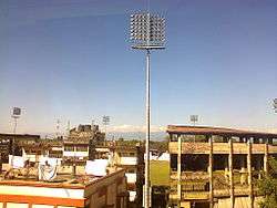
Satindra Mohan Dev Stadium is the only multipurpose stadium located at Silchar. The stadium has hosted an international one day match between the Indian and the England women's teams. It has also hosted Ranji Trophy and Duleep Trophy matches. Among the major football competitions, Santosh Trophy and I-League 2nd Division matches have been hosted at the ground.

Silchar also has an Indoor Stadium which is also used mainly for indoor sports.

The Tennis Club, Silchar is the only facility for hosting tennis matches and has multiple synthetic courts. The club also has an academy for imparting training.
Media
Silchar has an All India Radio station known as Akashvani Silchar. It broadcasts on AM and FM frequencies. Silchar also has a terrestrial television transmission center and studio of India's national broadcaster Doordarshan, known as DD Silchar.
In the print media, a number of Bengali and English daily newspapers are published from the town. The major newspapers published from Silchar include Bengali dailies Dainik Jugasankha, Anandabazar Patrika, Dainik Abichar, Dainik Prantajyoti, Samayik Prasanga, Janakantha and the English dailies The Sentinel and Eastern Chronicle. Besides the local newspapers, national and regional dailies like The Telegraph, The Times of India, The Statesman, The Assam Tribune etc. are also available.
Tourist attractions

- Khaspur: 20 km from Silchar stands the ruin of a great Dimasa kingdom, capital of historical time and importance. Khaspur was the capital of the Dimasa Kachari Kings and its construction was completed in 1690 AD. The main attractions are the Lion Gate, the Sun Gate and age-old kings temple. The original palace is non-existent, but its subsidiaries, the main entrance gate, the Suryadwar, Debalaya are intact. The entrances are of elephant-patterns.
- Bhuban Temple established by the great Dimasa warrior Veer Shambudhan Phonglo is the most celebrated temple of Lord Shiva in the entire South Assam. The Bhubaneshwar temple is about 50 km from Silchar and is on the top the Bhuvan hill. This is a place of pilgrimage and during the festival of Shivaratri, thousand of Shivayats march towards the hilltop to worship Lord Shiva. This temple by its geography attracts a lot of hikers as there are no motor roads to reach the hilltop. One has to hike at least 17 km from the plains to the temple.
- Iskcon Temple is an important temple dedicated mainly to Lord Krishna. The temple is in Ambikapatty, Silchar. It was built and is being operated by the world famous Sanatan Dharmic spiritual organization ISKCON. There is a vegetarian restaurant operated nearby by the organization ISKCON.
- Kancha Kanti Kali Temple: 11 km from Silchar stands the historical and most celebrated temple of South Assam, i.e., the temple of Mother Goddess "Kachakanti". She is said to be amalgamation of two powerful Hindu deities: mother Durga and mother Kali. The original temple was built in 1806 AD by the Kachari king. Human sacrifices were offered to the Goddess till 1818 AD. The old temple is ruined now and has been replaced by new temple which was built in 1978.
- Gandhibag is in Park Road, at the center of the town. The park is named after Mahatma Gandhi. There is a Shahid Minar in the park dedicated to the language martyrs who sacrificed their lives on 19 May 1962 fighting for the protection of the Bengali language against the Government of Assam.
- Maniharan Tunnel is a popular pilgrim spot about 5 km from Bhubaneswar temple. As per mythology, this tunnel was once used by Lord Krishna. The holy River Tribeni flows beneath this tunnel. Maniharan temple, dedicated to Lord Krishna, is on the premises.
Notable people
- Arun Kumar Chanda
- Moinul Hoque Choudhury
- Ullaskar Dutta
- Santosh Mohan Dev
- Kabindra Purkayastha
- Debojit Saha
- B. B. Bhattacharya
- Sushmita Dev
- Dilip Kumar Paul
Gallery
-

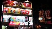
View of the ceiling from inside Goldighi Mall
-
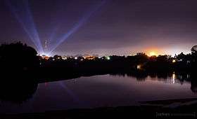
Silchar Airport, August 2007, on a rainy day with 1000m visibility
See also
References
- ↑ "Indian cities with population of 1 lakh and above" (PDF). Census India. Govt. of India. Retrieved 21 February 2014.
- ↑ "APCC member for nomination of Gaurav Gogoi from Barak Valley". The Sentinel, Assam. 6 June 2012. Retrieved 4 July 2012.
- ↑ "Silchar (India) - Britannica Online Encyclopedia". Britannica.com. Retrieved 2012-08-17.
- ↑ "No alliance with BJP, says AGP chief". The Telegraph, Calcutta. 27 December 2003. Retrieved 3 March 2014.
- ↑ "Silchar rly station to be renamed soon". The Times of India. 9 Jun 2009. Retrieved 3 March 2014.
- ↑ "ONGC :: ONGC Offices". Retrieved 8 June 2015.
- 1 2 http://www.assamtribune.com/scripts/detailsnew.asp?id=jan1015/state052
- ↑ "Location of Silchar". Wikimapia Foundation. Wikimapia. Retrieved 3 March 2014.
- ↑ "Silchar, India Page". Falling Rain Genomics, Inc. Falling Rain Genomics, Inc. Retrieved 3 March 2014.
- ↑ "Silchar, Cachar, Assam, India Map Lat Long Coordinates". www.latlong.net. Retrieved 2016-02-26.
- ↑ "Census of India". Govt. of India. Government of India. Retrieved 20 February 2014.
- 1 2 "Silchar City Population Census 2011 | Assam". www.census2011.co.in. Retrieved 2016-02-26.
- ↑ "Silchar Climatological Table Period: 1971–2000". India Meteorological Department. Retrieved 27 April 2015.
- ↑ "Ever recorded Maximum and minimum temperatures up to 2010". India Meteorological Department. Archived from the original on 21 May 2013. Retrieved 27 April 2015.
- ↑ "AG Suncity". Retrieved 8 June 2015.
- ↑ http://www.devascreations.in/index.html
- ↑ "Assam University, Homepage". Assam University. Retrieved 20 February 2014.
- ↑ "Statistical Data Fact Sheet of AUS" (PDF). Assam University. Assam University. Retrieved 20 February 2014.
- ↑ "TSSOT". Retrieved 8 June 2015.
- ↑ http://silcharpolytechnic.in/
- ↑ http://cdac.in/index.aspx?id=pk_itn_spot919
- ↑ http://www.guwahati.nielit.gov.in/aboutsec.php
- ↑ Super User. "NIAIMT Silchar". Retrieved 8 June 2015.
- ↑ http://www.dheassam.gov.in/circulars-1/meeting%2057.pdf retrieved on 14 January 2015
- ↑ "Silchar Medical College, Home Page". Silchar Medical College. Silchar Medical College. Retrieved 20 February 2014.
- ↑ "A. K. Chanda Law College". Retrieved 8 June 2015.
- ↑ "Silchar Medical College". Retrieved 8 June 2015.
- ↑ "Silchar Civil Hospital, Hospital Road, Silchar, Assam". Retrieved 8 June 2015.
- ↑ "TRAFFIC STATISTICS - DOMESTIC AIRCRAFT MOVEMENTS" (PDF). Retrieved 2012-08-28.
- ↑ "51 new low-cost airports to be set up: PMO". Daily News & Analysis. 28 June 2013. Retrieved 3 March 2014.
- ↑ "Capt V Roopa: Flying high, and back". The Times of India. Retrieved 8 June 2015.
- ↑ "List of Parliamentary & Assembly Constituencies" (PDF). Assam. Election Commission of India. Retrieved 2008-10-05.
External links
| Wikimedia Commons has media related to Silchar. |
 Silchar travel guide from Wikivoyage
- Official governmental site of Silchar
- NIT, Silchar
- Assam University, Silchar
- Guru Charan College, Silchar
- Cachar College, Silchar
- Silchar Medical College & Hospital, Silchar
- Radhamadhab College, Silchar
- Silchartoday.com
| Topics | |
|---|---|
| History | |
| Districts & Divisions |
|
| Geography | |
| Culture | |
| Arts, Literature, Music Cinema |
|
| People | |
| Notable surnames |
|
| Urban centres | |
| |