Sig, Algeria
| Sig | |
|---|---|
| Town | |
 | |
 Sig | |
| Coordinates: 35°31′N 0°11′W / 35.517°N 0.183°W | |
| Country |
|
| Provinces | Oran |
| District | Sig |
Sig (known under the Romans as Tasacora and under the French as Saint-Denis-de-Sig[1]) is a town with wide streets and tree-filled squares. Formerly located in Oran Province and now located in Mascara Province, north-western Algeria. Its population was 61,373 in 2008.[2]
The town's public garden is on the bank of the Sig river just down stream the confluence of the le-Mebtoûh and the Matarah. Sig is surrounded by fertile land irrigated by the Barrages des Cheurfas (dams) 25 kilometres (16 mi) upstream with the overflow stored in the Petit Barrage (little dams) 3.2 kilometres (2.0 mi) upstream from the town. The local land supports the growing of olives (groves of which surround the town), cotton, flax, grains, tobacco, and wine, much of which is proceed locally and exported. The other local industry is quarrying which for diatomite in Kieselguhr which is located neadby.[2]
Sig is located about 29 kilometres (18 mi) south the Gulf of Arzew, separated by the Sig plains and north-west of Mount Touakas (349 metres (1,145 ft) high).[2] Sig is about 44 kilometres (27 mi) east of Oran and 450 kilometres (280 mi) from Algiers. The temperatures there usually rise from May to the end of August. It can reach up to 44 °C (111 °F) and become very hot in a desert-like terrain.
Notes
- ↑ Toulotte 1894, p. 155.
- 1 2 3 EB staff 2015.
References
- EB staff (2015), "Sig - Algeria", Encyclopedia Britannica, retrieved 26 April 2015
- Toulotte, Anatole (1894), Géographie de l'Afrique chrétienne, Oberthur, p. 155, retrieved 5 November 2012
| Oran District | 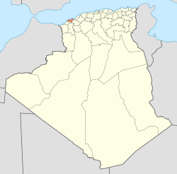 | |
|---|---|---|
| Aïn El Turk District | ||
| Arzew District | ||
| Bethioua District | ||
| Es Sénia District | ||
| Bir El Djir District | ||
| Boutlélis District | ||
| Oued Tlélat District | ||
| Gdyel District | ||