Siem Reap Province
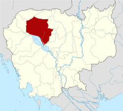
Siem Reap (Khmer: សៀមរាប, "Defeat of Siam") is a province (khaet) of Cambodia. It borders the provinces of Oddar Meanchey to the north, Preah Vihear and Kampong Thom to the east, Battambang to the south, and Banteay Meanchey to the west. Its capital and largest city is Siem Reap.
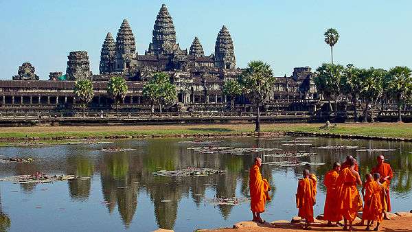
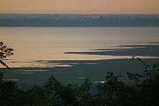
Siem Reap is the 10th largest province in Cambodia. With a population of 896,309, it ranks as the 6th largest in the nation. A large portion of Siem Reap's southern border is demarcated by the Tonle Sap and as such, it is one of the nine provinces that making up the Tonle Sap Biosphere Reserve. In modern times the province is best known as the site of Angkor and the Angkor Wat temple ruins.
Etymology
The name "Siem Reap" literally means "Siam Defeated", a reminder of the centuries-old conflict between the Siamese and the Khmer. In Siam, the province and its capital was called "Siemmarat" (Thai: เสียมราฐ), literally meaning "Siam's Territory".[2]
History
The province came under the control of the Thai kingdom of Siam in 1795 and was later returned to Cambodia in 1907 after French made a treaty with Siam for exchange of Trat and Dan Sai for the Siamese province of Inner Cambodia which included Phra Tabong (Battambang), Siemmarat (Siem Reap), and Nakhon Wat (Angkor Wat). The Inner Cambodia province was split into Battambang and Siem Reap by the royal decree of King Sisowath the same year. This area became part of a disputed territory between France and Siam (now Thailand) which led to the Franco-Thai War in 1941, resulting in victory for Thailand and a return to Thai control (with exception of Siem Reap and Angkor Wat). The province again reverted to Cambodia in 1946, after the end of World War II with French and UN international pressure.
Subdivisions
The province is subdivided into 12 districts, 100 communes and 907 villages.[3]
References
External links
|
|---|
|
|
|
| Districts | | |
|---|
|
| Geography | |
|---|
|
| Angkor Sites | |
|---|