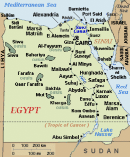
Sidi Barrani
| Sidi Barrani | |
|---|---|
 | |
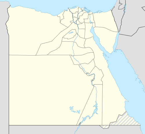 Sidi Barrani Location in Egypt | |
| Coordinates: 31°36′39″N 25°55′32″E / 31.61083°N 25.92556°ECoordinates: 31°36′39″N 25°55′32″E / 31.61083°N 25.92556°E | |
| Country |
|
| Governorate | Matruh |
| Population (2006) | |
| • Total | 14,393 |
| Time zone | EST (UTC+2) |
Sidi Barrani (Egyptian Arabic: سيدى برانى pronounced [ˈsiːdi bɑɾˈɾɑːni]) is a town in Egypt, near the Mediterranean Sea, about 95 km (59 mi) east of the border with Libya, and around 240 km (150 mi) from Tobruk, Libya.
Named after Sidi es-Saadi el Barrani, a Senussi sheikh who was a head of its Zawiya,[1] the village is mainly a Bedouin community. It has food and gasoline outlets, and one small hotel, but has virtually no tourist activity or visited historical curiosities.
History
Located close to the Roman city of Zygra, in the Roman province of Libya Inferior, Sidi Barrani is often mentioned in historical records to mark the limit of the initial Italian invasion of Egypt from Libya. The Italian Tenth Army built a series of forts in the vicinity.
American Field Service volunteers, providing ambulance services and serving with the British 8th Army were based in the area, in June 1942, 30 miles east of Sidi Barrani.
Sidi Barrani was a destination during the total solar eclipse on October 3, 2005, as expeditions traveled to the best observation point, Zawiet Mahtallah, 27 km (17 mi) east of Sidi Barrani. [2]
Climate
Köppen-Geiger climate classification system classifies its climate as hot desert (BWh), but it is part of the northern coast of Egypt which has moderated temperatures.
| Climate data for Sidi Barrani | |||||||||||||
|---|---|---|---|---|---|---|---|---|---|---|---|---|---|
| Month | Jan | Feb | Mar | Apr | May | Jun | Jul | Aug | Sep | Oct | Nov | Dec | Year |
| Average high °C (°F) | 17.9 (64.2) |
18.8 (65.8) |
20.2 (68.4) |
22.2 (72) |
24.1 (75.4) |
27 (81) |
28.2 (82.8) |
29 (84) |
28.1 (82.6) |
26.4 (79.5) |
23.5 (74.3) |
19.6 (67.3) |
23.75 (74.77) |
| Daily mean °C (°F) | 13.1 (55.6) |
13.9 (57) |
15.3 (59.5) |
17.5 (63.5) |
19.9 (67.8) |
22.7 (72.9) |
25 (77) |
25.5 (77.9) |
24.2 (75.6) |
21.8 (71.2) |
18.6 (65.5) |
14.5 (58.1) |
19.33 (66.8) |
| Average low °C (°F) | 8.4 (47.1) |
9 (48) |
10.5 (50.9) |
12.9 (55.2) |
15.7 (60.3) |
18.5 (65.3) |
21.9 (71.4) |
22.1 (71.8) |
20.4 (68.7) |
17.3 (63.1) |
13.8 (56.8) |
9.4 (48.9) |
14.99 (58.96) |
| Average precipitation mm (inches) | 39 (1.54) |
17 (0.67) |
11 (0.43) |
5 (0.2) |
3 (0.12) |
0 (0) |
0 (0) |
0 (0) |
1 (0.04) |
18 (0.71) |
21 (0.83) |
33 (1.3) |
148 (5.84) |
| Source: Climate-Data.org[3] | |||||||||||||
Notes
In Kurt Vonnegut's novel Bluebeard, Sidi Barrani is the site where Dan Gregory (a tormenting magazine illustrator and Nazi sympathizer) was killed on December 7, 1940 during the Battle of Sidi Barrani. The battle commenced until 10 December, in which 30,000 British troops defeated almost 80,000 Italian soldiers holding the town.
"Did I ever tell you about the time I was in Sidi Barrani?" was a catchphrase for Sam Costa in the BBC radio comedy show Much-Binding-in-the-Marsh which ran from 1944 to 1954 and was initially about life on a mythical Royal Air Force (RAF) station.
Spike Milligan was, according to his memoirs, posted to Sidi Barrani during the Second World War.
References
- ↑ Souar men Beladi magazine, no. 2, Souar men tharikh at Tariqa as Sanusiya, Maktab as Seraj li Di'aya wal I'lan, p. 39.
- ↑ "Valoria La Buena annular eclipse expedition Oct. 3, 2005" (report), Solar Physics Group, Astrophysics Lab, University of Rome, January 10, 2007, webpage (mostly Italian): ICRA-solar: mentions the Sidi Barrani observation area.
- ↑ "Climate: Sidi al Barrani - Climate graph, Temperature graph, Climate table". Climate-Data.org. Retrieved 17 August 2013.
External links
- Photograph of twilight Sidi Barrani solar eclipse (Oct. 2005, copyright 2005-2007 Magyar Csillagászati Egyesület): Hungarian-foto Sidi-twilight (540x345, 38 KB).
- Photograph of solar eclipse at Sidi Barrani (Oct. 2005, copyright 2005-2007 Magyar Csillagászati Egyesület): Hungarian-foto Sidi-eclipse (9 KB).
- Photograph of Sidi Barrani observers (Oct. 2005, copyright 2005-2007 Magyar Csillagászati Egyesület): Hungarian-foto Sidi-people (50 KB).
| Wikimedia Commons has media related to Sidi Barrani. |