Shrewton
| Shrewton | |
 High Street and River Till |
|
 Shrewton |
|
| Population | 1,870 (in 2011)[1] |
|---|---|
| OS grid reference | SU068439 |
| Civil parish | Shrewton |
| Unitary authority | Wiltshire |
| Ceremonial county | Wiltshire |
| Region | South West |
| Country | England |
| Sovereign state | United Kingdom |
| Post town | Salisbury |
| Postcode district | SP3 |
| Dialling code | 01980 |
| Police | Wiltshire |
| Fire | Dorset and Wiltshire |
| Ambulance | South Western |
| EU Parliament | South West England |
| UK Parliament | Salisbury |
| Website | shrewton |
Coordinates: 51°11′38″N 1°54′14″W / 51.194°N 1.904°W
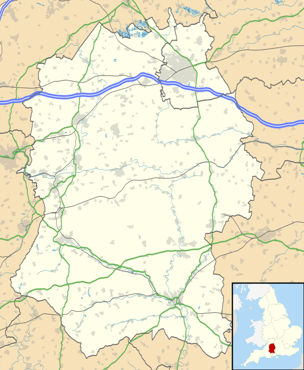
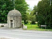
Shrewton is a village and civil parish on Salisbury Plain in Wiltshire, England, located around 6 miles (9.7 km) west of Amesbury and 14 miles (23 km) north of Salisbury. It lies on the A360 road between Stonehenge and Tilshead. It is close to the source of the River Till, which flows south to Stapleford.[2]
The name is derived from the Old English scīr-rēfa tūn, meaning 'sheriff's farm or settlement'.[3]
Governance
In 1934 the civil parish of Shrewton was enlarged by the addition of the parishes of Maddington (to the north) and Rollestone (south and east).[4] The parish elects a parish council. It is in the area of Wiltshire Council unitary authority, which is responsible for all significant local government functions.
The parish is in 'Till and Wylye Valley' electoral ward. This ward starts in the south at South Newton, passes through Shrewton and ends in the north at Tilshead. The total ward population taken at the 2011 census was 4,473.[5]
Addeston was a village of medieval origin, which now forms an integral part of the modern village of Shrewton. The place name survives in Addestone Farm (grid reference SU 0655 4300), Addestone Manor (SU 0673 4330) and Addestone Farm Cottage (SU 0660 4318).[6]
Notable landmarks

St Mary's Church in the Maddington part of the parish was built in the late 12th century. It has been designated as a Grade II* listed building[7] and is now in the care of the Churches Conservation Trust.[8] The church has Norman origins, belonging to Amesbury Priory in 1179,[9] with the earliest parts of the existing building dating from the late 12th and early 13th century,[7] however there have been several alterations since, including the renewel of the roof of the nave in 1603.[9] Sir Stephen Fox became the lord of the manor in the late 17th century and paid for the rebuilding the chancel and redecoration.[9] In 1853 the chancel was rebuilt and the whole church restored by Thomas Henry Wyatt,[8] including the erection of the gabled porch.[7] The walls of the nave and chancel have a chequerboard pattern of flint and sandstone. There is a low west tower. The interior includes a large plaster cartouche of strapwork enclosing the date 1637, which may the date of construction of a gallery which has since been demolished.[8] The stained glass includes work by Alexander Gibbs in the south aisle.[7] The church was declared redundant in 1975 and passed to the Redundant Churches Fund in 1979 which later became the Churches Conservation Trust.[9] The parish now uses the other St Mary's church,[10] in Shrewton, as distinct from St Mary's, Maddington.[9]
St Andrew's Church in the Rollestone settlement was built in the early 13th century. It has been designated as a Grade II* listed building[11] and is now in the care of the Churches Conservation Trust.[12] The church is built of flint and stone in a chequerwork pattern. It has two large Perpendicular windows, and a font from the 13th century. The oak benches were brought from the redundant church of St Catherine’s at Haydon, Dorset in 1981.[12]

The village has a primary school, Shrewton CE VC Primary School.[13] Appleford School, an independent specialist dyslexia school, is near the village.
Sport and leisure
Shrewton has a Non-League football club Shrewton United F.C. who play at the Recreation Ground. The village also has a cricket club who play in the Hampshire League.[14]
References
- ↑ "Wiltshire Community History - Census". Wiltshire Council. Retrieved 30 April 2015.
- ↑ Google (4 September 2016). "Shrewton" (Map). Google Maps. Google. Retrieved 4 September 2016.
- ↑ "Shrewton, Wiltshire". Key to English Place Names. University of Nottingham. Retrieved 29 July 2012.
- ↑ "Victoria County History - Wiltshire - Vol 15 pp242-252 - Parishes: Shrewton". British History Online. University of London. Retrieved 1 May 2015.
- ↑ "Till and Wylye Valley ward 2011". Retrieved 16 March 2015.
- ↑ "Addeston, Wiltshire". English Heritage. Retrieved 3 February 2014.
- 1 2 3 4 "Church of St. Mary the Virgin". Images of England. English Heritage. Retrieved 12 October 2010.
- 1 2 3 "St Mary, Maddington". Churches Conservation Trust. Retrieved 12 October 2010.
- 1 2 3 4 5 "Church of St. Mary, Maddington, Shrewton". Wiltshire County Council. Retrieved 12 October 2010.
- ↑ "Church of St. Mary, Shrewton". Wiltshire Community History. Retrieved 20 August 2011.
- ↑ "Church of St. Andrew". Images of England. English Heritage. Retrieved 13 October 2010.
- 1 2 "St Andrew, Rollestone". Churches Conservation Trust. Retrieved 13 October 2010.
- ↑ "Shrewton Primary School". Retrieved 1 May 2015.
- ↑ "Shrewton Cricket Club". Pitchero. Retrieved 1 May 2015.
External links
- "Shrewton". Wiltshire Community History. Wiltshire Council. Retrieved 1 May 2015.
![]() Media related to Shrewton at Wikimedia Commons
Media related to Shrewton at Wikimedia Commons