Shreveport-Bossier City-Minden CSA
| Greater Shreveport | |
|---|---|
| Combined Statistical Area | |
| Shreveport-Bossier City-Minden CSA | |
|
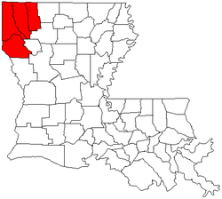
Map of Louisiana highlighting the Shreveport-Bossier City-Minden Combined Statistical Area | |
| Country |
|
| State |
|
| Parish |
Bossier Caddo DeSoto Webster |
| Largest city | Shreveport |
| Population (2010) | |
| • Total | 444,000 |
The Shreveport-Bossier City-Minden Combined Statistical Area was made up of four parishes in northwestern Louisiana. The statistical area consists of then-Shreveport-Bossier City Metropolitan Statistical Area and then-Minden Micropolitan Statistical Area. As of the 2010 census, the CSA had a population of 439,000 (though a July 1, 2011 estimate placed the population at 444,000).[1] On February 28, 2013, OMB changed definitions of census statistical areas, and all four parishes in this combined statistical area was redefined as Shreveport-Bossier City Metropolitan Statistical Area.[2]
Cities and suburbs
Cities
- Bossier City (Principal city and suburb)
- Mansfield
- Minden (Principal city)
- Shreveport (Principal city)
- Springhill
Towns
- Benton
- Blanchard (suburb)
- Cotton Valley
- Cullen
- Greenwood (suburb)
- Haughton (suburb)
- Keachie
- Logansport
- Oil City
- Plain Dealing
- Sarepta
- Sibley
- Stonewall (suburb)
- Vivian
Villages
- Belcher
- Dixie Inn
- Doyline
- Dubberly
- Gilliam
- Grand Cane
- Heflin
- Hosston
- Ida
- Longstreet
- Mooringsport
- Rodessa
- Shongaloo
- South Mansfield
- Stanley
Census-designated places
Unincorporated communities
Bossier Side
Caddo Side
DeSoto Side
Webster Side
Demographics
As of the census[3] of 2010, there were 439,000 people, 189,000 households, and 132,190 families residing within the CSA. The racial makeup of the CSA was 59.48% White, 37.68% African American, 0.42% Native American, 0.74% Asian, 0.04% Pacific Islander, 0.54% from other races, and 1.09% from two or more races. Hispanic or Latino of any race were 1.82% of the population.
The median income for a household in the CSA was $31,833, and the median income for a family was $38,182. Males had a median income of $31,273 versus $21,613 for females. The per capita income for the CSA was $16,192.
See also
- Louisiana census statistical areas
- List of cities, towns, and villages in Louisiana
- List of census-designated places in Louisiana
References
- ↑ "Table 2. Annual Estimates of the Population of Combined Statistical Areas: April 1, 2000 to July 1, 2009 (CBSA-EST2009-02)" (CSV). 2009 Population Estimates. United States Census Bureau, Population Division. 2010-03-23. Retrieved 2010-03-29.
- ↑ OMB BULLETIN NO. 13-01: Revised Delineations of Metropolitan Statistical Areas, Micropolitan Statistical Areas, and Combined Statistical Areas, and Guidance on Uses of the Delineations of These Areas. Office of Management and Budget. February 28, 2013.
- ↑ "American FactFinder". United States Census Bureau. Retrieved 2008-01-31.