Shoreacres, Texas
| Shoreacres, Houston | |
|---|---|
| City | |
 Location of Shoreacres, Houston | |
| Coordinates: 29°37′13″N 95°1′0″W / 29.62028°N 95.01667°WCoordinates: 29°37′13″N 95°1′0″W / 29.62028°N 95.01667°W | |
| Country | United States |
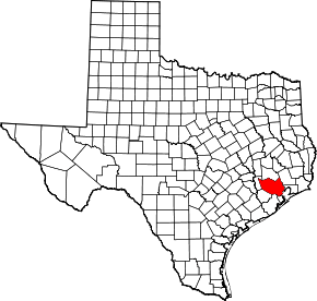
| State | Texas |
| Counties | Chambers, Harris |
| Area | |
| • Total | 1.0 sq mi (2.5 km2) |
| • Land | 0.9 sq mi (2.4 km2) |
| • Water | 0.04 sq mi (0.1 km2) |
| Elevation | 10 ft (3 m) |
| Population (2010) | |
| • Total | 1,493 |
| • Density | 1,500/sq mi (600/km2) |
| Time zone | Central (CST) (UTC-6) |
| • Summer (DST) | CDT (UTC-5) |
| ZIP code | 77571 |
| Area code(s) | 281 |
| FIPS code | 48-67688[1] |
| GNIS feature ID | 1347090[2] |
| Website |
www |
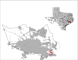
Shoreacres is a city located in Harris County in the U.S. state of Texas alongside State Highway 146. Established with a mayor-alderman form of city government, it was incorporated in 1949.[3] The population was 1,493 at the 2010 census.[4]
Geography

Shoreacres is located at 29°37′13″N 95°1′0″W / 29.62028°N 95.01667°W (29.620395, -95.016710).[5]
According to the United States Census Bureau, the city has a total area of 0.97 square miles (2.5 km2), of which 0.93 square miles (2.4 km2) is land and 0.039 square miles (0.1 km2), or 5.86%, is water.[6]
Demographics
| Historical population | |||
|---|---|---|---|
| Census | Pop. | %± | |
| 1950 | 183 | — | |
| 1960 | 518 | 183.1% | |
| 1970 | 1,872 | 261.4% | |
| 1980 | 1,260 | −32.7% | |
| 1990 | 1,316 | 4.4% | |
| 2000 | 1,488 | 13.1% | |
| 2010 | 1,493 | 0.3% | |
| Est. 2015 | 1,603 | [7] | 7.4% |
As of the census[1] of 2000, there were 1,488 people, 559 households, and 455 families residing in the city. The population density was 1,656.1 people per square mile (638.4/km²). There were 594 housing units at an average density of 661.1 per square mile (254.8/km²). The racial makeup of the city was 94.15% White, 1.01% African American, 0.07% Native American, 0.94% Asian, 0.07% Pacific Islander, 2.96% from other races, and 0.81% from two or more races. Hispanic or Latino of any race were 7.66% of the population.
There were 559 households out of which 32.2% had children under the age of 18 living with them, 72.1% were married couples living together, 5.9% had a female householder with no husband present, and 18.6% were non-families. 15.6% of all households were made up of individuals and 7.3% had someone living alone who was 65 years of age or older. The average household size was 2.66 and the average family size was 2.96.
In the city the population was spread out with 23.9% under the age of 18, 6.0% from 18 to 24, 28.2% from 25 to 44, 30.4% from 45 to 64, and 11.4% who were 65 years of age or older. The median age was 41 years. For every 100 females there were 102.2 males. For every 100 females age 18 and over, there were 100.4 males.
The median income for a household in the city was $71,985, and the median income for a family was $75,941. Males had a median income of $51,523 versus $31,389 for females. The per capita income for the city was $29,370. About 1.1% of families and 1.8% of the population were below the poverty line, including 0.5% of those under age 18 and 2.8% of those age 65 or over.
Education
Shoreacres is within the La Porte Independent School District and is zoned to La Porte High School.
Transportation
Harris County Transit operates public transportation.[9]
Government
Shoreacres is governed by a six-member city council under the mayor-council form of government. The current mayor is Kimberly Sanford(term ends 2018). The other council members include mayor pro-tem David Jennings(term ends 2017), Nancy Schnell (term ends 2017), Ricky Bowles(term ends 2018), Jerome McKown (term ends 2017) and Ron Hoskins(term ends 2018). Council members serve staggered two-year terms.
The city provides police, recycling, parks, planning, zoning, floodplain management, and building code inspections among its services. The city provides fire, sanitation, and emergency medical services by contract.
Effects of Hurricane Ike, 2008
On September 13, Hurricane Ike made landfall near Galveston.[10] 88 percent of the homes in Shoreacres suffered flood damage.[11] No local deaths were reported.[11]
See also
History of the Galveston Bay Area
References
- 1 2 "American FactFinder". United States Census Bureau. Retrieved 2008-01-31.
- ↑ "US Board on Geographic Names". United States Geological Survey. 2007-10-25. Retrieved 2008-01-31.
- ↑ TSHA Online - Texas State Historical Association
- ↑ "Profile of General Population and Housing Characteristics: 2010 Demographic Profile Data (DP-1): Shoreacres city, Texas". U.S. Census Bureau, American Factfinder. Retrieved June 15, 2012.
- ↑ "US Gazetteer files: 2010, 2000, and 1990". United States Census Bureau. 2011-02-12. Retrieved 2011-04-23.
- ↑ "Geographic Identifiers: 2010 Demographic Profile Data (G001): Shoreacres city, Texas". U.S. Census Bureau, American Factfinder. Retrieved June 15, 2012.
- ↑ "Annual Estimates of the Resident Population for Incorporated Places: April 1, 2010 to July 1, 2015". Retrieved July 2, 2016.
- ↑ "Census of Population and Housing". Census.gov. Archived from the original on May 11, 2015. Retrieved June 4, 2015.
- ↑ "Clear Lake/La Porte/Seabrook 5." Harris County Transit. Retrieved on January 15, 2010.
- ↑ Juan A. Lozano & Chris Duncan, Associated Press Writers (2008-09-13). "Ike blasts Texas coast, floods homes, cuts power". Yahoo! NEWS. Archived from the original on September 16, 2008. Retrieved 2008-09-13.
- 1 2 Snyder, Mike Tiny Shoreacres bares big burden Two months after it was hit hard by the storm, the small coastal village in the 'shadow of La Porte' is still in ruins, with 88% of homes and half of its people gone, Houston Chronicle, November 12, 2008, retrieved Nov. 13, 2008
External links
- City of Shoreacres official website
- Shoreacres, Texas from the Handbook of Texas Online
- U.S. Geological Survey Geographic Names Information System: Shoreacres, Texas
| Large cities |  | |
|---|---|---|
| Other cities | ||
| CDPs and non- municipalities | ||
| Counties | ||
| Subregions | ||
| Bodies of water | ||
| Major ports | ||
| Nature preserves | ||
| Counties | 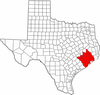 | |
|---|---|---|
| "Principal" cities | ||
| Other cities |
For a complete listing, see list of cities and towns in Houston–The Woodlands–Sugar Land MSA | |
| Unincorporated areas | ||
| Bodies of water | ||
Municipalities and communities of Chambers County, Texas, United States | ||
|---|---|---|
| Cities | 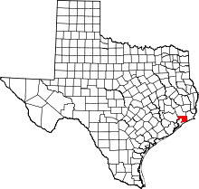 | |
| CDPs | ||
| Other unincorporated communities | ||
| Footnotes | ‡This populated place also has portions in an adjacent county or counties
±water surface only; land in adjacent county | |