Shelbina, Missouri
| Shelbina, Missouri | |
|---|---|
| City | |
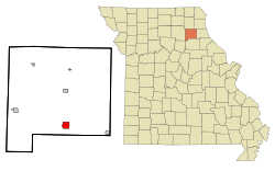 Location of Shelbina, Missouri | |
| Coordinates: 39°41′32″N 92°2′23″W / 39.69222°N 92.03972°WCoordinates: 39°41′32″N 92°2′23″W / 39.69222°N 92.03972°W | |
| Country | United States |
| State | Missouri |
| County | Shelby |
| Area[1] | |
| • Total | 2.34 sq mi (6.06 km2) |
| • Land | 2.34 sq mi (6.06 km2) |
| • Water | 0 sq mi (0 km2) |
| Elevation | 778 ft (237 m) |
| Population (2010)[2] | |
| • Total | 1,704 |
| • Estimate (2012[3]) | 1,669 |
| • Density | 728.2/sq mi (281.2/km2) |
| Time zone | Central (CST) (UTC-6) |
| • Summer (DST) | CDT (UTC-5) |
| ZIP code | 63468 |
| Area code(s) | 573 |
| FIPS code | 29-67178[4] |
| GNIS feature ID | 0726302[5] |
Shelbina /ʃɛlˈbaɪnə/ is a city in Shelby County, Missouri, United States. The population was 1,704 at the 2010 census.
History
Shelbina is derived from Shelby.[6]
Geography
Shelbina is located at 39°41′32″N 92°2′23″W / 39.69222°N 92.03972°W (39.692312, -92.039856).[7]
According to the United States Census Bureau, the city has a total area of 2.34 square miles (6.06 km2), all land.[1]
Demographics
| Historical population | |||
|---|---|---|---|
| Census | Pop. | %± | |
| 1870 | 1,145 | — | |
| 1880 | 1,289 | 12.6% | |
| 1890 | 1,691 | 31.2% | |
| 1900 | 1,733 | 2.5% | |
| 1910 | 2,174 | 25.4% | |
| 1920 | 1,809 | −16.8% | |
| 1930 | 1,826 | 0.9% | |
| 1940 | 2,107 | 15.4% | |
| 1950 | 2,113 | 0.3% | |
| 1960 | 2,067 | −2.2% | |
| 1970 | 2,060 | −0.3% | |
| 1980 | 2,169 | 5.3% | |
| 1990 | 2,172 | 0.1% | |
| 2000 | 1,943 | −10.5% | |
| 2010 | 1,704 | −12.3% | |
| Est. 2015 | 1,639 | [8] | −3.8% |
2010 census
As of the census[2] of 2010, there were 1,704 people, 717 households, and 443 families residing in the city. The population density was 728.2 inhabitants per square mile (281.2/km2). There were 860 housing units at an average density of 367.5 per square mile (141.9/km2). The racial makeup of the city was 98.8% White, 0.5% African American, 0.1% Native American, 0.1% Asian, and 0.5% from two or more races. Hispanic or Latino of any race were 1.1% of the population.
There were 717 households of which 29.3% had children under the age of 18 living with them, 46.4% were married couples living together, 9.9% had a female householder with no husband present, 5.4% had a male householder with no wife present, and 38.2% were non-families. 34.4% of all households were made up of individuals and 17% had someone living alone who was 65 years of age or older. The average household size was 2.27 and the average family size was 2.85.
The median age in the city was 43.5 years. 23.5% of residents were under the age of 18; 6.7% were between the ages of 18 and 24; 21.1% were from 25 to 44; 26.4% were from 45 to 64; and 22.2% were 65 years of age or older. The gender makeup of the city was 47.5% male and 52.5% female.
2000 census
As of the census[4] of 2000, there were 1,943 people, 843 households, and 503 families residing in the city. The population density was 844.4 people per square mile (326.2/km²). There were 966 housing units at an average density of 419.8/sq mi (162.2/km²). The racial makeup of the city was 98.10% White, 0.77% African American, 0.72% Native American, 0.05% from other races, and 0.36% from two or more races. Hispanic or Latino of any race were 0.26% of the population.
There were 843 households out of which 28.5% had children under the age of 18 living with them, 46.5% were married couples living together, 9.3% had a female householder with no husband present, and 40.3% were non-families. 37.5% of all households were made up of individuals and 22.7% had someone living alone who was 65 years of age or older. The average household size was 2.19 and the average family size was 2.91.
In the city the population was spread out with 22.8% under the age of 18, 7.9% from 18 to 24, 22.1% from 25 to 44, 21.3% from 45 to 64, and 25.9% who were 65 years of age or older. The median age was 43 years. For every 100 females there were 80.4 males. For every 100 females age 18 and over, there were 74.8 males.
The median income for a household in the city was $25,800, and the median income for a family was $33,529. Males had a median income of $26,393 versus $18,712 for females. The per capita income for the city was $17,645. About 12.3% of families and 16.8% of the population were below the poverty line, including 25.1% of those under age 18 and 12.0% of those age 65 or over.
Notable citizens
- Sam Walton, founder of Walmart
- Duke Cunningham,US Navy fighter pilot during the Vietnam War, former U.S. Congressman (R) from California, and jailed for corruption, i.e. taking bribes for his vote, and selling his political influence.
See also
References
- 1 2 "US Gazetteer files 2010". United States Census Bureau. Retrieved 2012-07-08.
- 1 2 "American FactFinder". United States Census Bureau. Retrieved 2012-07-08.
- ↑ "Population Estimates". United States Census Bureau. Retrieved 2013-05-30.
- 1 2 "American FactFinder". United States Census Bureau. Retrieved 2008-01-31.
- ↑ "US Board on Geographic Names". United States Geological Survey. 2007-10-25. Retrieved 2008-01-31.
- ↑ Eaton, David Wolfe (1918). How Missouri Counties, Towns and Streams Were Named. The State Historical Society of Missouri. p. 365.
- ↑ "US Gazetteer files: 2010, 2000, and 1990". United States Census Bureau. 2011-02-12. Retrieved 2011-04-23.
- ↑ "Annual Estimates of the Resident Population for Incorporated Places: April 1, 2010 to July 1, 2015". Retrieved July 2, 2016.
- ↑ "Census of Population and Housing". Census.gov. Retrieved June 4, 2015.
External links
- Historic maps of Shelbina in the Sanborn Maps of Missouri Collection at the University of Missouri
Municipalities and communities of Shelby County, Missouri, United States | ||
|---|---|---|
| Cities | 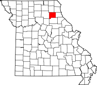 | |
| Villages | ||
| Unincorporated communities | ||