Shahekou District
| Shahekou 沙河口区 | ||||||||||||||||||||||||||||||||||
|---|---|---|---|---|---|---|---|---|---|---|---|---|---|---|---|---|---|---|---|---|---|---|---|---|---|---|---|---|---|---|---|---|---|---|
| District | ||||||||||||||||||||||||||||||||||
 Shahekou Location in Liaoning | ||||||||||||||||||||||||||||||||||
| Coordinates: 38°54′17″N 121°35′43″E / 38.9046°N 121.5952°ECoordinates: 38°54′17″N 121°35′43″E / 38.9046°N 121.5952°E[1] | ||||||||||||||||||||||||||||||||||
| Country |
| |||||||||||||||||||||||||||||||||
| Province | Liaoning | |||||||||||||||||||||||||||||||||
| Sub-provincial city | Dalian | |||||||||||||||||||||||||||||||||
| Area[2] | ||||||||||||||||||||||||||||||||||
| • Total | 34.71 km2 (13.40 sq mi) | |||||||||||||||||||||||||||||||||
| Population (2010)[3] | ||||||||||||||||||||||||||||||||||
| • Total | 693,140 | |||||||||||||||||||||||||||||||||
| • Density | 20,000/km2 (52,000/sq mi) | |||||||||||||||||||||||||||||||||
| Time zone | China Standard (UTC+8) | |||||||||||||||||||||||||||||||||
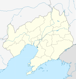
| Dalian district map |
| |||||||||||||||||||||||||||||||||
| Division code | 210204000000 | |||||||||||||||||||||||||||||||||

Shahekou District (simplified Chinese: 沙河口区; traditional Chinese: 沙河口區; pinyin: Shāhékǒu Qū) is one of the seven districts of Dalian, Liaoning province, People's Republic of China, forming part of the urban core. It is located in the western portion of the city. Its area is 34.71 square kilometres (13.40 sq mi) and its permanent population as of 2010 is 693,140, making it Dalian's most densely populated county-level division.[2][3] Its postal code is 116020, and the district government is located at 120 Tongtai Avenue.
Administrative divisions
There are 9 subdistricts within the district.[4]
Subdistricts:
- Zhongshangongyuan Subdistrict (中山公园街道)
- Baishanlu Subdistrict (白山路街道)
- Xinggong Subdistrict (兴工街道)
- Chunliu Subdistrict (春柳街道)
- Malan Subdistrict (马栏街道)
- Nanshahekou Subdistrict (南沙河口街道)
- Heishijiao Subdistrict (黑石礁街道)
- Lijia Subdistrict (李家街道)
- Xinghaiwan Subdistrict (星海湾街道)
Education
The following secondary schools are within Shahekou District:
- Dalian City No. 3 High School
- Dalian City No. 8 High School
- High School Associated with Liaoning Normal University
- Dalian City No. 13 High School
- Dalian City No. 47 High School
- Dalian City No. 48 High School
- Dalian Standard High School
References
- ↑ Google (2014-07-02). "Baishan Road Sub-district" (Map). Google Maps. Google. Retrieved 2014-07-02.
- 1 2 Dalian Statistical Yearbook 2012 (《大连统计年鉴2012》). Accessed 8 July 2014.
- 1 2 2010 Census county-by-county statistics (《中国2010年人口普查分县资料》). Accessed 8 July 2014.
- ↑ 大连市-行政区划网
External links
 Shahekou District travel guide from Wikivoyage
Sub-provincial City of Dalian | ||
|---|---|---|
| Districts |  | |
| County-level cities | ||
| Counties | ||
| Landmarks | ||
| Culture & demographics | ||
| Education | ||
| Transport | ||
^* Not a formal subdivision | ||
This article is issued from Wikipedia - version of the 10/14/2016. The text is available under the Creative Commons Attribution/Share Alike but additional terms may apply for the media files.