Seyssel, Haute-Savoie
| Seyssel | ||
|---|---|---|
|
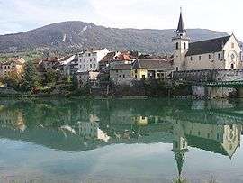
The village seen from the West | ||
| ||
 Seyssel | ||
|
Location within Auvergne-Rhône-Alpes region  Seyssel | ||
| Coordinates: 45°57′35″N 5°50′14″E / 45.9597°N 5.8372°ECoordinates: 45°57′35″N 5°50′14″E / 45.9597°N 5.8372°E | ||
| Country | France | |
| Region | Auvergne-Rhône-Alpes | |
| Department | Haute-Savoie | |
| Arrondissement | Saint-Julien-en-Genevois | |
| Canton | Seyssel (seat) | |
| Intercommunality | Pays de Seyssel | |
| Government | ||
| • Mayor (2001–2008) | Christian Monteil | |
| Area1 | 16.86 km2 (6.51 sq mi) | |
| Population (2006)2 | 2,099 | |
| • Density | 120/km2 (320/sq mi) | |
| Time zone | CET (UTC+1) | |
| • Summer (DST) | CEST (UTC+2) | |
| INSEE/Postal code | 74269 / 74910 | |
| Elevation |
250–937 m (820–3,074 ft) (avg. 265 m or 869 ft) | |
|
1 French Land Register data, which excludes lakes, ponds, glaciers > 1 km² (0.386 sq mi or 247 acres) and river estuaries. 2 Population without double counting: residents of multiple communes (e.g., students and military personnel) only counted once. | ||
.svg.png)
Seyssel is a commune in the Haute-Savoie department in the Auvergne-Rhône-Alpes region in south-eastern France.
Geography
The Fier forms most of the commune's southern border, then flows into the Rhone, which forms the commune's western border.
See also
References
| Wikimedia Commons has media related to Seyssel, Haute-Savoie. |
This article is issued from Wikipedia - version of the 10/28/2016. The text is available under the Creative Commons Attribution/Share Alike but additional terms may apply for the media files.