Seyðisfjörður
Coordinates: 65°15′47″N 14°0′32″W / 65.26306°N 14.00889°W
| Seyðisfjarðarkaupstaður | |
|---|---|
|
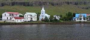
Seyðisfjörður in August 2010 | |
 | |
|
Location of the municipality | |
| Region | Eastern Region |
| Constituency | Northeast Constituency |
| Mayor | Vilhjálmur Jónsson |
| Area | 213 km2 (82 sq mi) |
| Population | 665 (2014)[1] |
| Density | 3.12/km2 (8.1/sq mi) |
| Municipal number | 7000 |
| Postal code(s) | 710 |
| Website |
sfk |

Seyðisfjörður (Icelandic pronunciation: [ˈseiðɪsfjœrðʏr̥]) is a town and municipality in the Eastern Region of Iceland at the innermost point of the fjord of the same name.
A road over Fjarðarheiði mountain pass connects Seyðisfjörður to the rest of Iceland; 27 kilometres (17 miles) to the ring road and Egilsstaðir. Seyðisfjörður is surrounded by mountains on all sides with most prominent Mt. Bjólfur to the West (1085m) and Strandartindur (1010m) to the East. The fjord itself is accessible on each side from the town, by following the main road that leads through the town. Further out the fjord is fairly remote but rich with natural interests including puffin colonies and ruins of former activity such as nearby Vestdalseyri, from where the local church was transported.
History
Settlement in Seyðisfjörður traces back to the early period of settlement in Iceland. The first settler was Bjólfur, who occupied the entire fjord. The burned down ruin of a "staf" church at Þórunnarstaðir has been carbon-dated to the 10th century, with earlier graves exhumed dating back to the 8th century.
Town settlement in the Seyðisfjörður area started in 1848. The town was settled by Norwegian fishermen. These settlers also built some of the existing wooden buildings in the town. Another now deserted settlement nearby in the fjord, Vestddalseyri was the site for the world's first modern industrialized whaling station. It was established in 1864 by renowned American whaler Thomas Welcome Roys and run by him and his workforce until 1866. Both settlements served primarily as fishing and trading posts. The first telegraph cable connecting Iceland to Europe was shored in Seyðisfjörður in 1906, making it a hub for international telecommunications well past the middle of last century. In 1913 a dam was made in the main river, harnessing power for the country's first high voltage AC power plant together with a distribution network for street lighting and home use, also the first of its kind in Iceland. Seyðisfjörður was used as a base for British/American forces during World War II and remnants of this activity are visible through the fjord, including a landing strip no longer in use and an oil ship SS El Grillo that was bombed and sunk. It remains a divers' wreck at the bottom of the fjord.
With the recent demise of the local fish-processing plant the village has shifted its economy to tourism. It still remains a significant fishing port on the east coast of Iceland, with harbours, ship construction facilities and a slip.
Overview

The town of Seyðisfjörður is well known for its old wooden buildings and has remnants of urban street configurations within its urban fabric. There is a camping ground, facilities for campers, hotels, a swimming pool, a library, hospital, post office, liquor store, and other retail activity. Seyðisfjörður also has a vibrant cultural scene with an arts centre, a Technical Museum and local heritage museum[2] and the only two cinemas in the east of Iceland. The LungA art festival takes place in Seyðisfjörður in July[3] and world-renowned artist Dieter Roth had a residence and art studio in Seyðisfjörður. The Dieter Roth Academy is centered in the Skaftfell cultural center.[4]
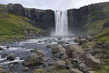
There are several waterfalls in the town. A popular hiking path starts at the town center, following the East bank of the Fjarðará, the river that flows through the center of town. Further up the river there are 25 waterfalls. During the winter, a skiing area is used in Fjarðarheiði mountain pass.
Skálanes nature and heritage centre can be found 17 km (10.6 mi) east of the town. The nature reserve is home to a diverse range of wildlife, as well as catering for visitors and anyone wanting to explore the south side of the fjord.
Transport
Port

Every week the car ferry MS Norröna of Smyril Line comes to Seyðisfjörður from Hirtshals in Denmark and Tórshavn in the Faroe Islands. Until January 2009 it also called at Bergen, Norway and Scrabster, Scotland.
Roads
Seyðisfjörður is connected to the Icelandic ring road Route 1 at Egilsstaðir, via Route 93 which departs west from Seyðisfjörður. Route 951 travels east along the northern side of Seyðisfjörð and Route 952 also travels east, but along the southern side of the fjord.
Sports
The local football club Huginn play in Iceland's third tier (3rd Division). The colours of their kit are yellow and black.
Climate
| Climate data for Seyðisfjörður (1981-2000) | |||||||||||||
|---|---|---|---|---|---|---|---|---|---|---|---|---|---|
| Month | Jan | Feb | Mar | Apr | May | Jun | Jul | Aug | Sep | Oct | Nov | Dec | Year |
| Record high °C (°F) | 17.5 (63.5) |
16.0 (60.8) |
15.4 (59.7) |
21.0 (69.8) |
21.5 (70.7) |
26.6 (79.9) |
27.0 (80.6) |
25.0 (77) |
25.0 (77) |
22.0 (71.6) |
20.7 (69.3) |
18.0 (64.4) |
27 (80.6) |
| Average high °C (°F) | 3.0 (37.4) |
2.9 (37.2) |
3.1 (37.6) |
4.7 (40.5) |
8.4 (47.1) |
11.3 (52.3) |
13.0 (55.4) |
13.2 (55.8) |
10.0 (50) |
6.4 (43.5) |
4.4 (39.9) |
2.7 (36.9) |
6.93 (44.47) |
| Daily mean °C (°F) | −0.2 (31.6) |
−0.3 (31.5) |
−0.1 (31.8) |
1.4 (34.5) |
4.9 (40.8) |
7.8 (46) |
9.9 (49.8) |
9.9 (49.8) |
7.2 (45) |
3.8 (38.8) |
1.5 (34.7) |
−0.2 (31.6) |
3.8 (38.83) |
| Average low °C (°F) | −3.5 (25.7) |
−3.5 (25.7) |
−3.5 (25.7) |
−1.6 (29.1) |
1.8 (35.2) |
4.8 (40.6) |
7.1 (44.8) |
7.0 (44.6) |
4.2 (39.6) |
0.8 (33.4) |
−1.5 (29.3) |
−3.3 (26.1) |
0.73 (33.32) |
| Record low °C (°F) | −18.0 (−0.4) |
−15.2 (4.6) |
−18.0 (−0.4) |
−12.6 (9.3) |
−8.4 (16.9) |
−3.5 (25.7) |
1.0 (33.8) |
0.0 (32) |
−5.7 (21.7) |
−9.9 (14.2) |
−14.0 (6.8) |
−15.8 (3.6) |
−18 (−0.4) |
| Average precipitation mm (inches) | 210.7 (8.295) |
156.1 (6.146) |
160.5 (6.319) |
94.2 (3.709) |
67.0 (2.638) |
55.9 (2.201) |
56.8 (2.236) |
95.0 (3.74) |
173.4 (6.827) |
214.2 (8.433) |
178.1 (7.012) |
188.6 (7.425) |
1,650.5 (64.981) |
| Source: Icelandic Met Office[5] | |||||||||||||
International relations
Twin towns — Sister cities
Seyðisfjörður is twinned with:
In popular culture
The 2015 Icelandic mystery television series Trapped (Icelandic: Ófærð) is set and filmed in the town. The series aired on BBC4 in the UK in early 2016.[6][7]
See also
References
- ↑ "Seyðisfjarðarkaupstaður". Samband íslenskra sveitarfélaga (in Icelandic). 2016. Retrieved 17 March 2016.
- ↑ "Technical Museum Seydisfjordur - history and local heritage". seydisfjordur.org. 2015. Retrieved 17 March 2016.
- ↑ "LungA Art Festival". Visit Seyðisfjörður. 2016. Retrieved 17 March 2016.
- ↑ "The Dieter Roth Academy at Skaftfell – Center for Visual Art, East Iceland". skaftfell.is. 2016. Retrieved 17 March 2016.
- ↑ "Monthly Temperature and Precipitation Averages for Seyðisfjörður". Icelandic Meteorological Office. Retrieved 5 June 2016.
- ↑ "Trapped". BBC Four. 2016. Retrieved 17 March 2016.
- ↑ Wollaston, Sam (15 February 2016). "Trapped review: stuck in a stormy, moody fjord with a killer on the loose? Yes please". The Guardian. Retrieved 17 March 2016.
External links
| Wikimedia Commons has media related to Seyðisfjörður. |
- Official website (engl./is.)
- Skaftfell Art Center
- Smyril Line (owner of car ferry Norröna) - official website
- Skálanes Nature & Heritage Centre