Semarang
| Semarang | ||||||||
|---|---|---|---|---|---|---|---|---|
| City | ||||||||
| Other transcription(s) | ||||||||
| • Hanacaraka | ꦑꦸꦛꦯꦼꦩꦫꦁ | |||||||
| • Chinese | 三宝垄 | |||||||
| • Pinyin | Sān bǎo lǒng | |||||||
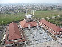
Clockwise from top: Tugu Muda monument, Old Town area of Semarang, Blenduk Church, Sam Poo Kong temple, Great Mosque of Central Java and Lawang Sewu | ||||||||
| ||||||||
| Nickname(s): Venetië van Java, Lumpia City | ||||||||
| Motto: Semarang Kota ATLAS | ||||||||
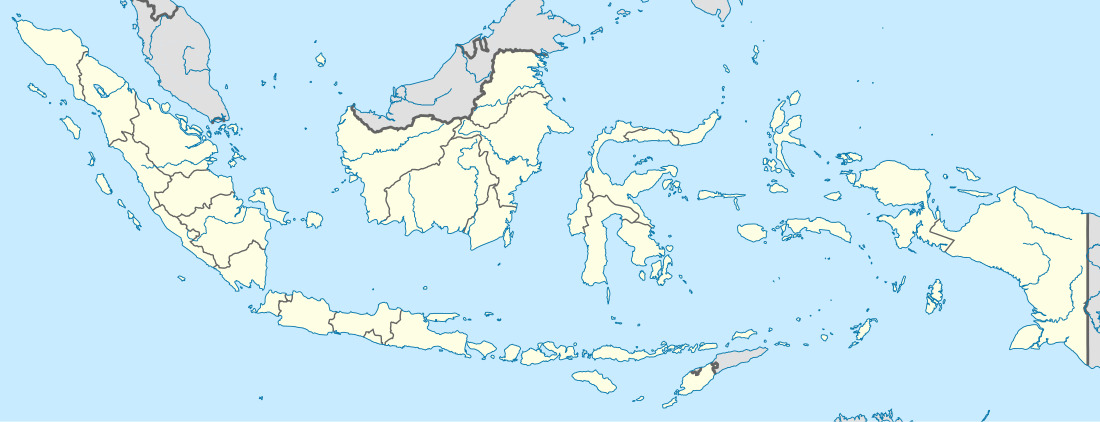 Semarang Location of Semarang in Indonesia | ||||||||
| Coordinates: 6°58′S 110°25′E / 6.967°S 110.417°ECoordinates: 6°58′S 110°25′E / 6.967°S 110.417°E | ||||||||
| Country | Indonesia | |||||||
| Province | Central Java | |||||||
| Government | ||||||||
| • Mayor | Hendrar Prihadi | |||||||
| Area | ||||||||
| • City | 373.78 km2 (144.32 sq mi) | |||||||
| • Metro | 1,643.4 km2 (634.5 sq mi) | |||||||
| Elevation | 4 m (13 ft) | |||||||
| Population (2010 Census) | ||||||||
| • City | 1,555,984 | |||||||
| • Density | 4,200/km2 (11,000/sq mi) | |||||||
| • Metro | 3,183,516 | |||||||
| • Metro density | 1,900/km2 (5,000/sq mi) | |||||||
| Demonym(s) | Semarangian | |||||||
| Time zone | WIB (UTC+7) | |||||||
| Area code(s) | +6224 | |||||||
| License plate | H | |||||||
| Website | www.semarang.go.id | |||||||

.jpg)


| Semarang | |||||||||||||||
| Traditional Chinese | 三寶壟 | ||||||||||||||
|---|---|---|---|---|---|---|---|---|---|---|---|---|---|---|---|
| Simplified Chinese | 三宝垄 | ||||||||||||||
| |||||||||||||||
Semarang (formerly Dutch: Samarang, Indonesian: Kota Semarang), is a city on the north coast of the island of Java, Indonesia. It is the capital and largest city of the province of Central Java.
It has an area of 373.78 square kilometres (144.32 sq mi) and a population of approximately 1,8 million people, making it Indonesia's fifth most populous city [1] and the fifth largest Indonesian city after Jakarta, Surabaya, Bandung, and Medan. The built-up (metro) area had 3,183,516 inhabitants at the 2010 census spread on 2 cities and 26 districts.[2] Greater Semarang (aka Kedungsapur) has a population of close to 6 million (see Greater Semarang section), and is located at 6°58′S 110°25′E / 6.967°S 110.417°E. A major port during the Dutch colonial era, and still an important regional center and port today, the city has a dominant Javanese population.
History

In 1678, Sunan Amangkurat II promised to give control of Semarang to the Dutch East India Company (VOC) as a part of a debt payment. In 1682, the Semarang state was founded by the Dutch colonial power. On 5 October 1705 after years of occupations, Semarang officially became a VOC city when Susuhunan Pakubuwono I made a deal to give extensive trade rights to the VOC in exchange of wiping out Mataram's debt. The VOC, and later, the Dutch East Indies government, established tobacco plantations in the region and built roads and railroads, making Semarang an important colonial trading centre.
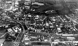
_in_Semarang_TMnr_10032316.jpg)
The historic presence of a large Indo (Eurasian) community in the area of Semarang is also reflected by the fact a creole mix language called Javindo existed there.[3]
The Japanese military occupied the city, along with the rest of Java, in 1942, during the Pacific War of World War II. During that time, Semarang was headed by a military governor called a Shiko, and two vice governors known as Fuku Shiko. One of the vice governors was appointed from Japan, and the other was chosen from the local population.
After Indonesian independence in 1945, Semarang became the capital of Central Java province.
City planning of Semarang during Dutch colonial era
The era of Classical Indische Town (1678–1870)
Semarang was handed by the Sultan of Mataram to the Dutch East Indies in 1678. The city was pictured as a small settlement with a pious Muslim area called Kauman, a Chinese quarter, and a Dutch fortress. The fortress has a pentagonal form with only one gate in the south and five monitoring towers to protect the Dutch settlement from rebellion actions, segregating the spaces between Dutch settlement and other areas.[4] In fact, the city of Semarang was only referred to the Dutch quarter while the other ethnic settlement were considered as villages outside the city boundary. The city, known as de Europeesche Buurt, was built in classical European style with church located in the centre, wide boulevards and streets skirted by beautiful villas.[5] According to Purwanto (2005),[6] the urban and architectural form of this settlement is very similar to the design principles applied in many Dutch cities, which begun to concern on the urban beautification.
Due to the long and costly Java War, there were not much of funding from the Dutch East Indies government, effecting the development of Semarang. The majority of land was used for rice fields and the only small improvement was the development of surrounding fortress. Although less developed, Semarang has a fairly arranged city system, in which urban activities were concentrated along the river and the settlement was linked to a market where different ethnic groups met to trade. The existence of the market, in the later years, become a primary element and a generator of urban economic growths.[7]
An important influence on urban growth was the Great Mail Road project in the 1847, which connected all the cities in northern coast of Central and East Java and made Semarang as the trade centre of agricultural production.[8] The project was soon followed by the development of the Netherlands Indies railway and the connecting roads into the inner city of Semarang at the end of 19th century.[7] Colombijn (2002)[8] marked the development as the shift of urban functions, from the former river orientation to all services facing the roads.
The growth of the modern city (1870–1922)
Improved communication, as the result of the Mail and Railway projects, had brought an economic booming for the city in the 1870s. There were hospital, churches, hotels, and large houses built along the new main roads; Bojongscheweg, Pontjolscheweg, and Mataram street, causing denser population in the ethnic settlements and creating the urban kampong.[5]
Urban growth had made acutely dense the urban kampong, reaching the number of 1000 inhabitants per hectare and degrading the quality of living condition.[9] In this early 20th century, mortality rate was very high due to the overcrowding and lack of hygiene that triggered the invasion of cholera and tuberculosis.[10] Cobban (1993)[9] noted the ethical movement of kampongverbetering led by Henry Tillema in 1913 and the concern of the Advisor for Decentralisation for kampong improvement through the betterment of public toilets, drainage, and the planning of public housing.
In 1917, a healthy housing project was implemented in the Southern part of Semarang called Candi Baru. Thomas Karsten, the advisor for city planning, transformed the concept of ethnic segregation that divided previous urban settlements into a new housing district plan based on economic classes. Although practically the three ethnic groups were also divided into three economic classes where the Dutch and rich Chinese occupied the largest lots in the housing district,[5] Karsten had effectively emerged the developed district by integrating the road network, introducing newly improved public wash and bathing, squares and sporting facilities that can be utilised communally.[11] Following the Candi Baru, there were three other housing plans between 1916–1919 to accommodate 55% population increase in Semarang; 45,000 Javanese, 8500 Chinese and 7000 Europeans. Karsten marked a new approach to town planning which emphasis on the aesthetic, practical and social requirements, articulated not in terms of racial terms but economic zones.[11]
Driven by economic growth and spatial city planning, the city had doubled in size and expanded to the south by the 1920s, creating a nucleus of a metropolis where multi-ethnic groups lived and traded in the city. The villages in the suburbs such as Jomblang and Jatingaleh steadily became the satellite towns of Semarang, more populated with a bigger market area. Before the invasion of Japan in 1942, Semarang had already become the capital of Central Java Province, as the result of trade and industrial success and spatial planning.[5]
Geography
Semarang is located on the northern coast of Java.
Climate
Semarang features a tropical rainforest climate that borders on a tropical monsoon climate. The city features distinctly wetter and drier months, with June through August being the driest months. However, in none of these months does average precipitation fall below 60 mm, hence the tropical rainforest categorization. Semarang on average sees approximately 2800 mm of rain annually. Average temperatures in the city are relatively consistent, hovering around 28 degrees Celsius.
| Climate data for Semarang | |||||||||||||
|---|---|---|---|---|---|---|---|---|---|---|---|---|---|
| Month | Jan | Feb | Mar | Apr | May | Jun | Jul | Aug | Sep | Oct | Nov | Dec | Year |
| Average high °C (°F) | 29 (85) |
29 (85) |
30 (86) |
31 (88) |
32 (89) |
32 (89) |
32 (89) |
32 (89) |
32 (90) |
32 (90) |
31 (88) |
30 (86) |
31 (88) |
| Average low °C (°F) | 25 (77) |
25 (77) |
25 (77) |
26 (78) |
26 (78) |
25 (77) |
24 (76) |
24 (76) |
25 (77) |
26 (78) |
26 (78) |
25 (77) |
25 (77) |
| Average precipitation mm (inches) | 430 (16.93) |
360 (14.17) |
320 (12.6) |
230 (9.06) |
160 (6.3) |
80 (3.15) |
80 (3.15) |
60 (2.36) |
100 (3.94) |
160 (6.3) |
220 (8.66) |
330 (12.99) |
2,780 (109.45) |
| Source: Weatherbase [12] | |||||||||||||
Flood control
In August 2011, a 421 metres (1,381 ft) tunnel dodger at Kreo river has been finished and Jatibarang Dam construction can begin, with completion targeted for July 2013. The dam is planned to ease 230 cubic metres (8,100 cu ft) per second of flood water and will generate 1.5 Megawatts of electricity, provide a drinking water resource and a boost to tourism.[13]

Transport
Air
Semarang's Achmad Yani airport is served by a number of operators including Air Asia, Garuda and Lion Air.[14]
Road
The primary means of public transportation is by minibus, called "bis." Semarang's largest bus terminals are Mangkang and Terboyo.
A bus rapid transit serves Semarang, called Trans Semarang.
Semarang has a toll road, Jalan Tol or the Semarang Artery. The Semarang-Solo Toll Road is under construction.
Semarang is on Indonesian National Route 1 that connects it to Merak and Ketapang (Banyuwangi). Indonesian National Route 14 toward Bawen starts here.
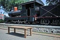
Rail

Semarang was connected to Surakarta (Solo) by a rail line in 1870.[15]
There are two large train stations in Semarang: Semarang Poncol and Semarang Tawang.
Sea
The main seaport is the Tanjung Mas seaport.
Education
Semarang is home to several notable universities and high schools, including the state-owned Diponegoro University and Universitas Negeri Semarang.
Temples


The Sam Poo Kong temple is the oldest Chinese temple in the city.[16]
Semarang River
As Singapore River, Semarang is constructing Semarang River at Banjir Kanal Barat (Garang River) near Karangayu Bridge. In medio July 2011, gardens in river banks and some traditional boats have available to use. The project will be finished in 2013 with river gardens, trotoars, gardens lighting, water activities, art sites, sport sites and balcony-and-stairs for sightseeing.[17]
Food

Semarang is widely known for its Bandeng presto (pressure-cooked milkfish), Lumpia, Wingko, Tahu Gimbal, and Ganjel Rel. Semarang has also been called 'The city of Jamu' because it is an important centre for the production of jamu which are a wide range of Indonesian herbal medicines that are very popular across Indonesia.[18]
Greater Semarang
Suburbanization has occurred to a great extent in Java, and Semarang is no exception. Greater Semarang was initially defined as Semarang, Semarang Regency, the newly carved Salatiga city, Kendal Regency, and Demak Regency.[19]
| Administrative division | Area (km²) | Population (2010 Census) | Population density (/km²) |
|---|---|---|---|
| Semarang Municipality | 373.70 | 2,067,254 | 5,531.85 |
| Semarang Regency | 981.95 | 930,727 | 947.83 |
| Salatiga Municipality | 56,781 | 177,088 | 3,118.79 |
| Kendal Regency | 1,002.23 | 900,313 | 898.31 |
| Demak Regency | 897.43 | 1,055,579 | 1,176.2 |
| Grobogan Regency | 1,975.865 | 1,413,328 | 715.3 |
| Greater Semarang | 5,287.96 | 6,544,289 | 1,238.83 |
Notable people born in Semarang
- Agung Laksono, politician and former Chairman of the House of Representatives.
- Anindya Kusuma Putri, Puteri Indonesia 2015 and Top 15 of Miss Universe 2015.
- Anne Avantie, fashion designer.
- Conrad Emil Lambert Helfrich, Dutch admiral.
- Daniel Sahuleka, Dutch musician.
- Fuad Hassan, politician, former Minister of Education and Culture.
- Hubertus van Mook, Dutch politician.
- Liem Bwan Tjie, architect.
- Oei Tiong Ham, Chinese Indonesian tycoon.
- P.F.Dahler, politician, member of Committee for Preparatory Work for Indonesian Independence (BPUPKI).
- Purnomo Yusgiantoro, politician and current Minister of Defence.
- Raden Saleh, painter.
- Rob Nieuwenhuys, literary historian and author.
- Sutiyoso, chief of Indonesian Intelligence Bureau (BIN).
- Tukul Arwana, comedian and television personality.
- Willem Einthoven, medical doctor, invented the ECG, Nobel Prize winner.
Sister cities
Semarang is twinned with:
References
- ↑ http://dispendukcapil.semarangkota.go.id/statistik/jumlah-penduduk-kota-semarang/2015-10-11
- ↑ http://www.citypopulation.de/php/indonesia-jawa-admin.php
- ↑ De Gruiter, Miel. "Javindo, a contact language in pre-war Semarang". (Peter Bakker & Maarten Mous. Mixed Languages: 15 Case Studies in Language Intertwining. Amsterdam: IFOTT. 1994.) pp. 151–159.
- ↑ Purwanto, L. M. F. (2005). Kota Kolonial Lama Semarang. Dimensi Teknik Arsitektur, 33(1), 27-33
- 1 2 3 4 Pratiwo. (2005). The City Planning of Semarang 1900–1970. In F. Colombijn, M. Barwegen, P. Basundoro & J. A. Khusyairi (Eds.), Old City, New City: The History of the Indonesian City Before and After Independence. Yogyakarta: Penerbit Ombak.
- ↑ Purwanto, L. M. F. (2005). Kota Kolonial Lama Semarang. Dimensi Teknik Arsitektur, 33(1), 27-33.
- 1 2 Nas, P. J. M., & Pratiwo. (2002). Java and De Groote Postweg, La Grande Route, the Great Mail Road, Jalan Raya Pos’. Bijdragen tot de Taal-, Land-en Volkenkunde, 158(4), 707–725.
- 1 2 Colombijn, F. (2002). Introduction; On the road. Bijdragen tot de Taal-, Land-en Volkenkunde, 158(4), 595-617.
- 1 2 Cobban, J. L. (1993). Public Housing in Colonial Indonesia 1900–1940. Modern Asian Studies, 27(04), 871-896.
- ↑ Silver, C. (2008). Planning the megacity: Jakarta in the twentieth century: Psychology Press.
- 1 2 Cote, J. (2004). Colonial designs: Thomas Karsten and the planning of urban Indonesia. Imprint, 2004, 01-01.
- ↑ "Weatherbase: Weather for Semarang, Indonesia". Weatherbase. 2011. Retrieved on 1 December 2011.
- ↑ "Bendungan Utama Waduk Jatibarang Dikerjakan". 13 August 2012.
- ↑ "Flights". Semarang. Lonely Planet. Retrieved 3 December 2015.
- ↑ Matthew Isaac Cohen. The Komedie Stamboel: Popular Theater in Colonial Indonesia, 1891-1903. p. 90.
- ↑ "It's Chinese New Year for all in Semarang". The Jakarta Post. 8 February 2016. Retrieved 8 February 2016.
- ↑ http://suaramerdeka.com/v1/index.php/read/layar/2011/07/16/834/-Eloknya-Singapore-River-di-Banjirkanal-Barat (Indonesian)
- ↑ Wahyuni Kamah, 'Semarang: Indonesia's City of Jamu', The Jakarta Globe, 26 March 2012.
- ↑ http://www.isocarp.net/Data/case_studies/478.pdf
- ↑ http://www.brisbane.qld.gov.au/about-council/economic-development/international-relations-sister-cities/list-of-sister-cities/semarang-indonesia/index.htm
- ↑ http://www.republika.co.id/berita/internasional/global/12/09/06/m9wg7g-kerja-sama-sister-city-semarangda-nang-akan-ditingkatkan
- ↑ http://id.berita.yahoo.com/marzuki-hubungan-indonesia-vietnam-harus-ditingkatkan-162007217.html
- Graaf, H. J. de (Hermanus Johannes), 1899-(?), "Chinese Muslims in Java in the 15th and 16th centuries : the Malay Annals of Semarang and Cerbon / translated and provided with comments by H.J. de Graaf and Th.G.Th. Pigeaud; edited by M.C. Ricklefs. Publisher: [Melbourne] : Monash University, 1984. Description: xiii, 221 p. : folded map ; 21 cm. ISBN 0-86746-419-4 : Series: Monash papers on Southeast Asia ; no. 12
External links
| Wikimedia Commons has media related to Semarang. |
- Official website (Indonesian)
 Semarang travel guide from Wikivoyage
Regencies and cities of Central Java | ||
|---|---|---|
Capital: Semarang | ||
| Regencies |  | |
| Cities | ||
| Villages | ||