Selke (river)
 | |
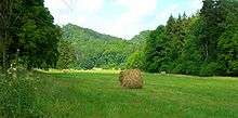
| Old bridge over the Selke near the Selke Mill | |
| Location | Saxony-Anhalt, |
|---|---|
| Length | 64.4 km (40.0 mi) |
| Source | west of Friedrichshöhe 51°38′13″N 10°54′19″E / 51.63694°N 10.90528°ECoordinates: 51°38′13″N 10°54′19″E / 51.63694°N 10.90528°E |
| Source height | 520 m above sea level (NN) |
| Mouth | near Rodersdorf into the Bode 51°52′23″N 11°13′45″E / 51.873028°N 11.229111°E |
| Mouth height | 118 m above sea level (NN) |
| Descent | 402 m |
| Basin | Elbe |
| Progression | Bode → Saale → Elbe → North Sea |
| Catchment | 468 km2 (181 sq mi) |
The Selke is a right-hand tributary of the River Bode that starts in the Harz Mountains before breaking out onto the northeastern Harz Foreland in the German state of Saxony-Anhalt. It has a length of 64 kilometres (40 mi),[1] of which 30 kilometres (19 mi) lies in the forested mountains of the Harz and the rest on the agricultural lowlands of the Harz Foreland.
Course

The Selke rises near the village of Friedrichshöhe in the borough of Güntersberge at a height of about 520 metres (1,710 ft) above NN. From Friedrichshöhe to Mägdesprung in the borough of Harzgerode it is accompanied by the Selke Valley Railway for a distance of 17 kilometres (11 mi). The Selke has cut deeply into the Harz Mountains in some places whilst in others it runs in a broad valley, depending on the bedrock. In Meisdorf on the northeastern edge of the Lower Harz the Selke leaves the forested mountain region and winds across a cultivated plain, continuing to flow in an easterly or northeasterly direction as far as Ermsleben. Beyond Ermsleben the river swing through 90° to the northwest, and runs from here in an almost straight line to its mouth on the River Bode near Rodersdorf, a village in the borough of Wegeleben. The Selke empties into the Bode at an elevation of 118 metres (387 ft).
In the past, the Selke burst its banks on several occasions causing significant damage. This led to plans by the state government for the expansion of existing floodwater retention basins and the creation of a new one. Particularly controversial is a medium-term 3.7-to-5.5-metre (12 to 18 ft) high embankment for the Selke Valley at Meisdorf. The citizens' initiative "Save the Selke Valley in the East Harz" is fighting this plan because they argue that it will destroy a scenically beautiful section of the Selke Valley that is important for nature conservation.
Castles
High above the Selke Valley is a striking and largely preserved medieval castle, Falkenstein, which is open to the public. On the other side of the valley, on a prominent spur, is a lofty viewing point, the Selkesicht, 330 metres (1,080 ft) above sea level, and at the site of another castle, the Ackeburg, with good views of Falkenstein Castle and the Selke valley. Both locations are checkpoints in the Harzer Wandernadel hiking network.
Tributaries
- Katzsohlbach (right)
- Limbach (left)
- Steinfurtbach (left)
- Westerbach (right)
- Rödelbach (right)
- Hüttenstollen
- Glasebach (right)
- Uhlenbach (left)
- Teufelsgrundbach
- Pulverbach (right)
- Schwefelbach (left)
- Friedenstalbach (left)
- Krebsbach (left)
- Schiebecksbach (right)
- Nagelbach (left)
- Titanbach (right)
- Sauerbach (left)
- Getel (left)
- Hauptseegraben (right)
- Grenzgraben (left)
See also
References
- ↑ Edmund Werner, Landesbetrieb für Hochwasserschutz und Wasserwirtschaft Sachsen-Anhalt. "Hochwasseraktionsplan Bode, Teilplan Selke".
External links
- Rettet das Selketal! – The citizen action group's web page with map of the Selke (German)
- Dissertation: Der Einfluß der Bergbaugschichte im Ostharz auf die Schwermetalltiefengradienten ... und die ... Schwermetalldispersion in den Einzugsgebieten von Bode und Selke im Harz. (pdf; 2.2 MB) (German)