Seagate, North Carolina
| Seagate, North Carolina | |
|---|---|
| CDP | |
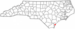 Location of Seagate, North Carolina | |
| Coordinates: 34°12′13″N 77°50′38″W / 34.20361°N 77.84389°WCoordinates: 34°12′13″N 77°50′38″W / 34.20361°N 77.84389°W | |
| Country | United States |
| State | North Carolina |
| County | New Hanover |
| Area | |
| • Total | 4.1 sq mi (10.7 km2) |
| • Land | 3.5 sq mi (9.2 km2) |
| • Water | 0.6 sq mi (1.5 km2) |
| Elevation | 23 ft (7 m) |
| Population (2000) | |
| • Total | 4,590 |
| • Density | 1,293.1/sq mi (499.3/km2) |
| Time zone | Eastern (EST) (UTC-5) |
| • Summer (DST) | EDT (UTC-4) |
| FIPS code | 37-60060[1] |
| GNIS feature ID | 1022529[2] |
Seagate is a census-designated place (CDP) in New Hanover County, North Carolina, United States. The population was 4,590 at the 2000 census. It is part of the Wilmington Metropolitan Statistical Area.
Geography
Seagate is located at 34°12′13″N 77°50′38″W / 34.20361°N 77.84389°W (34.203648, -77.843996).[3]
According to the United States Census Bureau, the CDP has a total area of 4.1 square miles (11 km2). 3.5 square miles (9.1 km2) of it is land and 0.6 square miles (1.6 km2) of it (13.84%) is water.
Demographics
As of the census[1] of 2000, there were 4,590 people, 1,851 households, and 1,269 families residing in the CDP. The population density was 1,293.1 people per square mile (499.2/km²). There were 2,041 housing units at an average density of 575.0 per square mile (222.0/km²). The racial makeup of the CDP was 92.09% White, 4.44% African American, 0.26% Native American, 0.68% Asian, 0.04% Pacific Islander, 1.26% from other races, and 1.22% from two or more races. Hispanic or Latino of any race were 2.29% of the population.
There were 1,851 households out of which 31.3% had children under the age of 18 living with them, 56.5% were married couples living together, 9.3% had a female householder with no husband present, and 31.4% were non-families. 22.1% of all households were made up of individuals and 7.0% had someone living alone who was 65 years of age or older. The average household size was 2.48 and the average family size was 2.91.
In the CDP the population was spread out with 23.7% under the age of 18, 8.7% from 18 to 24, 29.9% from 25 to 44, 26.8% from 45 to 64, and 11.0% who were 65 years of age or older. The median age was 38 years. For every 100 females there were 101.1 males. For every 100 females age 18 and over, there were 99.7 males.
The median income for a household in the CDP was $50,548, and the median income for a family was $62,724. Males had a median income of $40,443 versus $23,750 for females. The per capita income for the CDP was $29,567. About 8.7% of families and 11.7% of the population were below the poverty line, including 16.6% of those under age 18 and 11.7% of those age 65 or over.
References
- 1 2 "American FactFinder". United States Census Bureau. Retrieved 2008-01-31.
- ↑ "US Board on Geographic Names". United States Geological Survey. 2007-10-25. Retrieved 2008-01-31.
- ↑ "US Gazetteer files: 2010, 2000, and 1990". United States Census Bureau. 2011-02-12. Retrieved 2011-04-23.
Municipalities and communities of New Hanover County, North Carolina, United States | ||
|---|---|---|
| City |  | |
| Towns | ||
| CDPs |
| |
| Unincorporated communities | ||