Scholes International Airport at Galveston
| Scholes International Airport at Galveston (former Galveston Army Air Field) | |||||||||||||||
|---|---|---|---|---|---|---|---|---|---|---|---|---|---|---|---|
|
| |||||||||||||||
|
USGS 2006 orthophoto | |||||||||||||||
| IATA: GLS – ICAO: KGLS – FAA LID: GLS | |||||||||||||||
| Summary | |||||||||||||||
| Airport type | Public | ||||||||||||||
| Owner | City of Galveston | ||||||||||||||
| Serves | Galveston, Texas | ||||||||||||||
| Elevation AMSL | 6 ft / 2 m | ||||||||||||||
| Coordinates | 29°15′55″N 094°51′38″W / 29.26528°N 94.86056°WCoordinates: 29°15′55″N 094°51′38″W / 29.26528°N 94.86056°W | ||||||||||||||
| Website | www.GalvestonAirport.com | ||||||||||||||
| Map | |||||||||||||||
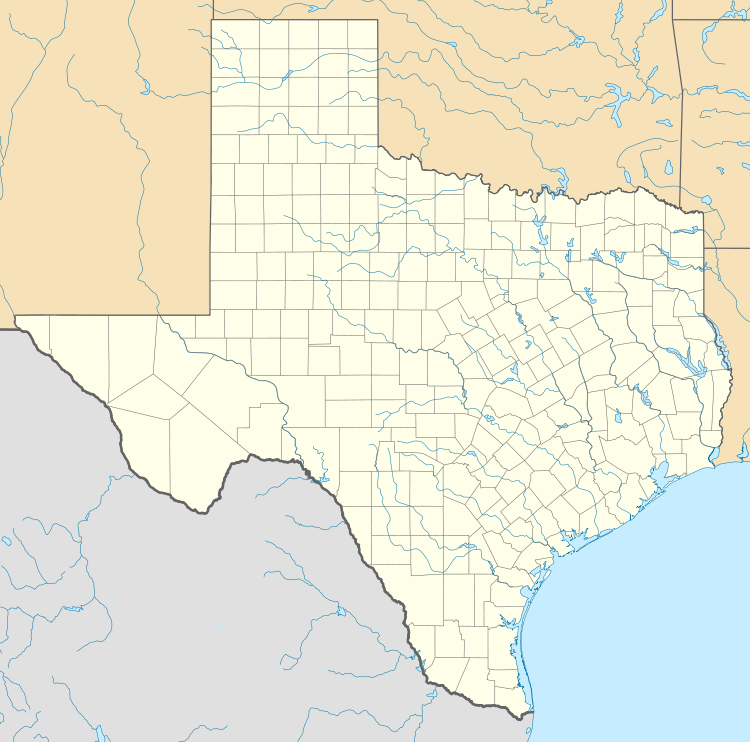 GLS Location of airport in Texas | |||||||||||||||
| Runways | |||||||||||||||
| |||||||||||||||
| Statistics (2011) | |||||||||||||||
| |||||||||||||||


Scholes International Airport at Galveston (IATA: GLS, ICAO: KGLS, FAA LID: GLS) is a city owned, public use airport located three nautical miles (6 km) southwest of the central business district of Galveston, a city in Galveston County, Texas, United States.[1] The airport is included in the National Plan of Integrated Airport Systems for 2011–2015, which categorized it as a reliever airport.[2]
The airport currently provides charter service and does not provide any commercial service. However, the airport's runways can accommodate airplanes as large as the Boeing 767-200.
Overview
Operated and maintained by the City of Galveston, GLS is a general aviation airport serving diverse aviation segments. It has enjoyed passenger service provided by several airlines in its history, including Trans-Texas Airways "TTA", the forerunner to Texas International Airlines, which itself, purchased National Airlines and later merged with (then) Denver based Continental Airlines... and ultimately merged with United Airlines. During the 1950s, Braniff Airways (later Braniff International) and Houston Metro Airlines, which operated a fleet of de Havilland Canada DHC6 "Twin Otters". At one point in the late 1960s, TTA operated Convair 600 twin turboprop service nonstop to both Houston and Beaumont/Port Arthur with continuing one stop, direct flights to Dallas and Austin. In the early 1950s, Braniff International provided Douglas DC-3 service to Houston International (later named William P. Hobby Airport), that directly connected to their Douglas DC-6 flights featuring "Million-aire" service from Houston to Dallas, Kansas City and Chicago. In later years, scheduled passenger air service from Galveston was operated by Houston Metro Airlines with De Havilland of Canada DHC-6 Twin Otters (twin turboprop aircraft) to Houston Intercontinental Airport (KIAH) with some of these flights making an intermediate stop in Clear Lake City (CLC airport), located near the NASA Johnson Space Center. A small commuter air carrier, Texas Airlines, also served the airport during the mid-1980s with flights to Houston Intercontinental Airport that were operated with Piper Navajo aircraft. [3]
The airport's Master Plan considers the potential return of commercial airline service as well as the increasing trend of corporate aircraft and oil industry helicopter activity. In preparation for increased corporate activity, the ultimate plan considers the extension of the primary runway (17/35) from 6000 X 150 ft (46 m). to 7,100 feet (2,200 m). Currently, it can accommodate aircraft as large as a Boeing 767.
GLS is an airport with air traffic control 12 hours a day (0600-1800), with direct clearance delivery service to Houston TRACON after the tower is closed. The Class D surface area changes to Class E and airport is uncontrolled. Airport lighting includes HIRL, MIRL, MALSR, REIL’s and PAPI’s as well as lighted taxiway and runway signage. It has an "A" ARFF Index. The 1,200-acre (4.9 km2) airport offers a terminal, a 24-hour fixed-base operator, 24-hour weather services, a U.S. Customs agent on call, and state-of-the-art navigational aids with precision approaches providing all-weather capabilities. It is a fairly popular fueling stop for transient military aircraft due to a Military Operations Area in the Gulf of Mexico. It is also the destination airport for air ambulances transferring patients to the Shriner's Burn Hospital for Children.
Of the 220+ aircraft based at GLS, 50+ are helicopters belonging to Bristow, Era, PHI and other oil industry vendors.
The Lone Star Flight Museum is located at the airport and boasts a large collection of flying antique military aircraft as well as the Texas Aviation Hall of Fame.
GLS ATIS Freq: 119.275, Phone Number: (409) 740-9248 ASOS
History
During the early 1920s, the present Galveston airport location began to be used for aircraft operations, by Bob Scholes and Fen Waters, among others), who were some of the earliest aircraft operators in Texas (both of whom were flying before the issuance of pilot licenses. Soon after, the City of Galveston ordered them to cease providing rides and aerobatic demonstrations, in their Hisso-Suiza converted, former OX-5 powered Standard for which they were using East Beach as a runway surface. Fen Waters was offered the use of what is the present airport property, by a friend whose family operated a cattle ranch and watermelon farm.
The Galveston Municipal Airport name dates back to 1931. For a time it was named Corrigan Airport in 1938 for Douglas "Wrong Way" Corrigan, a Galveston native.
During World War II, it was re-designated a United States Army Air Corps base and named "Galveston Army Air Field", United States Army Corps of Engineers, using funds made available by Congress through the Civil Aeronautics Authority, constructed three 6,000-foot (1,800 m)-long, hard-surface runways at the airport to accommodate army aircraft.
In January 1943, Galveston AAFld. was officially activated had the 46th Bombardment Group flying the Douglas A-20 Havoc in the anti-submarine role in the Gulf of Mexico until replaced by the 10th Antisubmarine Squadron, flying RM-37 Lockheed Venturas.
The Field was primarily used for replacement crew gunnery training by the 407th Fighter-Bomber Group, with targets being towed to the gunnery range at nearby Oyster Bay. The installation cost $7 million and at its peak had some 2,500 personnel assigned.
It was officially deactivated on November 15, 1945, with ownership reverting to the City of Galveston. The existing terminal was completed in 1949 and renamed Scholes Field in honor of Airport Manager and aviation pioneer, Robert "Bob" Scholes. As late as 1948, it was an active seaplane base per Sectional Aeronautical chart SA SAC O-5.
Facilities and aircraft
Scholes International Airport covers an area of 966 acres (391 ha) at an elevation of 6 feet (2 m) above mean sea level. It has two runways: 13/31 is 6,000 by 150 feet (1,829 x 46 m) with an asphalt and concrete surface; 17/35 is 6,001 by 150 feet (1,829 x 46 m) with a concrete surface.[1]
For the 12-month period ending June 3, 2011, the airport had 61,087 aircraft operations, an average of 167 per day: 55% air taxi, 44% general aviation, and 1% military. At that time there were 121 aircraft based at this airport: 64% single-engine, 17% multi-engine, 1% jet, 17% helicopter, 1% glider, and 2% ultralight.[1]
Regular traffic
Light general aviation aircraft, and the occasional transient business jets can be seen at GLS.
The most frequent traffic is that of the helicopters that support the offshore oil and gas industry operating in the Gulf of Mexico. These large Part 135 helicopter operators include:
- Bristow U.S. LLC flying Sikorsky S-92s, Sikorsky S-76s, Agusta Westland AW 139s, Eurocopter EC 135s, Bell 407s and Bell 206L-4s. Bristow US is part of Bristow Group which is one of the largest commercial helicopter operators in the world.[4]
- ERA flying Agusta A-119s, Eurocopter EC-135s, Sikorsky S-61s;
- PHI (Petroleum Helicopters Inc.) flying Bell JetRangers, Messerschmidt BO-105s, Eurocopter EC-135s, Sikorsky S-76s.
Lone Star Flight Museum
The Lone Star Flight Museum has a large number of static warbirds, and also maintains a fleet of air worthy warbirds including: Vega B-17 Flying Fortress, North American B-25 Mitchell Bomber, Douglas SBD Dauntless, Republic P-47 Thunderbolt, Vought F4U Corsair, General Motors (Eastern Aircraft) TBM Avenger, Grumman F6F Hellcat, Grumman F8F Bearcat, General Motors FM-2 Wildcat, Supermarine Spitfire, Hawker Hurricane, North American AT-6 Texan, Beech AT-11 Kansan, Cessna AT-17 Bobcat, Stinson L-5, Douglas DC-3 Sky Train, and Stearman PT-17.[5]
See also
References
- 1 2 3 4 FAA Airport Master Record for GLS (Form 5010 PDF). Federal Aviation Administration. Effective May 31, 2012.
- ↑ "2011–2015 NPIAS Report, Appendix A" (PDF, 2.03 MB). National Plan of Integrated Airport Systems. Federal Aviation Administration. October 4, 2010. External link in
|work=(help) - ↑ departedflights, Feb. 15, 1985 Official Airline Guide (OAG), Houston Intercontinental flight schedules
- ↑ http://www.bristowgroup.com
- ↑ "Aircraft Status". Lone Star Flight Museum.
-
 This article incorporates public domain material from the Air Force Historical Research Agency website http://www.afhra.af.mil/.
External links
|
|
.jpg)
| Airfields |
| .svg.png) | |||||||||||||||||||||||||||||||
|---|---|---|---|---|---|---|---|---|---|---|---|---|---|---|---|---|---|---|---|---|---|---|---|---|---|---|---|---|---|---|---|---|---|
| Units |
| ||||||||||||||||||||||||||||||||
| Command | |||||||||||||||||||
|---|---|---|---|---|---|---|---|---|---|---|---|---|---|---|---|---|---|---|---|
| Wings | |||||||||||||||||||
| Groups | |||||||||||||||||||
| Squadrons |
| ||||||||||||||||||
| Airfields |
| ||||||||||||||||||