Scheyville, New South Wales
| Scheyville Sydney, New South Wales | |||||||||||||
|---|---|---|---|---|---|---|---|---|---|---|---|---|---|
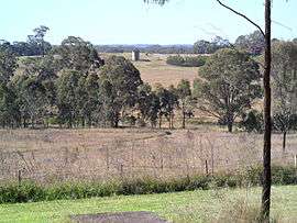 Training farm fields and early 1900s silo | |||||||||||||
| Coordinates | 33°36′40″S 150°52′58″E / 33.61120°S 150.88291°ECoordinates: 33°36′40″S 150°52′58″E / 33.61120°S 150.88291°E | ||||||||||||
| Population | 1,848 (2011 census)[1] | ||||||||||||
| Postcode(s) | 2756 | ||||||||||||
| Location | 54 km (34 mi) NW of Sydney CBD | ||||||||||||
| LGA(s) | City of Hawkesbury | ||||||||||||
| State electorate(s) | Hawkesbury | ||||||||||||
| Federal Division(s) | Macquarie | ||||||||||||
| |||||||||||||

Scheyville Centenary 2011
Scheyville (pronunciation: /ˌskaɪˈvɪl/[2][3]) is a suburb of Sydney, Australia. Scheyville is located 54 kilometres (34 mi) northwest of the Sydney central business district in the Hawkesbury local government area.
Military history
From 1965 to 1973, Scheyville was the site of Officer Training Unit, Scheyville (OTU Scheyville), established to provide training to meet the growing need for officers for the new conscripts called up for service under the national service scheme.
Parks
In 1997 large tracts of land in the area were dedicated as the Scheyville National Park. The area is named after William Schey, MLA, the Member for Redfern and later Darlington between 1887 and 1898.[2]
References
- ↑ Australian Bureau of Statistics (31 October 2012). "Oakville (SSC)". 2011 Census QuickStats. Retrieved 6 October 2014.
- 1 2 "Migrant camp seemed more like an adventure playground for young Joe". The Sydney Morning Herald. 14 May 2011. Retrieved 4 October 2014.
- ↑ "The Scheyville Farm". The Sydney Morning Herald. National Library of Australia. 19 August 1936. p. 10. Retrieved 4 October 2014.
External links
| Wikimedia Commons has media related to Scheyville, New South Wales. |
This article is issued from Wikipedia - version of the 4/27/2015. The text is available under the Creative Commons Attribution/Share Alike but additional terms may apply for the media files.