Schesaplana
| Schesaplana | |
|---|---|
|
Winter 2009 | |
| Highest point | |
| Elevation |
2,964.3 m (9,725 ft) (Swiss measurement) 2,965 metres (Austrian measurement) |
| Prominence | 826 m (2,710 ft) [1] |
| Isolation | 30.3 km (18.8 mi) [2] |
| Parent peak | Piz Kesch |
| Coordinates | 47°03′14″N 9°42′26″E / 47.05389°N 9.70722°ECoordinates: 47°03′14″N 9°42′26″E / 47.05389°N 9.70722°E |
| Geography | |
 Schesaplana Location in the Alps | |
| Location |
Vorarlberg, Austria Graubünden, Switzerland |
| Parent range | Rätikon |
| Climbing | |
| First ascent | 24 August 1610 by Christa Barball, Claus Manall, David Pappus |
| Easiest route | Hike |
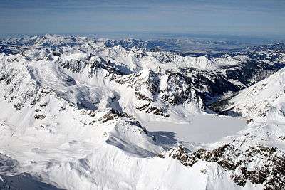
The Schesaplana is the highest mountain in the Rätikon mountain range at the border between Vorarlberg, Austria and Graubuenden, Switzerland. It has an elevation of 2,964.3 m (9,725 ft).
On the north side of the Schesaplana is a glacier called Brandner Gletscher. To the east is the Lünersee.
It is possible to reach the summit on various routes during a hike, making it useful for a multiday trek between the mountain huts in the area. A more horizontal trek is following the whole of the Rätikon chain along its southern face, called "Prättigauer Höhenweg".[3]
See also
References
- ↑ Swisstopo maps
- ↑ Retrieved from Google Earth. The nearest point of higher elevation is north of the Chlein Seehorn.
- ↑ Hiking Switzerland past Schesaplana, Graubünden
External links
| Wikimedia Commons has media related to Schesaplana. |
This article is issued from Wikipedia - version of the 1/30/2016. The text is available under the Creative Commons Attribution/Share Alike but additional terms may apply for the media files.