Scappoose Industrial Airpark
| Scappoose Industrial Airpark | |||||||||||
|---|---|---|---|---|---|---|---|---|---|---|---|
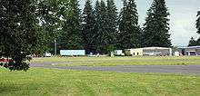 Hangars, planes, and runway | |||||||||||
| IATA: none – ICAO: KSPB – FAA LID: SPB | |||||||||||
| Summary | |||||||||||
| Airport type | Public | ||||||||||
| Owner/Operator | Port of St. Helens | ||||||||||
| Serves | Scappoose, Oregon | ||||||||||
| Elevation AMSL | 58 ft / 18 m | ||||||||||
| Coordinates | 45°46′16″N 122°51′43″W / 45.77111°N 122.86194°W | ||||||||||
| Website | ScappooseAirport.com | ||||||||||
| Runways | |||||||||||
| |||||||||||
| Statistics (2009) | |||||||||||
| |||||||||||
Scappoose Industrial Airpark (ICAO: KSPB, FAA LID: SPB, formerly 1S4) is a public use airport located one nautical mile (1.85 km) northeast of the central business district of Scappoose, in Columbia County, Oregon, United States.[1] It is owned and operated by the Port of St. Helens, an Oregon port district and municipal corporation, on behalf of district residents. According to the FAA's National Plan of Integrated Airport Systems for 2009–2013, it is categorized as a general aviation airport.[2]
Although many U.S. airports use the same three-letter location identifier for the FAA and IATA, this airport is assigned SPB by the FAA but has no designation from the IATA[3] (which assigned SPB to Charlotte Amalie Harbor Seaplane Base in Charlotte Amalie, Saint Thomas, U.S. Virgin Islands[4]).
Several privately held firms in the general aviation manufacturing industry are headquartered at the Scappoose Industrial Airpark.
Facilities and aircraft
Scappoose Industrial Airpark covers an area of 196 acres (79 ha) at an elevation of 58 feet (18 m) above mean sea level. It has one runway designated 15/33 with an asphalt surface measuring 5,100 by 100 feet (1,554 x 30 m).[1]
For the 12-month period ending April 29, 2009, the airport had 75,500 aircraft operations, an average of 206 per day: 93% general aviation, 7% air taxi, and <1% military. At that time there were 57 aircraft based at this airport: 75% single-engine, 2% multi-engine, 2% helicopter and 21% ultralight.[1]
References
- 1 2 3 4 FAA Airport Master Record for SPB (Form 5010 PDF). Federal Aviation Administration. Effective 8 April 2010.
- ↑ National Plan of Integrated Airport Systems for 2009–2013: Appendix A: Part 4 (PDF, 1.61 MB). Federal Aviation Administration. Updated 15 October 2008.
- ↑ "Scappoose Industrial Airpark (ICAO: KSPB, FAA: SPB)". Great Circle Mapper. Retrieved 29 May 2010.
- ↑ "Charlotte Amalie Harbor SPB (IATA: SPB, FAA: VI22)". Great Circle Mapper. Retrieved 29 May 2010.
External links
- ScappooseAirport.com
- Port of St. Helens
- Aerial image as of 5 August 2000 from USGS The National Map
- FAA Terminal Procedures for SPB, effective December 8, 2016
- Resources for this airport:
- FAA airport information for SPB
- AirNav airport information for KSPB
- FlightAware airport information and live flight tracker
- NOAA/NWS latest weather observations
- SkyVector aeronautical chart, Terminal Procedures