Scammon Bay, Alaska
| Scammon Bay | |
|---|---|
| City | |
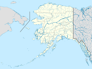 Scammon Bay Location in Alaska | |
| Coordinates: 61°50′33″N 165°34′54″W / 61.84250°N 165.58167°W | |
| Country | United States |
| State | Alaska |
| Census Area | Kusilvak |
| Incorporated | May 22, 1967[1] |
| Government | |
| • Mayor | Randall Charlie |
| • State senator | Donny Olson (D) |
| • State rep. | Neal Foster (D) |
| Area | |
| • Total | 0.6 sq mi (1.6 km2) |
| • Land | 0.6 sq mi (1.6 km2) |
| • Water | 0.0 sq mi (0.0 km2) |
| Elevation | 16 ft (5 m) |
| Population (2007)[2] | |
| • Total | 505 |
| • Density | 737.8/sq mi (284.9/km2) |
| Time zone | Alaska (AKST) (UTC-9) |
| • Summer (DST) | AKDT (UTC-8) |
| ZIP code | 99662 |
| Area code | 907 |
| FIPS code | 02-67680 |
Scammon Bay (Marayaaq in Central Yup'ik) is a city in Kusilvak Census Area, Alaska, United States. At the 2010 census the population was 474. It is named after Charles M Scammon Chief of Marine of the Western Union Telegraph Expedition by William Healey Dall in 1870.[3]
Geography
According to the United States Census Bureau, the city has a total area of 0.6 square miles (1.6 km2), all of it land.
Demographics
| Historical population | |||
|---|---|---|---|
| Census | Pop. | %± | |
| 1940 | 88 | — | |
| 1950 | 103 | 17.0% | |
| 1960 | 115 | 11.7% | |
| 1970 | 166 | 44.3% | |
| 1980 | 250 | 50.6% | |
| 1990 | 343 | 37.2% | |
| 2000 | 465 | 35.6% | |
| 2010 | 474 | 1.9% | |
| Est. 2015 | 515 | [4] | 8.6% |
As of the census[6] of 2000, there were 465 people, 96 households, and 84 families residing in the city. The population density was 737.8 people per square mile (285.0/km²). There were 114 housing units at an average density of 180.9 per square mile (69.9/km²). The racial makeup of the city was 1.94% White, 0.22% Black or African American, 96.13% Native American, 0.22% Pacific Islander, 0.22% from other races, and 1.29% from two or more races. 0.22% of the population were Hispanic or Latino of any race.
There were 96 households out of which 66.7% had children under the age of 18 living with them, 56.3% were married couples living together, 19.8% had a female householder with no husband present, and 12.5% were non-families. 12.5% of all households were made up of individuals and 1.0% had someone living alone who was 65 years of age or older. The average household size was 4.84 and the average family size was 5.25.
In the city the age distribution of the population shows 49.5% under the age of 18, 8.8% from 18 to 24, 24.5% from 25 to 44, 13.3% from 45 to 64, and 3.9% who were 65 years of age or older. The median age was 18 years. For every 100 females there were 94.6 males. For every 100 females age 18 and over, there were 97.5 males.
The median income for a household in the city was $25,625, and the median income for a family was $25,938. Males had a median income of $36,875 versus $13,750 for females. The per capita income for the city was $7,719. About 30.2% of families and 37.4% of the population were below the poverty line, including 49.0% of those under age 18 and none of those age 65 or over.
References
- ↑ 1996 Alaska Municipal Officials Directory. Juneau: Alaska Municipal League/Alaska Department of Community and Regional Affairs. January 1996. p. 135.
- ↑ "Annual Estimates of the Population for Incorporated Places in Alaska". United States Census Bureau. 2008-07-10. Retrieved 2008-07-14.
- ↑ Orth, Donald (1967). Dictionary of Alaska Place Names. Washington DC: U.S. Govt. Print. Off.
- ↑ "Annual Estimates of the Resident Population for Incorporated Places: April 1, 2010 to July 1, 2015". Retrieved July 2, 2016.
- ↑ "Census of Population and Housing". Census.gov. Retrieved June 4, 2015.
- ↑ "American FactFinder". United States Census Bureau. Retrieved 2008-01-31.
Coordinates: 61°50′33″N 165°34′54″W / 61.842489°N 165.581694°W
Municipalities and communities of Kusilvak Census Area, Alaska, United States | ||
|---|---|---|
| Cities | 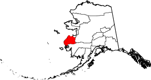 | |
| CDP | ||