Sawmills, North Carolina
| Sawmills, North Carolina | ||
|---|---|---|
| Town | ||
| ||
| Motto: "Biggest Little Town in the Foothills" | ||
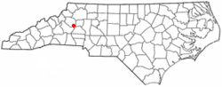 Location of Sawmills, North Carolina | ||
| Coordinates: 35°49′7″N 81°28′48″W / 35.81861°N 81.48000°WCoordinates: 35°49′7″N 81°28′48″W / 35.81861°N 81.48000°W | ||
| Country | United States | |
| State | North Carolina | |
| County | Caldwell | |
| Area | ||
| • Total | 6.63 sq mi (17.16 km2) | |
| • Land | 6.62 sq mi (17.14 km2) | |
| • Water | 0.008 sq mi (0.02 km2) | |
| Elevation | 1,247 ft (380 m) | |
| Population (2010) | ||
| • Total | 5,240 | |
| • Density | 792/sq mi (305.7/km2) | |
| Time zone | Eastern (EST) (UTC-5) | |
| • Summer (DST) | EDT (UTC-4) | |
| FIPS code | 37-59540[1] | |
| GNIS feature ID | 1027457[2] | |
| Website |
townofsawmills | |
Sawmills is a town in Caldwell County, North Carolina, in the United States. As of the 2010 census, the town population was 5,240.[3] It is part of the Hickory–Lenoir–Morganton Metropolitan Statistical Area. The town is named after the lumber industry that used to be prevalent in the area.
Geography
Sawmills is located in southern Caldwell County, bordered by Hudson to the north and Granite Falls to the east. Lake Rhodhiss borders the town on the south. Sawmills Veterans Park is located on Lake Rhodiss, providing recreational facilities, activities and trails.
According to the U.S. Census Bureau, Sawmills has a total area of 6.6 square miles (17.2 km2), of which 0.008 square miles (0.02 km2), or 0.09%, is water.[3]
Demographics
| Historical population | |||
|---|---|---|---|
| Census | Pop. | %± | |
| 1990 | 4,088 | — | |
| 2000 | 4,921 | 20.4% | |
| 2010 | 5,240 | 6.5% | |
| Est. 2015 | 5,104 | [4] | −2.6% |
As of the census[1] of 2000, there were 4,921 people, 1,942 households, and 1,448 families residing in the town. The population density was 787.4 people per square mile (304.0/km²). There were 2,045 housing units at an average density of 327.2 per square mile (126.3/km²). The racial makeup of the town was 97.34% White, 0.55% African American, 0.20% Native American, 0.16% Asian, 0.02% Pacific Islander, 1.16% from other races, and 0.57% from two or more races. Hispanic or Latino of any race were 2.36% of the population.
There were 1,942 households out of which 35.7% had children under the age of 18 living with them, 56.8% were married couples living together, 11.5% had a female householder with no husband present, and 25.4% were non-families. 21.0% of all households were made up of individuals and 5.7% had someone living alone who was 65 years of age or older. The average household size was 2.53 and the average family size was 2.89.
In the town the population was spread out with 25.7% under the age of 18, 8.8% from 18 to 24, 32.3% from 25 to 44, 24.0% from 45 to 64, and 9.2% who were 65 years of age or older. The median age was 34 years. For every 100 females there were 99.0 males. For every 100 females age 18 and over, there were 97.0 males.
The median income for a household in the town was $36,391, and the median income for a family was $41,579. Males had a median income of $27,933 versus $20,688 for females. The per capita income for the town was $15,597. About 4.3% of families and 8.9% of the population were below the poverty line, including 8.2% of those under age 18 and 11.2% of those age 65 or over.
References
- 1 2 "American FactFinder". United States Census Bureau. Retrieved 2008-01-31.
- ↑ "US Board on Geographic Names". United States Geological Survey. 2007-10-25. Retrieved 2008-01-31.
- 1 2 "Geographic Identifiers: 2010 Demographic Profile Data (G001): Sawmills town, North Carolina". U.S. Census Bureau, American Factfinder. Retrieved December 19, 2014.
- ↑ "Annual Estimates of the Resident Population for Incorporated Places: April 1, 2010 to July 1, 2015". Retrieved July 2, 2016.
- ↑ "Census of Population and Housing". Census.gov. Retrieved June 4, 2015.
External links
Municipalities and communities of Caldwell County, North Carolina, United States | ||
|---|---|---|
| Cities |  | |
| Towns | ||
| Village | ||
| CDP | ||
| Unincorporated communities | ||
| Footnotes | ‡This populated place also has portions in an adjacent county or counties | |