Sathing Phra District
| Sathing Phra สทิงพระ | |
|---|---|
| Amphoe | |
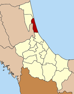 Amphoe location in Songkhla Province | |
| Coordinates: 7°28′24″N 100°26′18″E / 7.47333°N 100.43833°ECoordinates: 7°28′24″N 100°26′18″E / 7.47333°N 100.43833°E | |
| Country |
|
| Province | Songkhla |
| Area | |
| • Total | 120.0 km2 (46.3 sq mi) |
| Population (2005) | |
| • Total | 50,089 |
| • Density | 417.4/km2 (1,081/sq mi) |
| Time zone | THA (UTC+7) |
| Postal code | 90190 |
| Geocode | 9002 |
Sathing Phra (Thai: สทิงพระ) is a district (Amphoe) in the northern part of Songkhla Province, southern Thailand.
Geography
Neighboring districts are (from the south clockwise) Singhanakhon of Songkhla Province, Pak Phayun of Phatthalung Province, Krasae Sin and Ranot of Songkhla Province again. To the east is the Gulf of Thailand.
The western part of the district is at the shore of the Thale Luang, the northern part of the Songkhla Lake.
History
Originally named Chathing Phra, it was renamed to Sathing Phra in 1961.[1]
Administration
The district is subdivided into 11 subdistricts (tambon), which are further subdivided into 79 villages (muban). Sathing Phra is a township (thesaban tambon) which covers parts of tambon Cha Thing Phra.
| No. | Name | Thai name | Villages | Inh. | |
|---|---|---|---|---|---|
| 1. | Chathing Phra | จะทิ้งพระ | 7 | 6,009 | |
| 2. | Kradang-nga | กระดังงา | 7 | 4,674 | |
| 3. | Sanam Chai | สนามชัย | 5 | 4,012 | |
| 4. | Di Luang | ดีหลวง | 8 | 3,608 | |
| 5. | Chumphon | ชุมพล | 7 | 5,664 | |
| 6. | Khlong Ri | คลองรี | 9 | 3,787 | |
| 7. | Khu Khut | คูขุด | 9 | 5,657 | |
| 8. | Tha Hin | ท่าหิน | 9 | 4,345 | |
| 9. | Wat Chan | วัดจันทร์ | 6 | 3,778 | |
| 10. | Bo Daeng | บ่อแดง | 6 | 4,794 | |
| 11. | Bo Dan | บ่อดาน | 6 | 3,761 |
References
- ↑ พระราชกฤษฎีกาเปลี่ยนชื่ออำเภอและตำบลบางแห่ง พ.ศ. ๒๕๐๔ (PDF). Royal Gazette (in Thai). 78 (33 ก): 382–. April 11, 1961.
This article is issued from Wikipedia - version of the 11/18/2014. The text is available under the Creative Commons Attribution/Share Alike but additional terms may apply for the media files.