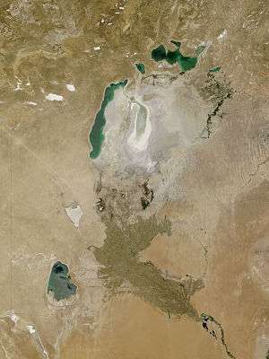
Sarygamysh Lake
| Sarygamysh Lake | |
|---|---|
 December 2001 | |
| Coordinates | 42°00′N 57°20′E / 42.000°N 57.333°ECoordinates: 42°00′N 57°20′E / 42.000°N 57.333°E |
| Basin countries | Turkmenistan, Uzbekistan |
| Max. length | 125 km |
| Max. width | 90 km |
| Surface area | ca. 5,000 km² |
| Average depth | 8 m |
| Max. depth | 40 m |
| Water volume | 12 km³ |
| Surface elevation | 5 m |
The Sarygamysh Lake, also Sarykamysh or Sary-Kamysh (Turkmen: Sarygamyş köli, Uzbek: 'Sariqamish ko‘li', Russian: Сарыкамы́шское озеро), Turkmen for "Yellow Reed", is a lake situated in central north Turkmenistan. It is geographically located approximately midway between the Caspian Sea and the Aral Sea. Approximately the northwest quarter of the lake belongs to the country of Uzbekistan, while the rest belongs to Turkmenistan.
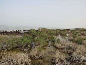

Lake Sarygamysh was fed, up to the 17th century, by the Uzboy River, a distributary of the Amu Darya River, which continued on to the Caspian Sea. Today, it is largely fed by the run-off water from surrounding irrigated lands, containing high levels of pesticides, herbicides and heavy metals.
The name of the lake comes from Turkmen sarykamysh 'yellow reed'.[1]
The Turkmen section of the lake and the land around it is protected by the Sarygamyş Sanctuary.
References
- ↑ E.M. Pospelov, Geograficheskiye nazvaniya mira (Moscow, 1998), p. 369.
| Wikimedia Commons has media related to Sarygamysh Lake. |