Sarteneja
| Sarteneja | |
|---|---|
| Village | |
| Village of Sarteneja | |
|
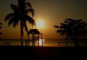
Beachfront of Sarteneja | |
| Nickname(s): Sarten | |
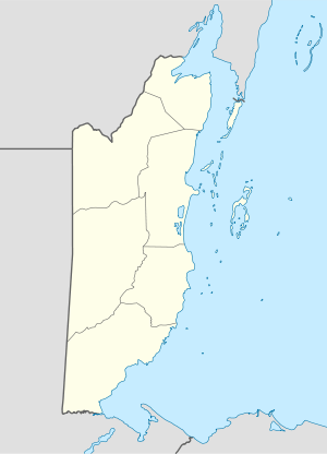 Sarteneja Location of Sarteneja in Corozal District, Belize | |
| Coordinates: 18°21′12″N 88°8′46″W / 18.35333°N 88.14611°W | |
| Country |
|
| District | Corozal District |
| Constituency | Corozal South East |
| Sarteneja | 1847 |
| Government | |
| • Chairman | Luciano Cruz (UDP) |
| Area | |
| • Total | 90.33 km2 (34.88 sq mi) |
| Elevation | 2-4 m (−11 ft) |
| Population (2010)[1] | |
| • Total | 1,824 |
| Demonym(s) | Sartenejeño(a) |
| Time zone | Central (UTC-6) |
| Climate | Aw |

Sarteneja, first known as "Tza-ten-a-ha", is the largest fishing community in Belize. This community is also the second most largest village, after San Narciso, in the Corozal District and recorded a population of 1,824 according to the 2010 census.[1] The name "Sarteneja" is a distortion of its original Mayan name, "Tza-ten-a-ha", to Castilian Spanish both meaning "water between the rocks".
It is located on the Sarteneja Peninsula, approximately forty miles by road from Orange Walk Town and is near the privately owned Shipstern Conservation & Management Area. The village's economy is based primarily on fishing for lobster, conch and finfish. There are many farmers, particularly retired fishermen that develop their farmland with agriculture. Recently, tourism is becoming increasingly significant as a source of income or at least as another alternative livelihood for those no longer interested in extracting the aforementioned species but instead help with their conservation or even with their sustainable exploitation.
Most of Sarteneja's inhabitants are of Yucatec Maya Mestizo ancestry. .
References
- 1 2 Belize Population and Housing Census 2010 (PDF) (Report). Statistical Institute of Belize. 2013. p. 64. Retrieved 14 May 2016.