Saraland, Alabama
| Saraland, Alabama | |
|---|---|
| City | |
| Motto: "Gateway to Progress" | |
 | |
| Coordinates: 30°49′31″N 88°5′31″W / 30.82528°N 88.09194°W | |
| Country | United States |
| State | Alabama |
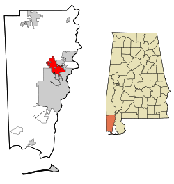
| County | Mobile |
| Incorporated | 1957 |
| Government | |
| • Type | Mayor–council |
| • Mayor | Dr. Howard rubenstien |
| Area | |
| • Total | 22 sq mi (57 km2) |
| • Land | 21.9 sq mi (56.7 km2) |
| • Water | 0.1 sq mi (0.3 km2) |
| Elevation | 13 ft (4 m) |
| Population (2010) | |
| • Total | 13,405 |
| • Density | 558.5/sq mi (215.6/km2) |
| Time zone | Central (CST) (UTC-6) |
| • Summer (DST) | CDT (UTC-5) |
| ZIP code | 36571 |
| Area code(s) | 251 |
| FIPS code | 01-68160 |
| GNIS feature ID | 0153329 |
| Website | http://www.saraland.org/ |
Saraland is a city in Mobile County, Alabama, United States, and a suburb of Mobile. As of the 2010 census, the population of the city is 13,405. It is a part of the Mobile metropolitan area. Saraland is the third largest city in Mobile County.
Geography
Saraland is located at 30°49′31″N 88°5′31″W / 30.82528°N 88.09194°W (30.825186, -88.091932).[1]
According to the U.S. Census Bureau, the city has a total area of 22.0 square miles (57 km2), of which 21.9 square miles (57 km2) is land and 0.1 square miles (0.26 km2) (0.50%) is water.
History
The land area that was to become the present-day Saraland, was included in a Spanish land grant to Don Diego Alvarez. Hence, descendants of Alvarez were the ones to give the community its first name: Alvarez Station. Later land squatters moved into the area and were able, legally, in 1800 to begin purchasing property. In 1807, a land office was opened in St. Stephens to handle all land transactions. Some of the pioneer families who seized the opportunity to buy up sections were named Alvarez, Rice, Hartley, Moore, LaCoste, Williams, Tool and Cleveland. Ultimately, Alvarez Station was called Cleveland Station. The present name of the city is reported to have been given by C.J. DeWitt, a retired minister editor who moved south in 1890 for health reasons. He opened the first post office on the Southern Railroad in 1895. The community is purported to be the namesake of his beloved wife, Sara.
Saraland was sparsely populated during the first part of the 20th century, until an industrial and population boom occurred in neighboring Mobile. Northward expansion of Mobile in the 1940s and 50's brought about the incorporation of Saraland in 1957. At the time of incorporation, the city reported only 125 residents. By the 1960 U.S. Census, annexations had swelled the population to 4,595. In 1980, census figures cited 9,844 Saraland residents. Current census records report that as of 2000, Saraland's population has grown to 12,288.
The worst rail disaster in the history of Amtrak occurred near Saraland on Big Bayou Canot on September 22, 1993. At approximately 2:53 AM, Amtrak's Sunset Limited train, powered by three locomotives, and en route from Los Angeles, California to Miami, Florida with 220 passengers and crew aboard, crossed the Bayou Canot bridge at high speed and derailed at a kink in the track caused by a barge captain who rammed the bridge by making a wrong turn in the waterway, and failed to report the accident. Forty-seven people, of whom 42 were passengers, were killed, many by drowning, others by fire. Much of the rescue efforts were average citizens of the community who journeyed out in the early morning hours in small fishing boats to help at the scene.
Demographics
| Historical population | |||
|---|---|---|---|
| Census | Pop. | %± | |
| 1960 | 4,595 | — | |
| 1970 | 7,840 | 70.6% | |
| 1980 | 9,833 | 25.4% | |
| 1990 | 11,751 | 19.5% | |
| 2000 | 12,288 | 4.6% | |
| 2010 | 13,405 | 9.1% | |
| Est. 2015 | 13,906 | [2] | 3.7% |
| U.S. Decennial Census[3] 2013 Estimate[4] | |||
As of the census[5] of 2000, there were 12,288 people, 4,810 households, and 3,602 families residing in the city. The population density was 560.9 people per square mile (216.5/km²). There were 5,138 housing units at an average density of 234.5 per square mile (90.5/km²). The racial makeup of the city was 88.50% White, 8.97% Black or African American, 0.56% Native American, 0.46% Asian, 0.01% Pacific Islander, 0.37% from other races, and 1.13% from two or more races. 1.17% of the population were Hispanic or Latino of any race.
There were 4,810 households out of which 31.8% had children under the age of 18 living with them, 61.0% were married couples living together, 10.5% had a female householder with no husband present, and 25.1% were non-families. 21.2% of all households were made up of individuals and 8.1% had someone living alone who was 65 years of age or older. The average household size was 2.55 and the average family size was 2.97.
In the city the population was spread out with 23.4% under the age of 18, 9.4% from 18 to 24, 29.3% from 25 to 44, 24.4% from 45 to 64, and 13.5% who were 65 years of age or older. The median age was 37 years. For every 100 females there were 95.4 males. For every 100 females age 18 and over, there were 92.2 males.
The median income for a household in the city was $38,318, and the median income for a family was $43,471. Males had a median income of $35,431 versus $22,787 for females. The per capita income for the city was $19,470. About 7.4% of families and 9.0% of the population were below the poverty line, including 12.2% of those under age 18 and 8.9% of those age 65 or over.
2010 census
As of the census[6] of 2010, there were 13,405 people, 5,208 households, and 3,757 families residing in the city. The population density was 558.5 people per square mile (215.6/km²). There were 5,828 housing units at an average density of 266.1 per square mile (102.8/km²). The racial makeup of the city was 83.7% White, 12.0% Black or African American, 0.8% Native American, 0.6% Asian, 0.1% Pacific Islander, 1.5% from other races, and 1.4% from two or more races. 2.5% of the population were Hispanic or Latino of any race.
There were 5,208 households out of which 27.9% had children under the age of 18 living with them, 54.4% were married couples living together, 13.4% had a female householder with no husband present, and 27.9% were non-families. 22.8% of all households were made up of individuals and 10.0% had someone living alone who was 65 years of age or older. The average household size was 2.57 and the average family size was 2.01.
In the city the population was spread out with 22.9% under the age of 18, 8.0% from 18 to 24, 25.8% from 25 to 44, 27.5% from 45 to 64, and 15.8% who were 65 years of age or older. The median age was 40 years. For every 100 females there were 97.7 males. For every 100 females age 18 and over, there were 101.9 males.
The median income for a household in the city was $48,721, and the median income for a family was $54,845. Males had a median income of $44,201 versus $31,235 for females. The per capita income for the city was $22,192. About 8.8% of families and 14.9% of the population were below the poverty line, including 28.3% of those under age 18 and 7.0% of those age 65 or over.
Transportation
Economy
- Royal Dutch Shell operates the Shell Saraland Refinery in Saraland.[7]
- Alorica Telecommunications Center
Education
Primary and secondary schools
Public schools
Saraland is served by the Saraland Board of Education. Residents are zoned to Saraland Elementary School, Adams Middle School, and Saraland High School.[8]
In June 2006, the City of Saraland voted to break away from the Mobile County Public School System and form its own school system.[9] The school district came into effect in the northern hemisphere fall 2008; at the time Saraland Elementary and Adams Middle were now a part of the city district, but high schoolers had to attend county schools because Saraland High School was not yet open.[10] Prior to the split of the City of Saraland from the county system in 2009, Saraland was zoned to Satsuma High School.[11] 2011 was the final year in which Saraland residents were permitted by the county to attend county schools.[12]
Several years prior to 2009 officials of Saraland, Satsuma, and Chickasaw contemplated forming the "Delta School District."[13]
Private schools
Private schools within Saraland include Evangel Christian School, North Mobile Christian School, and the Saraland Yeshiva right outside of the city limits.
Notable people
- Ann Casey, retired professional wrestler[14]
- Jay Prosch, National Football League fullback for the Houston Texans[15]
References
- ↑ "US Gazetteer files: 2010, 2000, and 1990". United States Census Bureau. 2011-02-12. Retrieved 2011-04-23.
- ↑ "Annual Estimates of the Resident Population for Incorporated Places: April 1, 2010 to July 1, 2015". Retrieved July 2, 2016.
- ↑ "U.S. Decennial Census". Census.gov. Retrieved June 6, 2013.
- ↑ "Annual Estimates of the Resident Population: April 1, 2010 to July 1, 2013". Retrieved June 3, 2014.
- ↑ "American FactFinder". United States Census Bureau. Retrieved 2008-01-31.
- ↑ "American FactFinder". United States Census Bureau. Retrieved 2015-08-04.
- ↑ "Locations", ShellChemicals.com, webpage: ShChem-loc-33.
- ↑ "Schools." Saraland City Schools. Retrieved on October 22, 2010.
- ↑ "Education." Saraland Chamber of Commerce. Retrieved on October 22, 2010.
- ↑ Lucio, Diana. "Saraland School System Coming Soon." WKRG. Saturday November 3, 2007. Retrieved on October 22, 2010.
- ↑ Cannon, Jason. "Vickers accepts Saraland position." Demopolis Times. Tuesday June 23, 2009. Retrieved on November 17, 2012.
- ↑ Philips, Rena Havner. "Mobile County school system sees dropping enrollment." Mobile Press-Register. Monday December 12, 2011. Retrieved on November 17, 2012.
- ↑ Philips, Rena Havner. "Chickasaw officials to examine possible school split." Mobile Press-Register. Friday March 27, 2009. Retrieved on March 31, 2009.
- ↑ Kociaba, Bill. "Ann Casey: More than just a pretty face". Cauliflower Alley Club. Retrieved 2015-03-14.
- ↑ "Jay Prosch". ESPN. Retrieved 15 March 2015.
External links
Coordinates: 30°49′31″N 88°05′31″W / 30.825186°N 88.091932°W
Municipalities and communities of Mobile County, Alabama, United States | ||
|---|---|---|
| Cities | 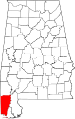 | |
| Towns | ||
| CDPs | ||
| Unincorporated communities | ||
| Ghost town | ||
| Footnotes | ‡This populated place also has portions in an adjacent county or counties | |