Saoner
| Saoner सावनेर Saraswatpur, Savner | |
|---|---|
| SCB town | |
 Saoner Location in Maharashtra, India | |
| Coordinates: 21°23′09″N 78°55′12″E / 21.3858107°N 78.9201379°ECoordinates: 21°23′09″N 78°55′12″E / 21.3858107°N 78.9201379°E | |
| Country |
|
| State | Maharashtra |
| District | Nagpur |
| Population (2001) | |
| • Total | 26,631 |
| Languages | |
| • Official | Marathi |
| Time zone | IST (UTC+5:30) |
| PIN | 441107 |
| Telephone code | 07113 |
| Vehicle registration | MH-40 |
| Nearest city | Nagpur |
| Literacy | 78% |
| Vidhan Sabha constituency | Saoner |
| Climate | Healthy (Köppen) |
| Website |
www |
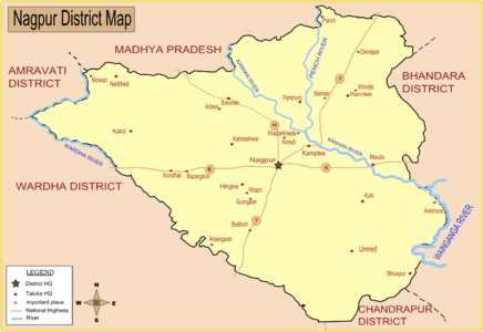
Saoner is a town and tehsil headquarters in north part of Nagpur district in state of Maharashtra, India. The town is governed by Saoner municipal council.[1] It is 36 kilometres (22 mi) from Nagpur city. Saoner is located on the bank of Kolar River.
History
Saoner is said to be mentioned in the Jaimini Ashwamedh under the name of Saraswatpur, and there are many legends connected with it. Ancient Shiv temple also known as Hemdapanti Shiv temple is also located near the bank of Kolar river. It is believed that while worshiping the Lord Shiva the flow of Kolar river was bent to form OM shape. This OM shape of Kolar river can be easily seen by satellite image. Ancient temple of Lord Ganesh is located at the neighboring village of Adasa on a hill. Saoner is also of historic importance due to its role in the 1942 Quit India Movement against the British.
Demographics
As of 2001 India census,[2] the town of Saoner had a population of 26,631. Males constituted 51% of the population and females 49%. Saoner had an average literacy rate of 73%, higher than the national average of 59.5%: male literacy was 79%, and female literacy was 68%. In Saoner, 14% of the population was under 6 years of age.
Climate
Saoner has tropical wet and dry climate (Köppen climate classification) with dry conditions prevailing for most of the year. It receives about 163 mm of rainfall in June. The amount of rainfall is increased in July to 294 mm. Gradual decrease of rainfall has been observed from July to August (278 mm) and September (160 mm).[3] The highest recorded daily rainfall was 304 mm on 14 July 1994. Summers are extremely hot, lasting from March to June, with May being the hottest month. Winter lasts from November to January, during which temperatures drop below 10 °C (50 °F).[3] The highest recorded temperature in the city was 48 °C on May 19, 2015, while the lowest was 3.9 °C.
| Climate data for Nagpur Airport (1971–1990) | |||||||||||||
|---|---|---|---|---|---|---|---|---|---|---|---|---|---|
| Month | Jan | Feb | Mar | Apr | May | Jun | Jul | Aug | Sep | Oct | Nov | Dec | Year |
| Record high °C (°F) | 36.6 (97.9) |
39.2 (102.6) |
45.0 (113) |
46.1 (115) |
47.8 (118) |
47.7 (117.9) |
40.6 (105.1) |
37.8 (100) |
38.9 (102) |
39.5 (103.1) |
35.6 (96.1) |
39.7 (103.5) |
47.8 (118) |
| Average high °C (°F) | 28.7 (83.7) |
31.2 (88.2) |
36.2 (97.2) |
40.7 (105.3) |
42.4 (108.3) |
37.5 (99.5) |
31.6 (88.9) |
30.5 (86.9) |
32.3 (90.1) |
32.7 (90.9) |
30.4 (86.7) |
28.1 (82.6) |
33.5 (92.3) |
| Daily mean °C (°F) | 20.8 (69.4) |
23.2 (73.8) |
27.7 (81.9) |
32.5 (90.5) |
35.1 (95.2) |
31.9 (89.4) |
27.9 (82.2) |
27.1 (80.8) |
27.7 (81.9) |
26.4 (79.5) |
23.0 (73.4) |
20.4 (68.7) |
27.0 (80.6) |
| Average low °C (°F) | 12.9 (55.2) |
15.1 (59.2) |
19.2 (66.6) |
24.3 (75.7) |
27.8 (82) |
26.3 (79.3) |
24.1 (75.4) |
23.6 (74.5) |
23.1 (73.6) |
20.0 (68) |
15.5 (59.9) |
12.6 (54.7) |
20.4 (68.7) |
| Record low °C (°F) | 3.9 (39) |
5.0 (41) |
8.3 (46.9) |
13.9 (57) |
19.4 (66.9) |
20.0 (68) |
19.4 (66.9) |
18.3 (64.9) |
16.6 (61.9) |
11.6 (52.9) |
6.7 (44.1) |
5.5 (41.9) |
3.9 (39) |
| Average precipitation mm (inches) | 12.5 (0.492) |
20.7 (0.815) |
17.6 (0.693) |
14.3 (0.563) |
19.2 (0.756) |
190.1 (7.484) |
341.7 (13.453) |
280.5 (11.043) |
183.1 (7.209) |
56.8 (2.236) |
16.6 (0.654) |
13.2 (0.52) |
1,166.3 (45.917) |
| Average rainy days (≥ 1.0 mm) | 1.8 | 2.2 | 1.9 | 1.2 | 2.9 | 11.4 | 17.5 | 16.5 | 10.4 | 4.0 | 1.3 | 1.1 | 72.2 |
| Average relative humidity (%) | 54 | 43 | 30 | 24 | 27 | 55 | 77 | 80 | 74 | 61 | 55 | 56 | 53 |
| Mean monthly sunshine hours | 272.0 | 268.3 | 287.6 | 290.8 | 293.8 | 186.6 | 115.4 | 116.7 | 182.5 | 260.4 | 264.1 | 268.8 | 2,807 |
| Source #1: NOAA[4] | |||||||||||||
| Source #2: India Meteorological Department (record high and low up to 2010)[6] | |||||||||||||
Extreme Weather
The average number of Heat wave days occurring in Saoner in the Summer months of March, April & May is 0.5, 2.4 and 7.2 days respectively. May is the most uncomfortable and hottest month with, for example, 18 days of heat waves being experienced in 1973, 1988 and 2010. The summer season is characterized by other severe weather activity like thunderstorms, dust storms, hailstorms and squalls. Generally, hailstorms occur during March and dust storms during March and April. These occur infrequently (0.1 per day). Squalls occur more frequently with 0.3 per day in March and April rising to 0.8 per day in May.[3]
Culture
Pola (Festival of Bullocks) and Holi are the main festivals of this area. Famous Marathi writers include Ram Ganesh Gadkari. Most of the people of Saoner are Kunbi (farmers), Teli (oil merchants) and Koshti (cotton weavers), and some of the red dye is still produced, for which the town was at one time noted.
Economy
This small town is famous for its coal mines, textile and paper industry. The primary occupation of its people is farming. Nearly 65% of the people are engaged in growing oranges on 80% of available nearby land. But in recent days coal mines has brought new employment opportunities in this region. Saoner is part of Ramtek (Lok Sabha constituency). The local language is Marathi but a most people also speak Hindi. Most of the bridges and government buildings were built by the British Government in the late 1930s. WCL (Western Coalfields India Limited) has open cast and closed coal mines, coal is mined and transported with the help of railway wagons to Khaparkheda Thermal Powerhouse. A large weekly market is held on Fridays, at which the ordinary attendance is about 10,000. This is chiefly a grocery, cloth and cattle bazar. In the open season from two to three hundred cattle are sold weekly. But Saoner, like Katol, now depends chiefly on its trade in raw cotton. There are four ginning factories at work, two of which have presses. On the west Katol town is a successful rival, and most of the cotton grown south of Saoner goes directly to the city.
Transportation
Saoner is well connected to Nagpur by road. Saoner was connected by narrow gauge railway which was disconnected since 2015 as broad gauge conversion work started between Nagpur and Chhindwara. It is expected to be finished by the end of 2018. From 2015 Indian Railways has started constructing a dedicated railway link from Saoner to Nagpur, Chhindwara,.Jabalpur. State Government of Maharashtra and Madhya Pradesh operate stage carrier bus service, besides private taxis and autos. The iconic NH 69 passes via Saoner. Which is connected Nagpur To Ahmadabad Via Saoner Baitul Indore. Also National Highway number 547 started from Saoner and end to Narsinghpur in north via Chhindawara. One new national highway (547 E) started from Saoner to Dhapewada kalmeshwar and end to Gondkhairi on Nagpur Amravati Road.
Telecom operators
In Saoner there are 7 Telecom operator which are -
5)Reliance
And there are four 3G Operators-
1)Airtel 3G
2)Idea 3G
3)Vodafone 3G
4)BSNL 3G (started since 10/11/2015.)
4G Operators -
1) Jio 4G
2) Airtel 4G
3) Idea 4G
4) Reliance 4G
References
- ↑ "Administrative divisions of Nagpur district". National Informatic Center. Government of Maharashtra. Retrieved 2009-01-09.
- ↑ "Census of India 2001: Data from the 2001 Census, including cities, villages and towns (Provisional)". Census Commission of India. Archived from the original on 2004-06-16. Retrieved 2008-11-01.
- 1 2 3 http://imdnagpur.gov.in/Climate_NGP.pdf
- ↑ "Nagpur/Sonegaon Climate Normals 1971–1990". National Oceanic and Atmospheric Administration. Retrieved 17 April 2015.
- ↑ https://web.archive.org/web/20150413020426/http://www.imd.gov.in:80/doc/climateimp.pdf
- ↑ "Ever recorded Maximum and minimum temperatures up to 2010". India Meteorological Department. Archived from the original on May 21, 2013. Retrieved 17 April 2015.
 |
Pandhurna , Madhya Pradesh State | Sausar, Chhindwara, Madhya Pradesh State | Pench National Park | |
| Narkhed | |
Parseoni, Ramtek | ||
| ||||
| | ||||
| Katol | Kalmeshwar | Nagpur |