Santo Antônio do Monte
| Santo Antônio do Monte | |||
|---|---|---|---|
| Municipality | |||
| |||
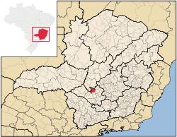 Location in Minas Gerais state | |||
 Santo Antônio do Monte Location in Brazil | |||
| Coordinates: 20°05′13″S 45°37′38″W / 20.08694°S 45.62722°WCoordinates: 20°05′13″S 45°37′38″W / 20.08694°S 45.62722°W | |||
| Country |
| ||
| Region | Southeast Region | ||
| State | Minas Gerais | ||
| Area | |||
| • Total | 1,125.78 km2 (434.67 sq mi) | ||
| Population (2015)[1] | |||
| • Total | 27,752 | ||
| • Density | 25/km2 (64/sq mi) | ||
| Time zone | BRT/BRST (UTC-3/-2) | ||


Santo Antônio do Monte (Portuguese, St. Antony of the Hill) is a municipality in the central part of the state of Minas Gerais, Brazil. The population is 27,752 (2015 est.) in an area of 1125.78 km².[1] The city is located 194 km west of state capital Belo Horizonte. The city is also known as Samonte. Santo Antonio do Monte was founded in the 18th century and it became a municipality on November 16, 1875. The main economic activity of the city is the production of fireworks. Nowadays there are in the city about 50 firework factories.
Neighboring municipalities
References
External links
- (Portuguese) http://www.citybrazil.com.br/mg/stoantoniomonte/
- Prefeitura de Santo Antônio do Monte (government site)
This article is issued from Wikipedia - version of the 5/1/2016. The text is available under the Creative Commons Attribution/Share Alike but additional terms may apply for the media files.