Santander Department
| Department of Santander Departamento de Santander | |||
|---|---|---|---|
| Department | |||
| |||
|
Motto: Santandereanos siempre adelante (Spanish: People of Santander always ahead) | |||
| Anthem: Himno de Santander | |||
 Santander shown in red | |||
 Topography of the department | |||
| Coordinates: 7°8′N 73°0′W / 7.133°N 73.000°WCoordinates: 7°8′N 73°0′W / 7.133°N 73.000°W | |||
| Country |
| ||
| Region | Andes Region | ||
| Established | May 13, 1857 | ||
| Capital | Bucaramanga | ||
| Largest city | Bucaramanga | ||
| Government | |||
| • Governor | Didier Alberto Tavera Amado (2016-2019) (Liberal Party) | ||
| Area | |||
| • Total | 30,537 km2 (11,790 sq mi) | ||
| Area rank | 12th | ||
| Population (2015)[1] | |||
| • Total | 2,061,095 | ||
| • Rank | 7th | ||
| • Density | 67/km2 (170/sq mi) | ||
| Time zone | UTC-05 | ||
| ISO 3166 code | CO-SAN | ||
| Provinces | 8 | ||
| Municipalities | 87 | ||
| Website | gobernaciondesantander.gov.co | ||
.svg.png)
.svg.png)
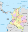
Santander is a department of Colombia. Santander inherited the name of one of the nine original states of the United States of Colombia. It is located in the central northern part of the country, borders the east with the Magdalena River, borders to the south and southeast with Boyacá, to the northeast with Norte de Santander Department, to the north with Cesar Department, and to the west with Bolivar and Antioquia Departments. Its capital is the city of Bucaramanga.
History
Pre-Columbian era
Prior to the arrival of the Spaniards, the territory now known as Santander was inhabited by Amerindian ethnic groups: Muisca, Chitareros, Laches, Yariguí, Opón, Carare and Guanes.
Their political and social structure was based on cacicazgos, a federation of tribes led by a cacique, with different social classes. Their main activity was planting maize, beans, yuca, arracacha, cotton, agave, tobacco, tomato, pineapple, guava, among others. Their agricultural skills were sufficiently developed to take advantage of the different mountainous terrains. The Guanes utilized terraces and an artificial system of irrigation. They had a knowledge of arts and crafts based on ovens to produce ceramics. They had cotton to make clothing and accessories such as hats and bags.
Colonization
Spanish conqueror Antonio de Lebríja led the first expedition through the area in 1529. The area was later invaded c. 1532 by German Ambrosius Ehinger in a quest to find El Dorado. This disrupted or destroyed many of the Amerindian villages. Some ethnic groups like the Yariguíes, Opones, and Carares fought the conquerors until they became extinct. Explorer Gonzalo Jiménez de Quesada later went to the area in an effort to appease the tribes. The colonization process in the area was started by Martín Galeano who founded the village of Vélez on July 3, 1539 and Pedro de Ursúa and Ortún Velázquez de Velasco founded the village of Pamplona (now part of the Norte de Santander Department) in 1549.
Once the Amerindian tribes were dominated, the Spanish organized the territory based on Cabildos (councils) to maintain the dominance and administer justice in the conquered territory. Amerindians were enslaved and forced to work in agriculture, manufacturing goods, and mines. These two villages functioned as centers for the Cabildos' territories. In 1636 the Cabildo of Vélez was transferred to a new jurisdiction centered on the village of Girón, with an area which went from the Sogamoso River, Río del Oro to the Magdalena River. The village of San Gil was created in 1689, segregated from the Jurisdiction of Vélez. In 1789 the village of Socorro was also segregated from Vélez and they were all put under the mandate of the Province of Tunja, a subdivision of the Viceroyalty of New Granada. On July 9, 1795 the corregimiento of Vélez – San Gil – Socorro was created due to the unsustainability of the Province of Tunja, and local government was established in the village of Socorro.
Cuisine
Santander cuisine, referred to as santandereas, includes regional specialties and food from the Department's capital city of Bucaramanga and other cities such as Cepita.
Dishes
- Arepa Santandereana, corn arepa with salt and pork
- Arroz de Peñaflor
- Empanadas Santandereana, local empanada
- Hormigas culonas, roasted "big ass" ants; the winged ants used are especially abundant in March and April
- Carne oreada, thin steak
- Sobrebarriga
- Fricassee Santandereana, a preparation of viscera and blood of goat mixed with white rice camuro and accompanied by roasted kid
- Veleño sandwich
- Corn arepa pela'o
- Sobrebarriga tamales
- Carne seca
- Cabrito; goat; cabrito is meat from a young (little) goat
- Mute (food), a soup of various grains and meat
- Changua, milk and egg soup
- Fritanga, fried snacks)
- Pepitoria, rice with goat intestine and goat blood
- Chorizos del Valle de San José, a chorizo specialty
- Yuca
Beverages
- Chicha de maiz, chicha from maize
- Chicha de corozo, chicha from palm nut
- Masato
- Goat milk
- Guarapo
- Aguardiente, alcoholic beverage made from sugarcane
- Panela's limonada, lemonade drink
Artists
The most outstanding and representative artists of the Colombian Santander department are Segundo Agelvis, Mario Hernández Prada, Carlos Gómez Castro, Martín Quintero, Oscar Rodríguez Naranjo and Pacheco de Suratá.
Administrative divisions
Provinces
The department is subdivided into provinces:
- Metropolitan Province
- North Soto Province
- Comunera Province
- Guanentá Province
- Vélez Province
- García Rovira Province
- Mares Province
- Carare-Opón Province
Municipalities
- Aguada
- Albania
- Aratoca
- Barbosa
- Barichara
- Barrancabermeja
- Betulia
- Bolívar
- Bucaramanga
- Cabrera
- California
- Capitanejo
- Carcasí
- Cepitá
- Cerrito
- Charalá
- Charta
- Chima
- Chipatá
- Cimitarra
- Concepción
- Confines
- Contratación
- Coromoro
- Curití
- El Carmen
- El Guacamayo
- El Peñón
- El Playón
- Encino
- Enciso
- Florián
- Floridablanca
- Galán
- Gámbita
- Girón
- Guaca
- Guadalupe
- Guapotá
- Guavatá
- Güepsa
- Hato
- Jesús María
- Jordán
- La Belleza
- Landázuri
- La Paz
- Lebrija
- Los Santos
- Macaravita
- Málaga
- Matanza
- Mogotes
- Molagavita
- Ocamonte
- Oiba
- Onzaga
- Palmar
- Palmas Socorro
- Páramo
- Piedecuesta
- Pinchote
- Puente Nacional
- Puerto Parra
- Puerto Wilches
- Rionegro
- Sabana de Torres
- San Andrés
- San Benito
- San Gil
- San Joaquín
- San José de Miranda
- San Miguel
- Santa Bárbara
- Santa Helena del Opón
- San Vicente de Chucurí
- Simacota
- Socorro
- Suaita
- Sucre
- Suratá
- Tona
- Valle de San José
- Vélez
- Vetas
- Villanueva
- Zapatoca
See also
References
- ↑ "Estimaciones de Población 1985 - 2005 y Proyecciones de Población 2005 - 2020 Total Municipal por Área (estimate)". Departamento Administrativo Nacional de Estadística. Retrieved 16 January 2016.
External links
| Wikimedia Commons has media related to Santander Department. |
| Wikivoyage has a travel guide for Santander, Colombia. |
 | ||