Santa Ynez Airport
| Santa Ynez Airport | |||||||||||
|---|---|---|---|---|---|---|---|---|---|---|---|
| IATA: SQA – ICAO: KIZA – FAA LID: IZA | |||||||||||
| Summary | |||||||||||
| Airport type | Public | ||||||||||
| Serves | County of Santa Barbara | ||||||||||
| Location | Santa Ynez | ||||||||||
| Opened | October 29, 1947 | ||||||||||
| Elevation AMSL | 671 ft / 205 m | ||||||||||
| Coordinates | 34°36′25″N 120°04′32″W / 34.60694°N 120.07556°WCoordinates: 34°36′25″N 120°04′32″W / 34.60694°N 120.07556°W | ||||||||||
| Map | |||||||||||
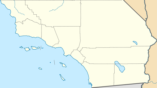 SQA Location in California | |||||||||||
| Runways | |||||||||||
| |||||||||||
Santa Ynez Airport (IATA: SQA, ICAO: KIZA, FAA LID: IZA) is a public airport located one mile (2 km) southeast of the central business district of Santa Ynez, in the Santa Ynez Valley of Santa Barbara County, California. The airport covers 125 acres (51 ha) and has one runway(18/26), measuring 2,804 x 75 ft. (854 x 23 m).[4] The airport does not have a control tower but does offer some services, including 24-hour access to both 100LL and Jet A self-service fuel and tie-downs for transient aircraft.
Santa Ynez Airport is classified as a regional general aviation airport,[5] and averaged 83 aircraft operations per day in 2015: 55% transient general aviation, 43% local general aviation, 1% air taxi, and <1% military. There are 112 aircraft based at the airport, including 15 gliders and 6 ultra-lights; the remaining aircraft are helicopters (5), single-engine airplanes (78), and the remaining 8 aircraft are multi-engine. There are no jets based at the airport.[6]
History
The Santa Ynez Airport was started in 1946 when a group of men from the Santa Ynez Valley asked the board of supervisors to purchase 155 acres in the valley to start a flying club. It wasn't until September 30th, 1949 that the State of California, Division of Aeronautics issued the first permit allowing for flight operations to commence. In 1950, the landing strip was upgraded with a 2,000-foot (610-meter) asphalt runway and parallel taxiway. In 1954 runway lights were installed, and the following year saw the opening of the glider port. In 1957, the runway was lengthened by 800 feet (244 m) to its current length. Between 1963 and 1982, the airport maintained a fleet of blue 1958 Chevrolet Yeoman rental cars which became synonymous with the airport among frequent visitors to Santa Ynez.[7]
Private aircraft owners use Santa Ynez as a hub for storing their plane as well as for refueling, and it is a popular stop-over airport for traveling private pilots. It boasts one of the best gliding locations in Southern California.[8] Santa Ynez Airport also serves as a staging ground for Santa Barbara County Sheriff's Department helicopters.[9]
References
- ↑ "Santa Ynez Airport Info". Santa Ynez Airport. Retrieved 3 January 2014.
- ↑ "Santa Ynez Airport History". Santa Ynez Airport. Retrieved 3 January 2014.
- ↑ "Santa Ynez Airport". Federal Aviation Administration. Retrieved 3 January 2014.
- ↑ FAA Airport Master Record for IZA (Form 5010 PDF)
- ↑ “2015–2019 NPIAS Report, Appendix A” (PDF, 7.89 MB), Federal Aviation Administration, January 20, 2015
- ↑ "Air Nav data for IZA"
- ↑ Official IZA site
- ↑ "Gliding". Santa Ynez Airport. Retrieved 3 January 2014.
- ↑ "Air Support Unit".