Santa Bárbara Municipality
| Santa Bárbara | |
|---|---|
| Municipality | |
 Municipality of Santa Bárbara in Chihuahua | |
|
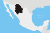
Santa Bárbara Location in Mexico | |
| Coordinates: 26°48′N 105°49′W / 26.800°N 105.817°WCoordinates: 26°48′N 105°49′W / 26.800°N 105.817°W | |
| Country |
|
| State | Chihuahua |
| Municipal seat | Santa Bárbara |
| Area | |
| • Total | 424.2 km2 (163.8 sq mi) |
| Population (2010) | |
| • Total | 10,427 |
| • Density | 25/km2 (64/sq mi) |
Santa Bárbara is one of the 67 municipalities of Chihuahua, in northern Mexico. The municipal seat lies at Santa Bárbara. The municipality, one of the smallest in Chihuahua, covers an area of 424.2 km².
As of 2010, the municipality had a total population of 10,427,[1] up from 10,120 as of 2005.[2]
As of 2010, the city of Santa Bárbara had a population of 8,765.[1] Other than the city of Santa Bárbara, the municipality had 105 localities, none of which had a population over 1,000.[1]
Geography
Towns and villages
The municipality has 53 localities. The largest are:
| Name | Population (2005) |
|---|---|
| Santa Bárbara | 8,673 |
| Punto Alegre | 374 |
| Corral de Piedras | 334 |
| Total Municipality | 10,120 |
References
- 1 2 3 "Santa Bárbara". Catálogo de Localidades. Secretaría de Desarrollo Social (SEDESOL). Retrieved 23 April 2014.
- ↑ "Santa Bárbara". Enciclopedia de los Municipios de México. Instituto Nacional para el Federalismo y el Desarrollo Municipal. Retrieved October 19, 2008.
This article is issued from Wikipedia - version of the 6/28/2014. The text is available under the Creative Commons Attribution/Share Alike but additional terms may apply for the media files.