Sandersville, Mississippi
| Sandersville, Mississippi | |
|---|---|
| Town | |
|
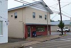
The U.S. Post Office in Sandersville, Mississippi | |
 Location of Sandersville, Mississippi | |
 Sandersville, Mississippi Location in the United States | |
| Coordinates: 31°47′8″N 89°2′4″W / 31.78556°N 89.03444°WCoordinates: 31°47′8″N 89°2′4″W / 31.78556°N 89.03444°W | |
| Country | United States |
| State | Mississippi |
| County | Jones |
| Area | |
| • Total | 5.0 sq mi (13.0 km2) |
| • Land | 5.0 sq mi (12.8 km2) |
| • Water | 0.0 sq mi (0.1 km2) |
| Elevation | 276 ft (84 m) |
| Population (2000) | |
| • Total | 789 |
| • Density | 159.2/sq mi (61.5/km2) |
| Time zone | Central (CST) (UTC-6) |
| • Summer (DST) | CDT (UTC-5) |
| ZIP code | 39477 |
| Area code(s) | 601 |
| FIPS code | 28-64920 |
| GNIS feature ID | 0677364 |
Sandersville is a town in Jones County, Mississippi. The population was 789 at the 2000 census. It is part of the Laurel micropolitan area.
Scottish settlers migrated here during the 1820s, and built the Good Hope Presbyterian Church. In 1855, the town was named after the Sanders, a pioneer family.
Home construction was influence by the Victorian Era, as there are a noticeable number of cupolas in the town.[1]
Hunt Refining Company has a refinery north-east of Sandersville which processes crude oil acquired primarily from local Mississippi fields. The refinery produces distillate feedstock, paving grade asphalt, heavy gas oils, naptha, and roofing grade asphalt.[2]
Professional football player Doug Satcher was born in Sandersville.
Geography
Sandersville is located at 31°47′8″N 89°2′4″W / 31.78556°N 89.03444°W (31.785455, -89.034572).[3]
According to the United States Census Bureau, the town has a total area of 5.0 square miles (13 km2), of which 5.0 square miles (13 km2) is land and 0.1 square miles (0.26 km2) (1.00%) is water.
Demographics
| Historical population | |||
|---|---|---|---|
| Census | Pop. | %± | |
| 1900 | 357 | — | |
| 1910 | 604 | 69.2% | |
| 1920 | 559 | −7.5% | |
| 1930 | 565 | 1.1% | |
| 1940 | 562 | −0.5% | |
| 1950 | 681 | 21.2% | |
| 1960 | 657 | −3.5% | |
| 1970 | 694 | 5.6% | |
| 1980 | 800 | 15.3% | |
| 1990 | 853 | 6.6% | |
| 2000 | 789 | −7.5% | |
| 2010 | 731 | −7.4% | |
| Est. 2015 | 721 | [4] | −1.4% |
As of the census[6] of 2000, there were 789 people, 317 households, and 231 families residing in the town. The population density was 159.2 people per square mile (61.4/km²). There were 350 housing units at an average density of 70.6 per square mile (27.2/km²). The racial makeup of the town was 92.14% White, 6.84% African American, 0.89% Native American, and 0.13% from two or more races. Hispanic or Latino of any race were 0.13% of the population.
There were 317 households out of which 31.9% had children under the age of 18 living with them, 56.8% were married couples living together, 12.9% had a female householder with no husband present, and 27.1% were non-families. 23.3% of all households were made up of individuals and 13.6% had someone living alone who was 65 years of age or older. The average household size was 2.49 and the average family size was 2.94.
In the town the population was spread out with 23.2% under the age of 18, 9.8% from 18 to 24, 28.1% from 25 to 44, 22.2% from 45 to 64, and 16.7% who were 65 years of age or older. The median age was 39 years. For every 100 females there were 92.9 males. For every 100 females age 18 and over, there were 84.8 males.
The median income for a household in the town was $26,538, and the median income for a family was $34,167. Males had a median income of $27,614 versus $20,313 for females. The per capita income for the town was $14,429. About 12.8% of families and 16.2% of the population were below the poverty line, including 18.3% of those under age 18 and 28.9% of those age 65 or over.
Education
The Town of Sandersville is served by the Jones County School District.
References
- ↑ McElvaine, Robert S. (1988). Mississippi: The WPA Guide to the Magnolia State. University Press of Mississippi.
- ↑ "Refining Operations". Hunt Refining Company. 2013.
- ↑ "US Gazetteer files: 2010, 2000, and 1990". United States Census Bureau. 2011-02-12. Retrieved 2011-04-23.
- ↑ "Annual Estimates of the Resident Population for Incorporated Places: April 1, 2010 to July 1, 2015". Retrieved July 2, 2016.
- ↑ "Census of Population and Housing". Census.gov. Retrieved June 4, 2015.
- ↑ "American FactFinder". United States Census Bureau. Retrieved 2008-01-31.
Municipalities and communities of Jones County, Mississippi, United States | ||
|---|---|---|
| Cities |  | |
| Towns | ||
| CDP |
| |
| Other unincorporated communities | ||