Sanday, Inner Hebrides
| Gaelic name | Sandaigh |
|---|---|
| Location | |
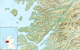 Sanday Sanday shown within Lochaber | |
| OS grid reference | NG282043 |
| Physical geography | |
| Island group | Small Isles |
| Area | 184 ha (0.71 sq mi) |
| Area rank | 114 [1] |
| Highest elevation | 59 m (194 ft) |
| Administration | |
| Sovereign state | United Kingdom |
| Country | Scotland |
| Council area | Highland |
| Demographics | |
| Population | 9[2] |
| Population rank | 69 [1] |
| Pop. density | 5 people/km2[2][3] |
| References | [3][4] |
Sanday (Scottish Gaelic: Sandaigh) is one of the Small Isles, in the Scottish Inner Hebrides. It is a tidal island linked to its larger neighbour, Canna, via sandbanks at low tide, and also connected to the larger island by a bridge. Canna and Sanday form a single community, and are usually described as Canna.

Like its neighbour, Canna, the whole island is owned by the National Trust for Scotland (NTS), and is part of the Lochaber committee area of Highland Council.[5] Whereas Canna is run by the NTS as a single farm, parts of Sanday are used for crofting.
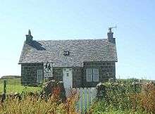
A small primary school on Sanday serves the communities of both islands, and currently (2009) has four pupils, of whom two are the children of the teacher. A footbridge to the island was built in 1905 to allow pupils from Canna to reach the school regardless of the state of the tide. This bridge was destroyed by storms in 2005, and has been replaced by a road bridge which was completed in April 2006. This new bridge allows vehicular access at all tide levels between the two islands, although parts of the road on Sanday is still covered by water during high tides.
From the mainland the island can be reached by the Caledonian MacBrayne ferry system from the port of Mallaig. Sanday includes rocks that are geologically part of the Paleocene and Eocene British Tertiary Volcanic Province, among some of the youngest rocks found in Scotland.[6]
The largest and most conspicuous building on Sanday is the deconsecrated Catholic church of St Edward, which stands alone on an elevated part of the island, away from the cottages which, together with the school, cluster around the bay facing Canna. The church, which is also owned by the National Trust for Scotland, was restored and converted into a hostel and Study Centre by the Hebridean Trust. This project was undertaken at the invitation of the owners. The Centre is linked to the Archive of Gaelic language and culture that was created by the former owner of Canna and Sanday, the late John Lorne Campbell. It was successfully completed and opened in 2001 by HRH The Princess Royal. Subsequently, there was water ingress, which caused damage to the interior. This challenge is in the hands of the National Trust for Scotland.
References
- 1 2 Area and population ranks: there are c. 300 islands over 20 ha in extent and 93 permanently inhabited islands were listed in the 2011 census.
- 1 2 National Records of Scotland (15 August 2013) (pdf) Statistical Bulletin: 2011 Census: First Results on Population and Household Estimates for Scotland - Release 1C (Part Two). "Appendix 2: Population and households on Scotland’s inhabited islands". Retrieved 17 August 2013.
- 1 2 Haswell-Smith, Hamish (2004). The Scottish Islands. Edinburgh: Canongate. ISBN 978-1-84195-454-7.
- ↑ Ordnance Survey: Landranger map sheet 39 Rùm, Eigg, Muck & Canna (Map). Ordnance Survey. 2007. ISBN 9780319229941.
- ↑ Patterson, A (June 2000). "Seabird Enhancement Programme on the Islands of Canna and Sanday". Case Studies -- Species Regeneration. National Trust for Scotland. Retrieved 2006-06-10.
- ↑ "Tertiary Igneous (TER-IGN)". Geological Conservation Review GCR Database. Joint Nature Conservation Committee. Retrieved 2006-06-10.
External links
| Wikimedia Commons has media related to Sanday, Inner Hebrides. |
Coordinates: 57°3′0″N 6°28′54″W / 57.05000°N 6.48167°W