Sand Branch, Dallas County, Texas
Sand Branch (sometimes spelled Sandbranch) is an unincorporated community in Dallas County, Texas, United States. According to the Handbook of Texas, the community had an estimated population of 400 in 2000.[1]
Geography
Sand Branch is located approximately two miles south of U.S. Highway 175 and 14 miles southeast of Downtown Dallas on Belt Line Road in southeastern Dallas County. It is situated between the Trinity River and Hickory Creek, southwest of Seagoville.[1] Sand Branch is the only unincorporated settlement left in Dallas County, as the vast majority of the county lies within incorporated cities.
Background
The Sand Branch Community has long been considered one of the poorest areas in Dallas County.[2] The area's living conditions and lack of basic services have led some to label the largely lower-income, predominately African American community a "non-border colonia" because of its similarities to those settlements situated along the southwestern United States border with Mexico.[3]
Streets
Eight streets are located within the community Sand Branch. They are:
|
|
Education
Public education in the community of Sand Branch is provided by the Dallas Independent School District. Zoned campuses include Kleberg Elementary School (grades PK-5), Seagoville Middle School (grades 6-8), and Seagoville High School (grades 9-12).[4][5][6]
References
- 1 2 "Sand Branch, Texas". The Handbook of Texas online. Retrieved 2009-11-09.
- ↑ "The Lost Community of Sandbranch". Richard West, D Magazine. 1985-09-01. Retrieved 2009-11-09.
- ↑ "The present day saga on one Texas non-border colonia". John Henneberger, Texas Housers. 2008-07-11. Retrieved 2009-11-09.
- ↑ "Kleberg Elementary School Attendance Zone" (PDF). 2009-10 Attendance Zone Maps. Demographic Studies Department, Dallas Independent School District. Retrieved 2009-11-09.
- ↑ "Seagoville Middle School Attendance Zone" (PDF). 2009-10 Attendance Zone Maps. Demographic Studies Department, Dallas Independent School District. Retrieved 2009-11-09.
- ↑ "Seagoville High School Attendance Zone" (PDF). 2009-10 Attendance Zone Maps. Demographic Studies Department, Dallas Independent School District. Retrieved 2009-11-09.
External links
- U.S. Geological Survey Geographic Names Information System: Sand Branch, Texas
- Sand Branch, Texas from the Handbook of Texas Online
Municipalities and communities of Dallas County, Texas, United States | ||
|---|---|---|
| Cities | 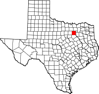 | |
| Towns | ||
| Unincorporated communities | ||
| Historical communities | ||
| Footnotes | ‡This populated place also has portions in an adjacent county or counties | |
Coordinates: 32°38′06″N 96°37′11″W / 32.63500°N 96.61972°W