San Remigio, Antique
| San Remigio | |
|---|---|
| Municipality | |
|
San Remigio landscape | |
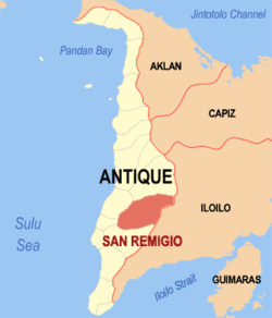 Location within Antique province | |
.svg.png) San Remigio Location within the Philippines | |
| Coordinates: 10°53′N 122°07′E / 10.88°N 122.12°ECoordinates: 10°53′N 122°07′E / 10.88°N 122.12°E | |
| Country | Philippines |
| Region | Western Visayas (Region VI) |
| Province | Antique |
| District | Lone district |
| Founded | July 1, 1864 |
| Barangays | 45 (see Barangays) |
| Government [1] | |
| • Type | Sangguniang Bayan |
| • Mayor | Glenn V. Cabigunda |
| Area[2] | |
| • Total | 406.98 km2 (157.14 sq mi) |
| Population (2015 census)[3] | |
| • Total | 31,935 |
| • Density | 78/km2 (200/sq mi) |
| • Voter (2016)[4] | 17,572 |
| Time zone | PST (UTC+8) |
| ZIP code | 5714 |
| IDD : area code | +63 (0)36 |
| Income class | 3rd class |
| PSGC | 060614000 |
| Website |
elgu |

San Remigio, officially the Municipality of San Remigio (Karay-a: Banwa kang San Remigio; Hiligaynon: Banwa sang San Remigio; Filipino: Bayan ng San Remigio), is a municipality in the province of Antique in the Western Visayas (Region VI) of the Philippines. The population was 31,935 at the 2015 census.[3] In the 2016 election, it had 17,572 registered voters.[4]
San Remigio is about 21 kilometres (13 mi) north-east from the provincial capital, San Jose de Buenavista.
Geography
San Remigio is located at 10°53′N 122°07′E / 10.88°N 122.12°E.
According to the Philippine Statistics Authority, the municipality has a land area of 406.98 square kilometres (157.14 sq mi)[2] constituting 14.91% of the 2,729.17-square-kilometre- (1,053.74 sq mi) total area of Antique.
Almost 70% of its land area are mountainous and the remaining 30% comprise the flat lowland and rolling hills.
Agriculture occupies 47.815 square kilometres (18.461 sq mi) of land. Of this, 44.37 square kilometres (17.13 sq mi) is for food crops, 1.035 square kilometres (0.400 sq mi) is for permanent crops, and 2.41 square kilometres (0.93 sq mi) for commercial crops.
Barangays
San Remigio is politically subdivided into 45 barangays.[5]
| PSGC | Barangay | Population | ±% p.a. | ||
|---|---|---|---|---|---|
| 2015[3] | 2010[6] | ||||
| 060614001 | Agricula | 1.7% | 547 | 494 | +1.96% |
| 060614002 | Alegria | 1.3% | 431 | 422 | +0.40% |
| 060614003 | Aningalan | 1.9% | 607 | 511 | +3.33% |
| 060614004 | Atabay | 0.6% | 178 | 175 | +0.32% |
| 060614005 | Bagumbayan | 1.9% | 612 | 484 | +4.57% |
| 060614006 | Baladjay | 2.1% | 660 | 1,100 | −9.27% |
| 060614007 | Banbanan | 0.8% | 269 | 265 | +0.29% |
| 060614008 | Barangbang | 4.3% | 1,362 | 1,150 | +3.27% |
| 060614009 | Bawang | 1.5% | 470 | 441 | +1.22% |
| 060614010 | Bugo | 5.0% | 1,600 | 1,586 | +0.17% |
| 060614011 | Bulan-bulan | 1.8% | 565 | 541 | +0.83% |
| 060614012 | Cabiawan | 1.6% | 502 | 449 | +2.15% |
| 060614013 | Cabunga-an | 1.4% | 457 | 450 | +0.29% |
| 060614014 | Cadolonan | 3.0% | 954 | 883 | +1.48% |
| 060614016 | Carawisan I | 1.7% | 556 | 514 | +1.51% |
| 060614017 | Carawisan II | 1.8% | 567 | 514 | +1.89% |
| 060614018 | Carmelo I | 1.5% | 485 | 419 | +2.82% |
| 060614019 | Carmelo II | 1.2% | 392 | 370 | +1.11% |
| 060614020 | General Fullon | 2.0% | 630 | 613 | +0.52% |
| 060614021 | General Luna | 2.1% | 672 | 603 | +2.08% |
| 060614023 | Iguirindon | 3.5% | 1,117 | 1,064 | +0.93% |
| 060614024 | Insubuan | 0.9% | 299 | 280 | +1.26% |
| 060614025 | La Union | 2.0% | 629 | 504 | +4.31% |
| 060614026 | Lapak | 1.3% | 427 | 425 | +0.09% |
| 060614027 | Lumpatan | 2.0% | 646 | 602 | +1.35% |
| 060614028 | Magdalena | 2.0% | 637 | 615 | +0.67% |
| 060614029 | Maragubdub | 2.2% | 692 | 678 | +0.39% |
| 060614030 | Nagbangi I (Amatong) | 2.1% | 664 | 700 | −1.00% |
| 060614031 | Nagbangi II | 1.5% | 491 | 484 | +0.27% |
| 060614033 | Nasuli | 1.6% | 502 | 473 | +1.14% |
| 060614022 | Orquia (Igcatumbal) | 0.7% | 218 | 207 | +0.99% |
| 060614034 | Osorio I | 2.4% | 757 | 717 | +1.04% |
| 060614035 | Osorio II | 2.7% | 865 | 843 | +0.49% |
| 060614036 | Panpanan I | 4.1% | 1,302 | 1,350 | −0.69% |
| 060614037 | Panpanan II | 1.5% | 475 | 494 | −0.74% |
| 060614015 | Poblacion (Calag-itan) | 5.7% | 1,836 | 1,670 | +1.82% |
| 060614039 | Ramon Magsaysay | 2.2% | 701 | 647 | +1.54% |
| 060614040 | Rizal | 0.9% | 280 | 273 | +0.48% |
| 060614041 | San Rafael | 3.8% | 1,228 | 1,187 | +0.65% |
| 060614042 | Sinundolan | 5.9% | 1,875 | 1,856 | +0.19% |
| 060614043 | Sumaray | 1.6% | 497 | 345 | +7.20% |
| 060614044 | Trinidad | 3.4% | 1,092 | 1,056 | +0.64% |
| 060614045 | Tubudan | 1.9% | 610 | 459 | +5.56% |
| 060614046 | Vilvar | 1.5% | 477 | 446 | +1.29% |
| 060614047 | Walker | 3.5% | 1,102 | 1,087 | +0.26% |
| Total | 31,935 | 30,446 | +0.91% | ||
Demographics
| Population census of San Remigio | |||||||||||||||||||||||||
|---|---|---|---|---|---|---|---|---|---|---|---|---|---|---|---|---|---|---|---|---|---|---|---|---|---|
|
| ||||||||||||||||||||||||
| Source: PSA[3][6][7] | |||||||||||||||||||||||||
In the 2015 census, San Remigio had a population of 31,935.[3] The population density was 78 inhabitants per square kilometre (200/sq mi).
In the 2016 election, it had 17,572 registered voters.[4]
Economy
The municipality of San Remigio produced a total of 13,074.02 metric tons of palay in an area of 41.87 square kilometres (16.17 sq mi) of which only 22.00% are irrigated and the rest are rain fed and upland area.
San Remigio has a road network of 187.452 kilometres (116.477 mi). Based on administrative classification, 42.696 kilometres (26.530 mi) are municipal roads and 136.124 kilometres (84.584 mi) are barangay roads. There are eleven bridges in the municipality with a total length of 321.391 kilometres (199.703 mi). All of the bridges are bailey and found along the national road.
One major contributor to the economic activity of the town is the remittances of the overseas contract workers.
Natural attractions
San Remigio is host to natural attractions like the Igbaclag Cave, Bato Cueva, Kanyugan Cave, Magpungay Cave, Pula Falls, Timbaban Falls and Batuan Falls, the lakes of Maylumboy and Danao, the stone of Datu Sumakwel, Bato Bintana and White Castle Stone, and the mountain ranges of San Remigio.[8] The rivers are rich with gem stones and the biggest flower Rafflesia can be seen in the upland barangays of Tubudan and La Union.
References
- ↑ "Municipality". Quezon City, Philippines: Department of the Interior and Local Government. Retrieved 31 May 2013.
- 1 2 "Province: Antique". PSGC Interactive. Makati City, Philippines: Philippine Statistics Authority. Retrieved 4 November 2016.
- 1 2 3 4 5 "Region VI (WESTERN VISAYAS)". Census of Population (2015): Total Population by Province, City, Municipality and Barangay (Report). PSA. Retrieved 20 June 2016.
- 1 2 3 "2016 National and Local Elections Statistics". Commission on Elections. 2016.
- ↑ "Municipal: San Remigio, Antique". PSGC Interactive. Quezon City, Philippines: Philippine Statistics Authority. Retrieved 8 January 2016.
- 1 2 "Region VI (WESTERN VISAYAS)". Census of Population and Housing (2010): Total Population by Province, City, Municipality and Barangay (Report). NSO. Retrieved 29 June 2016.
- ↑ "Region VI (WESTERN VISAYAS)". Census of Population (1995, 2000 and 2007): Total Population by Province, City and Municipality (Report). NSO. Archived from the original on 24 June 2011.
- ↑ "San Remigio". Official Antique Website. 2012. Retrieved 11 February 2013.
External links
| Wikimedia Commons has media related to San Remigio, Antique. |
 |
Patnongon | Valderrama | Maasin, Iloilo | |
| Belison | |
Alimodian, Iloilo Leon, Iloilo | ||
| ||||
| | ||||
| Sibalom | Tubungan, Iloilo |
San Jose de Buenavista (capital) | |
| Municipalities | |