San Quintin, Pangasinan
| San Quintin | ||
|---|---|---|
| Municipality | ||
 | ||
| ||
 Map of Pangasinan showing the location of San Quintin | ||
.svg.png) San Quintin Location within the Philippines | ||
| Coordinates: 15°59′04″N 120°48′54″E / 15.98444°N 120.81500°ECoordinates: 15°59′04″N 120°48′54″E / 15.98444°N 120.81500°E | ||
| Country |
| |
| Region | Ilocos (Region I) | |
| Province | Pangasinan | |
| District | 6th district of Pangasinan | |
| Founded | June 5, 1863 | |
| Barangays | 21 | |
| Government[1] | ||
| • Mayor | Clark Cecil Tiu | |
| Area[2] | ||
| • Total | 115.90 km2 (44.75 sq mi) | |
| Population (2010)[3] | ||
| • Total | 32,626 | |
| • Density | 280/km2 (730/sq mi) | |
| Time zone | PST (UTC+8) | |
| ZIP code | 2444 | |
| Dialing code | 75 | |
| Income class | 3rd class; partially urban | |
| Website | sanquintinpangasinan.gov.ph | |

San Quintin (Pangasinan: Baley na San Quintin), is a third class municipality in the province of Pangasinan, Philippines. According to the 2010 census, it has a population of 32,626 people.[3]
Barangays
San Quintin is politically subdivided into 21 barangays.[2]
- Alac
- Baligayan
- Bantog
- Bolintaguen
- Cabangaran
- Cabalaoangan
- Calomboyan
- Carayacan
- Casantamaria-an
- Gonzalo
- Labuan
- Lagasit
- Lumayao
- Mabini
- Mantacdang
- Nangapugan
- San Pedro
- Ungib
- Poblacion Zone I
- Poblacion Zone II
- Poblacion Zone III
Demographics
| Population census of San Quintin | ||
|---|---|---|
| Year | Pop. | ±% p.a. |
| 1990 | 24,293 | — |
| 1995 | 26,257 | +1.47% |
| 2000 | 28,258 | +1.59% |
| 2007 | 30,556 | +1.08% |
| 2010 | 32,626 | +2.41% |
| 2015 | 32,945 | +0.19% |
| Source: National Statistics Office[3][4] | ||

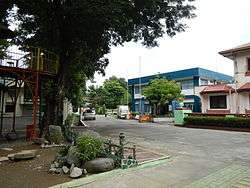
San Quintin Town Hall
Climate
| Climate data for San Quintin, Pangasinan | |||||||||||||
|---|---|---|---|---|---|---|---|---|---|---|---|---|---|
| Month | Jan | Feb | Mar | Apr | May | Jun | Jul | Aug | Sep | Oct | Nov | Dec | Year |
| Average high °C (°F) | 31 (88) |
31 (88) |
32 (90) |
34 (93) |
35 (95) |
34 (93) |
32 (90) |
32 (90) |
32 (90) |
32 (90) |
32 (90) |
31 (88) |
32.3 (90.4) |
| Average low °C (°F) | 22 (72) |
22 (72) |
22 (72) |
24 (75) |
24 (75) |
24 (75) |
24 (75) |
24 (75) |
24 (75) |
23 (73) |
23 (73) |
22 (72) |
23.2 (73.7) |
| Average precipitation mm (inches) | 13.6 (0.535) |
10.4 (0.409) |
18.2 (0.717) |
15.7 (0.618) |
178.4 (7.024) |
227.9 (8.972) |
368 (14.49) |
306.6 (12.071) |
310.6 (12.228) |
215.7 (8.492) |
70.3 (2.768) |
31.1 (1.224) |
1,766.5 (69.548) |
| Average rainy days | 3 | 2 | 2 | 4 | 14 | 16 | 23 | 21 | 24 | 15 | 10 | 6 | 140 |
| Source: World Weather Online[5] | |||||||||||||
References
- ↑ "Municipalities". Quezon City, Philippines: Department of the Interior and Local Government. Retrieved 26 November 2012.
- 1 2 "Province: PANGASINAN". PSGC Interactive. Makati City, Philippines: National Statistical Coordination Board. Retrieved 26 November 2012.
- 1 2 3 "Total Population by Province, City, Municipality and Barangay: as of May 1, 2010" (PDF). 2010 Census of Population and Housing. National Statistics Office. Retrieved 26 November 2012.
- ↑ "Province of Pangasinan". Municipality Population Data. LWUA Research Division. Retrieved 5 September 2013.
- ↑ "San Quintin, Pangasinan: Average Temperatures and Rainfall". World Weather Online. Retrieved 31 October 2015.
External links
| Wikimedia Commons has media related to San Quintin, Pangasinan. |
- Philippine Standard Geographic Code
- Philippine Census Information
- Local Governance Performance Management System
- San Quintin Pangasinan
 |
Tayug | Natividad | | |
| Santa Maria | |
Carranglan, Nueva Ecija | ||
| ||||
| | ||||
| Umingan |
Lingayen (capital) | |
| Municipalities |
|
| Component cities | |
| Independent component city |
|
| Barangays | |
This article is issued from Wikipedia - version of the 9/13/2016. The text is available under the Creative Commons Attribution/Share Alike but additional terms may apply for the media files.